
By Roselyn Fauth
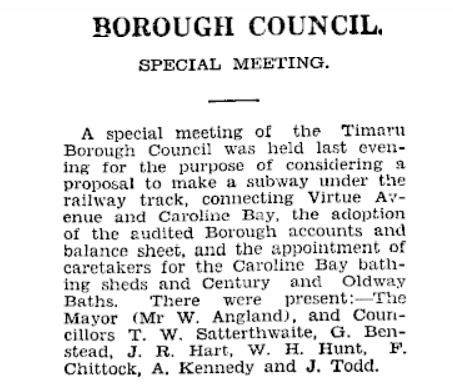
Timaru Herald, Volume CXXV, Issue 18384, 1 October 1929, Page 3 https://paperspast.natlib.govt.nz/newspapers/THD19291001.2.13
I went looking for a tree and a mysterious pole on the Benvenue Cliffs... and on the history hunt I found a traffic argument.
The newspaper article was about the Bay Viaduct, a structure I had passed many times without giving it much notice. In May 1932, Timaru was arguing over whether motor vehicles should be allowed to use it. Some people wanted the entrance reopened because it provided a direct route into Caroline Bay. Others feared that cars passing through the narrow underpass would endanger the women and children walking there...
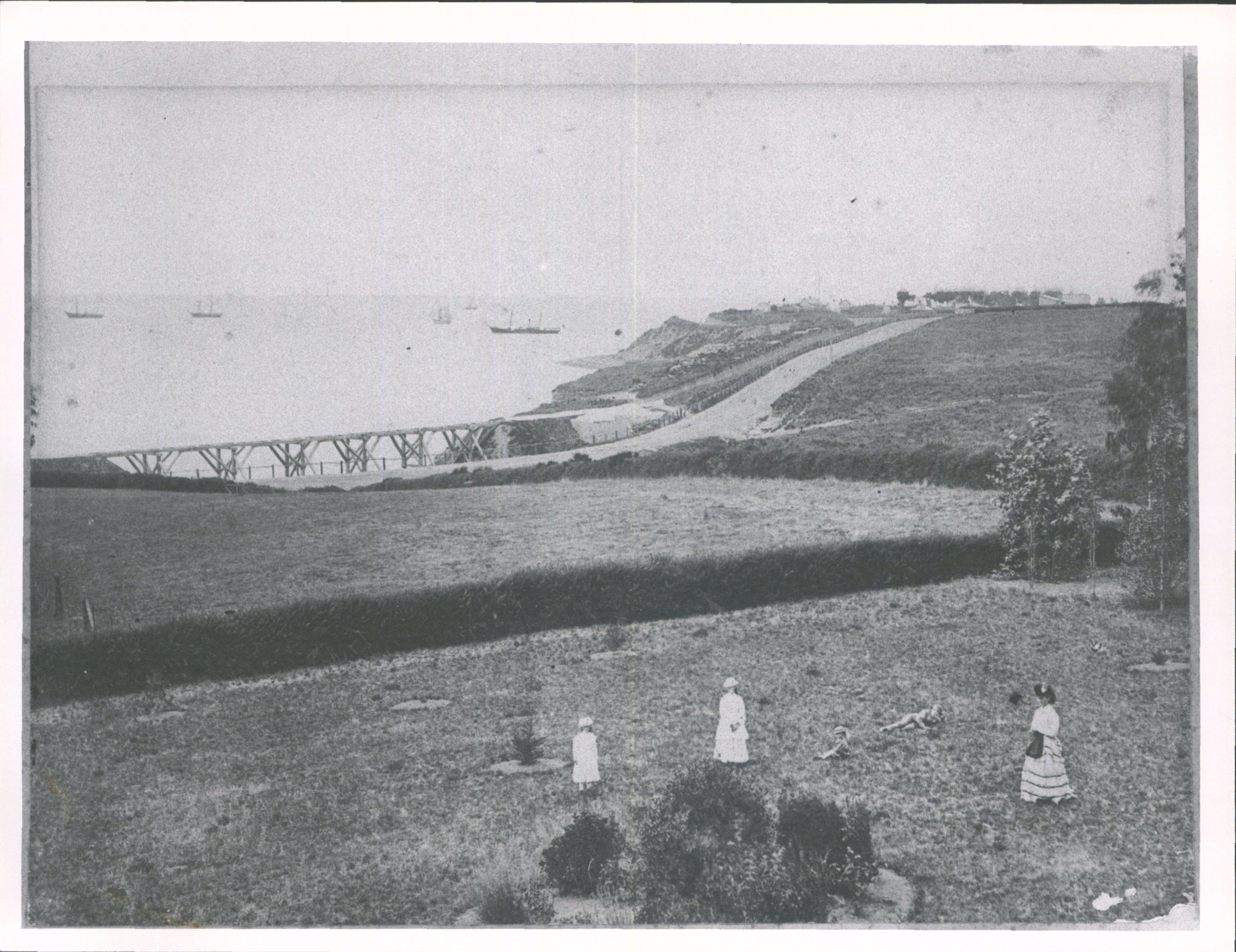
The Bay Viaduct began as a timber railway structure across Whale’s Creek in the early 1870s. After storms stripped away the protective shingle beach in 1879, the sea began cutting dangerously close to its supports. Railway engineers responded by forming an artificial rubble-stone beach and constructing a substantial stone abutment and wing wall. A local quarryman later recorded supplying about 2,000 cubic yards of Timaru stone for the protective works. The crossing was altered again in 1892–93, when new abutments and iron girders were installed and the old timber viaduct was filled in. The surviving underpass may therefore contain several generations of work. Timaru District Council identifies local bluestone in the structure, but the precise dates of every section of walling still require further investigation.. Looking towards the sea near Timaru (1871-1875). Hocken Digital Collections, accessed 17/04/2025, https://hocken.recollect.co.nz/nodes/view/23692 Low quality image. For further information on use of low quality scans and on how to order a high quality image please see conditions of use.
Before I could understand the argument, I had to work out exactly which viaduct they meant.
Which viaduct?
Today there are two railway underpasses at the northern end of Caroline Bay.
The historic Bay Viaduct is at the foot of Wai-iti Road, beside the present State Highway 1 corridor. It was once used by vehicles but is now a pedestrian entrance into the Bay.
Farther north, the separate Virtue Avenue underpass is used by both vehicles and pedestrians. There is also a footbridge over the railway from The Terrace, making a third structure that can easily become tangled in the story.
The 1932 debate concerned the older Wai-iti Road Bay Viaduct. We know this because Virtue Avenue was described as the alternative route for motorists. The Timaru District Council’s Caroline Bay heritage assessment also lists the Wai-iti Road underpass and the Virtue Avenue vehicle entrance separately.
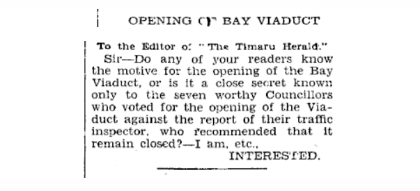
Timaru Herald, Volume CXXXVI, Issue 19173, 3 May 1932, Page 14 https://paperspast.natlib.govt.nz/newspapers/THD19320503.2.88.2
Built for the railway
The Bay Viaduct appears to date from the construction of the railway around Timaru’s coastal edge in the mid-1870s. The railway line crossed the gully at the mouth of Whales Creek, creating an opening beneath the tracks near the foot of Wai-iti Road.
At that time, there was no broad sandy playground below it. The sea came much closer to the cliffs and railway, and the shoreline was exposed to erosion.
An 1880 government report described the railway viaduct over Whales Creek as having originally stood about a chain back from the high-water mark. The sea had since stripped away protective shingle and cut into the clay near the structure, threatening the railway. Stone was placed along the shore to protect the line and the viaduct.
On the left the cutting for the Wai-iti Tramway and the stone abutment of the Bay viaduct on the right - south canterbury Museum 2021062029 https://timdc.pastperfectonline.com/photo/458E31E9-57B5-4D17-B6D5-305632505525
Some of that stone was Timaru bluestone. Evidence given during an inquiry into the harbour works recorded that a local quarryman had supplied about 2,000 yards of Timaru stone for protective work near the viaduct.
The council’s heritage assessment also identifies Timaru bluestone in the surviving underpass and the small shelter beside it. However, we should not assume that every visible section of wall was built at the same time.
The core railway crossing may date from about 1875, while adjoining retaining walls could have been added, extended or rebuilt as the coastline, railway cutting and entrance evolved. I have not yet found the contract or council record that dates the entire bluestone wall or confirms exactly when it was built to tidy the railway edge.
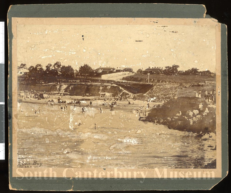
A view of Caroline Bay from the north, c 1890s Shows numerous persons on the Bay, on the narrow beach or in the shallows, in the vicinity of the railway viaduct at the foot of Wai-iti Road https://timdc.pastperfectonline.com/photo/F091EC37-4CC0-40E6-8036-223240537770

The lower end of Wai-iti Road, Timaru, with Caroline Bay and the harbour in the background, circa 1908. Depicts several people and a horse drawn wagon, on Wai-iti Road. On Caroline Bay the bathing sheds and swings are visible, while a ship exits the harbour in the background. Excavations and drainage pipes along the side of the road suggest that this was taken during James Craigie's mayoralty when the previous 'open drains' were piped underground. Handwritten on reverse "Wai-iti Road & Evans St early 1900s". Catalogue Number 2312 https://timdc.pastperfectonline.com/photo/02CF8A05-F0DF-4617-9164-339245655591
1872–75: timber railway viaduct constructed
1879–80: rubble protection, stone abutment and wing wall added after coastal erosion
1892–93: new abutments and iron girders built; the old timber viaduct was filled in
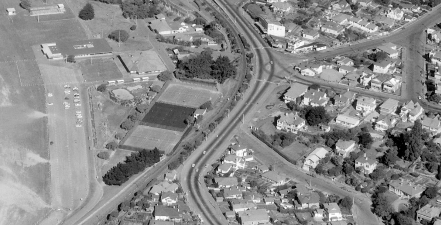
Timaru. Whites Aviation Ltd: Photographs. Ref: WA-68501-F. Alexander Turnbull Library, Wellington, New Zealand. /records/22302249
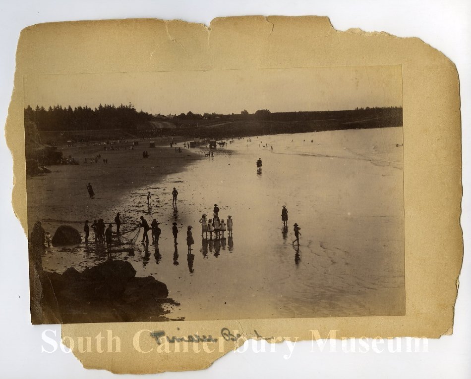
Caroline Bay c1895 Beverley Via-duct and Evans St - South Canterbury Museum 2000210077
The Bay grew around it
The viaduct’s purpose changed as Caroline Bay changed. Timaru’s harbour works interrupted the natural movement of sediment along the coast. Sand accumulated north of the harbour, gradually creating the beach we know today. The railway, once laid beside a rough and exposed shoreline, now separated the town from a growing recreation ground.
The cliffs were cut back, paths and lawns were formed, and facilities were added. Caroline Bay became the place for swimming, concerts, sports, picnics, dances and public gatherings. The old railway opening at Wai-iti Road became one of its principal entrances.
Then came the motor car... by the late 1920s and early 1930s, motorists, pedestrians, delivery vehicles and crowds attending Bay events were all being funnelled towards a narrow railway underpass near a complicated road junction. Virtue Avenue was developed as another motor route, allowing traffic to enter or leave the Bay farther north.
The old viaduct was eventually closed to general vehicle traffic.

The Bay viaduct stood at the foot of Wai-iti Road, beside Evans Street, where Virtue Avenue now passes beneath the railway into Caroline Bay. Evans Street looking toward the corner of Wai-iti Road South Canterbury Musuem 2310 https://timdc.pastperfectonline.com/photo/EAD4964C-365D-469C-A508-869378282730
The 1932 argument
On 3 May 1932, the Timaru Herald reported the latest debate over whether the Bay Viaduct should be reopened to cars.
Some councillors argued that it offered a more convenient entrance, particularly for people travelling from the southern end of Timaru or attending evening functions at Caroline Bay.
The Caroline Bay Association objected. Other community organisations opposed reopening it, and letters appeared in the newspaper. Timaru’s traffic inspector supported keeping the viaduct closed. He said the change had made traffic easier to manage, while visitors had spoken favourably of the Virtue Avenue route. Trade vehicles already had limited morning access to Bay businesses through the separate Strathallan Street entrance.
At the centre of the debate were “women and children”. They were repeatedly described as the people most at risk from cars approaching the viaduct. Councillor A. Kennedy reportedly accepted that it was an extremely dangerous location, possibly the most dangerous in Timaru, but believed traffic controls could make it safe.
The traffic inspector’s argument was simpler. Closing the underpass to cars had removed the danger. Reopening it would bring the danger back.
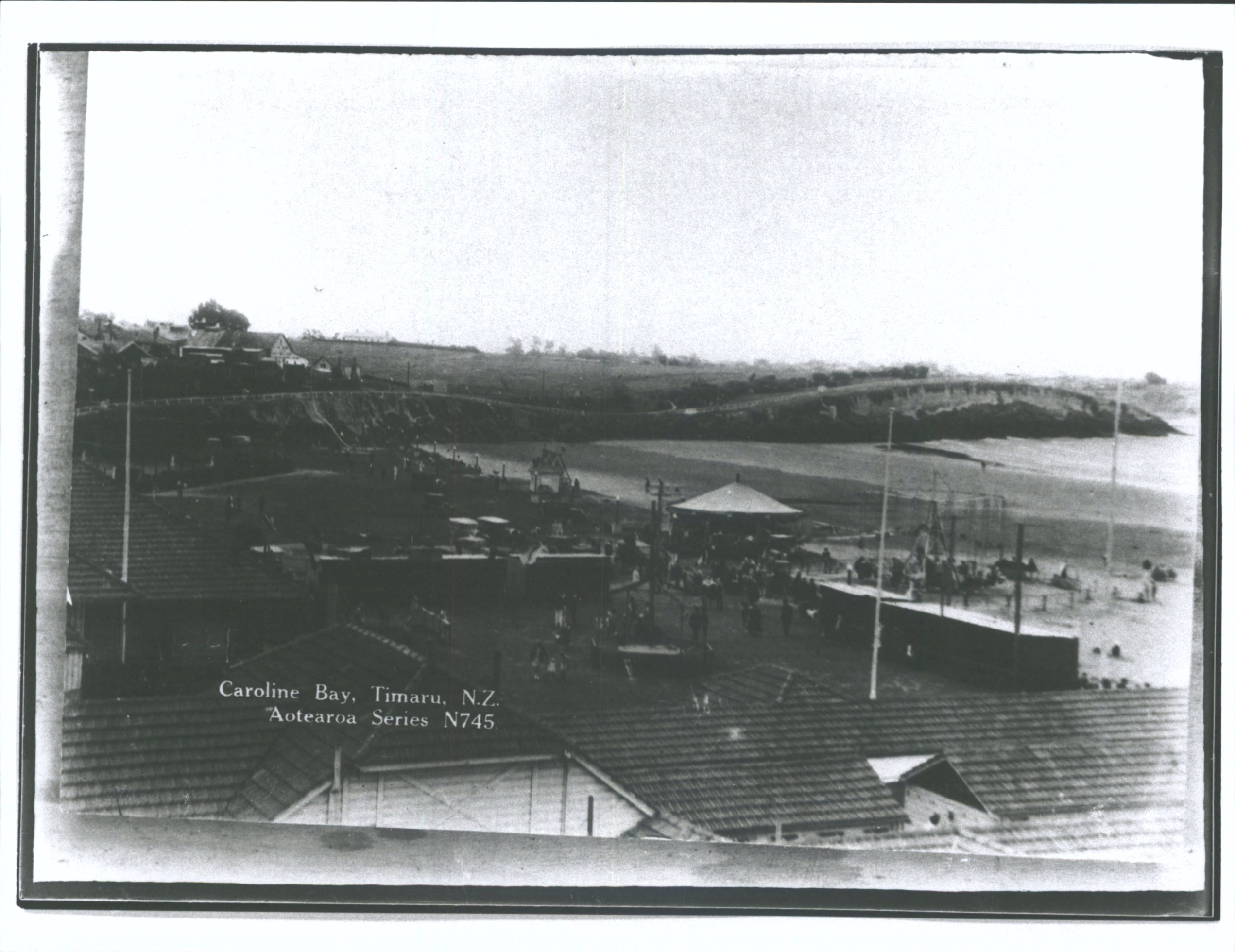
Caroline Bay, Timaru, N.Z.. Hocken Digital Collections, accessed 23/07/2026, https://hocken.recollect.co.nz/nodes/view/23940
Where were the women?
The surviving report tells us what councillors, officials, motorists and organisations thought. Women and children were discussed constantly, but no woman was named or quoted.
That does not mean Timaru women were silent.
The Women Citizens’ Association and the local National Council of Women were active at the time. Women’s groups were discussing politics, public welfare, education, nursing, civic facilities and the needs of mothers and children. During the 1923 mayoral campaign, organised women had even been invited to offer suggestions about facilities used by women and young mothers.
We do not yet have evidence that the Women Citizens’ Association formally entered the 1932 viaduct dispute. Its meeting reports from the period still need to be checked carefully.
Perhaps the real question is not why women failed to speak. Perhaps they were speaking elsewhere, while the newspaper’s council report concentrated on the men in the chamber.

Evans Street Timaru and the Gabels 1910
Timaru in May 1932
The argument also took place near the bleakest point of the Great Depression.
Jobs were scarce, wages and public spending had been cut, and relief organisations were helping families with little money coming in. Across New Zealand, unemployment demonstrations had erupted in Dunedin and Auckland. Women led a march through Christchurch on 1 May, only two days before the Timaru viaduct report appeared.
Women paid unemployment tax, yet they were not given the same access to government unemployment relief as men. They organised workrooms, meals and assistance schemes while lobbying for recognition as workers and citizens.
That gives the Timaru discussion another layer. In the council chamber, women were presented mainly as vulnerable pedestrians needing protection. Elsewhere, women were organising, protesting and demanding a greater public voice.
An overlooked piece of Timaru
The Bay Viaduct initially looked like a small detour from my research into a tree and a pole.
Instead, it led back to the arrival of the railway, coastal erosion, local bluestone, the creation of Caroline Bay and the rise of motor traffic. It also led into a debate about public safety and whose voices were heard when decisions were made.
The structure is still there at the foot of Wai-iti Road. Trains pass over it and pedestrians walk beneath it, just as generations of people have done before them.
I had barely noticed it.
Then one newspaper article opened up the whole story.
Side quest: What else was happening in May 1932?
Once I had worked out where the Bay viaduct was, another question sent me off on a side quest. What was happening around Timaru while people were arguing about whether cars should be allowed back through it?
The newspaper report appeared on 3 May 1932, close to the bleakest point of the Great Depression. Jobs were scarce, wages had fallen, building work had slowed and relief committees were trying to help families who had little money coming in. South Canterbury had also recently endured dry conditions, adding more pressure to a district that depended heavily on farming.
Caroline Bay must have felt particularly important at a time like this. It was a place where people could walk, gather and enjoy themselves without spending much money. It hosted concerts, ceremonies, rallies and community events. Only eleven days after the viaduct report appeared, a large crowd gathered at the Bay for the fiftieth anniversary commemorations of the 1882 shipwreck disaster and the presentation of the historic Alexandra lifeboat.
The argument about the viaduct was therefore not simply about a shortcut. It was about how people reached one of Timaru’s most heavily used public spaces, and whether the convenience of motorists should come before the safety of people walking through it.
Across New Zealand, things were becoming increasingly tense. Unemployed people were marching in Dunedin, Auckland, Christchurch and Wellington. The major Queen Street riot had taken place in Auckland less than three weeks earlier, and thousands would demonstrate outside Parliament in Wellington one week later.
Women were part of these protests and relief efforts, but the system treated them differently. Women paid unemployment tax, yet received little direct government assistance if they lost their jobs. They organised workrooms, meals, committees and demonstrations. On 1 May 1932, just two days before the Timaru viaduct report was published, unemployed women marched through Christchurch.
That makes the language used in the Timaru debate especially interesting. Inside the council chamber, women and children were spoken about mainly as vulnerable pedestrians who needed protection from motor traffic. Elsewhere, women were organising, protesting and demanding to be recognised as workers and citizens.
The contrast was even sharper overseas. Germany was becoming increasingly unstable as Adolf Hitler’s political support grew. Japan had occupied Manchuria. Millions were unemployed across Britain, Europe and the United States. Later that same month, Amelia Earhart became the first woman to fly solo across the Atlantic.
So while Timaru’s councillors debated whether cars should pass beneath the railway and into Caroline Bay, the world around them was shifting. Motor vehicles were changing towns. Economic hardship was challenging governments. Women were demanding a greater public voice.
The Bay viaduct debate may look like a small local disagreement, but it sat inside much bigger questions about public space, safety, power and whose voices were heard.
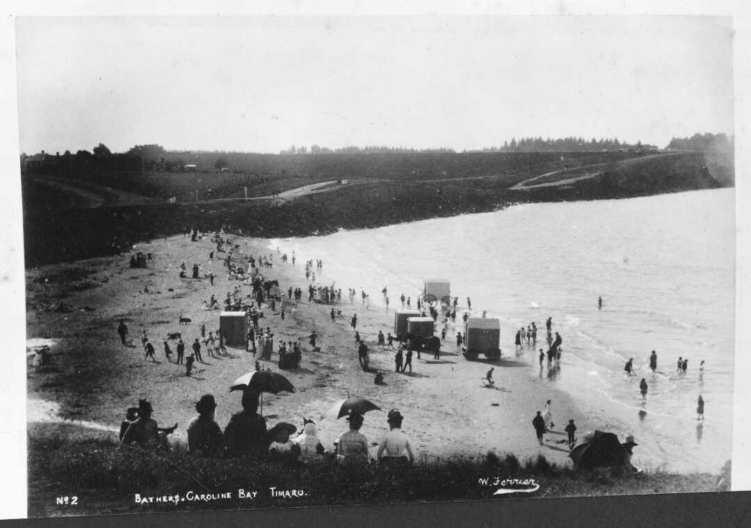
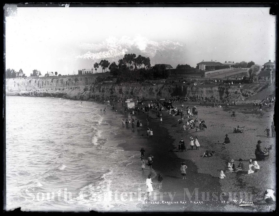
Caroline Bay in 1890. Crowd on the beach at Caroline Bay, Timaru, circa 1890. Bathing machines are by the surf. Perhaps this is the stream at the left. Photograph taken by William Ferrier. - National Library. Tiaki Reference Number: PAColl-4746-02
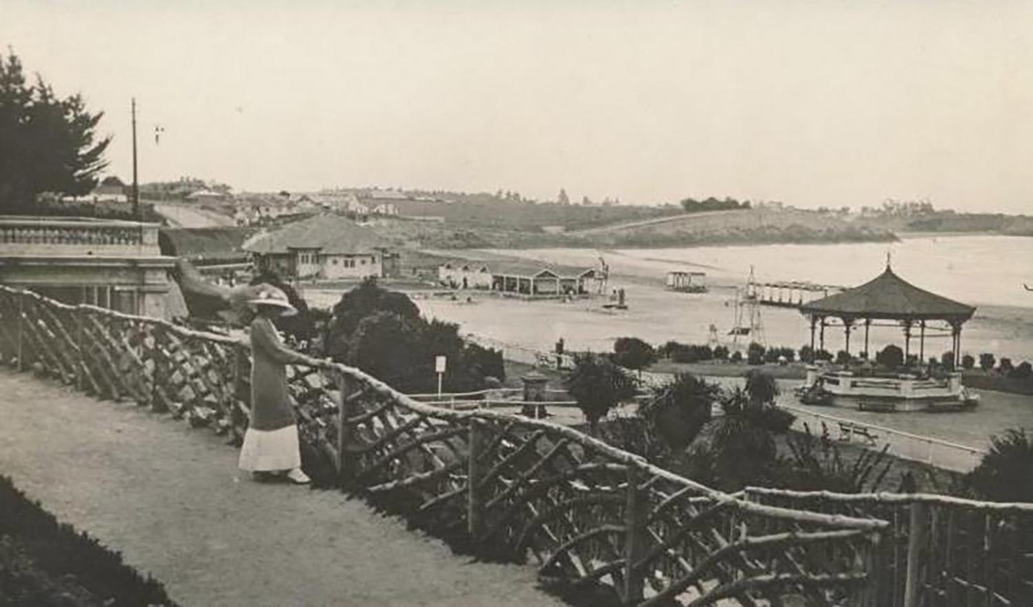
New Zealand - Timaru - Caroline Bay - 1940’s - Fyfe photo - Photo Postcard Format #t443
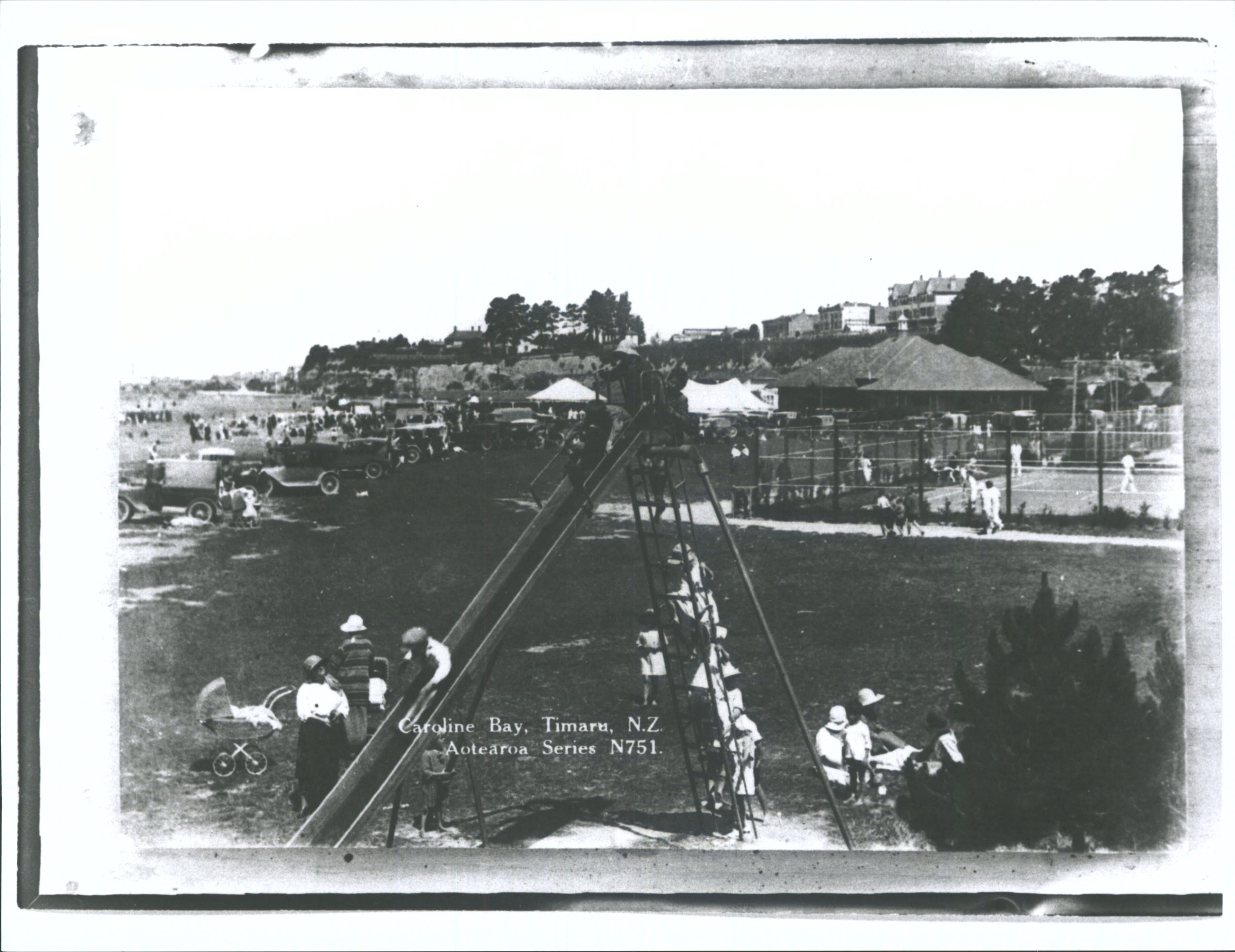
Caroline Bay, Timaru, N.Z.. Hocken Digital Collections, accessed 23/07/2026, https://hocken.recollect.co.nz/nodes/view/23983
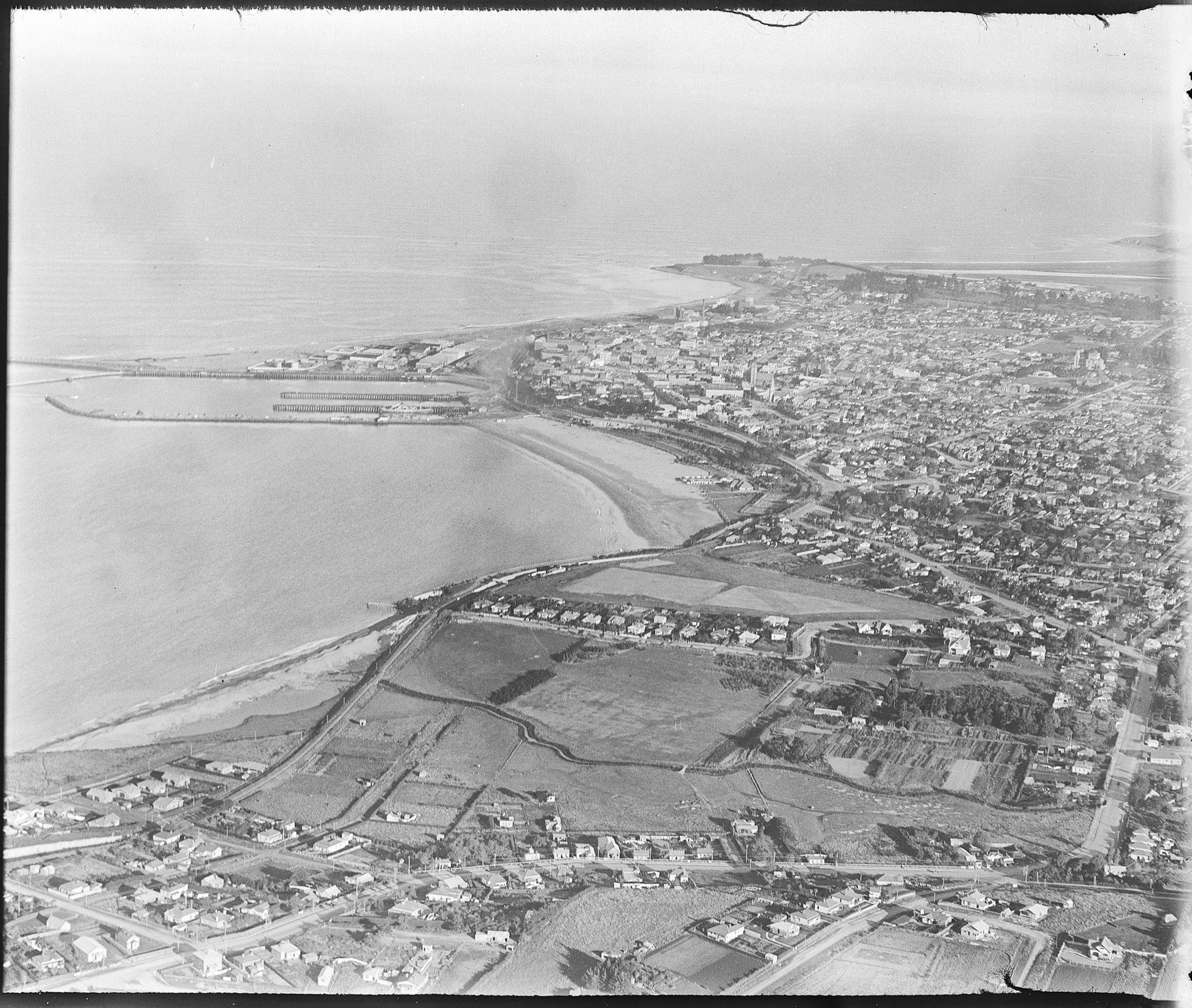
1927 Timaru from the air - Auckland Libraries Heritage Collections FDM-0690-G - Creative Commons Licence: Attribution CC BY
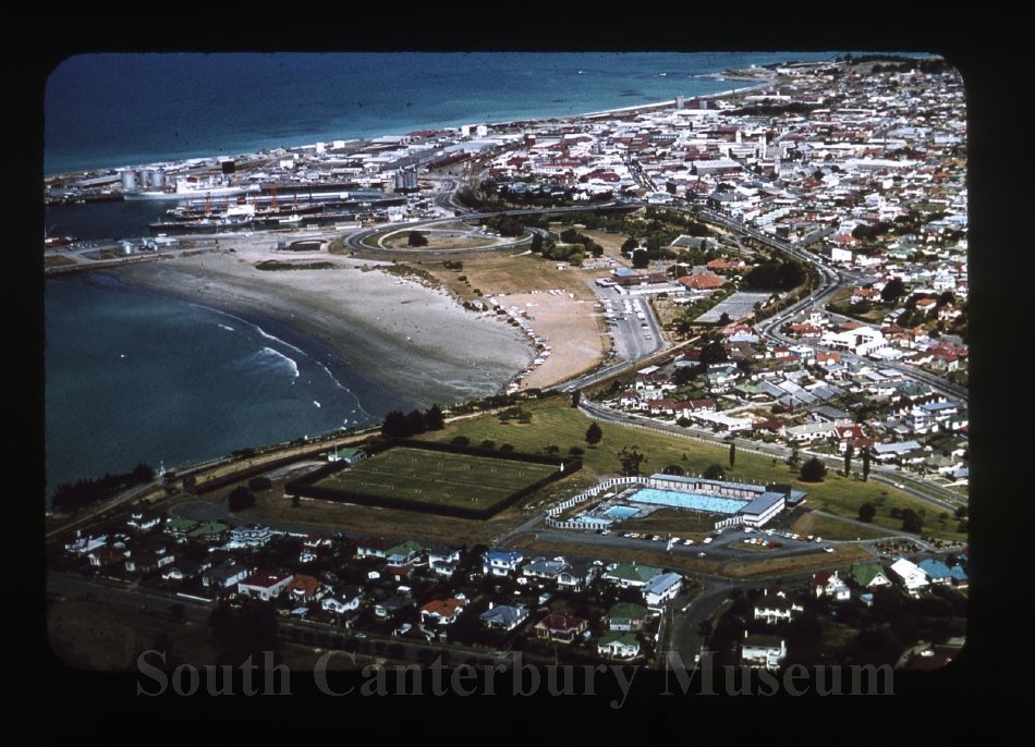
c. 1975 view of Maori Hill and Caroline Bay, Timaru Main School SCM 2018064.023

The Bay Hill, Hewlings Street, and Wai-iti Road intersection, prior to the Timaru bypass realignment, circa 1990. Depicts the view looking south along Evans Street towards the block that was largely demolished to make way for the main road bypass. - South Canterbury Museum Catalogue Number L2012/007.001 https://timdc.pastperfectonline.com/photo/3E7E2EB3-622C-4D12-8888-685128474632