Let’s go on a Kai Moana Hunt! Head to Caroline Bay Playground to have some free fun, and learn about who lives in our sea, reefs, wetlands and lagoons!

2 million years ago, lava flowed like fingers down sloping plains, helping to shape the terrain of Kā Poupou-a-Rakihouia (the South Canterbury coastline). This volcanic reef also shaped the natural harbour, wetlands and coastline of Timaru, Te Tihi-o-Maru.

Ngāi Tahu used to travel 3-5 days on foot between lakes Wairewa (south of Christchurch) and Waitarakao (Washdyke Lagoon) connecting the settlements of Te Pātaka-a-Rākaihautū (Banks Peninsula) with coastal kāinga to the south, including the famous Te Waiateruatī pā.
To prepare for seasonal expeditions, Māori gathered food around Caroline Bay and neighbouring wetlands, lagoons and rivers.

Maori use kete (woven bags used to gather food) from Te Kouka Cabbage Trees and Harakeke Flax bushes.

Wetlands and coarse gravel beaches eventually gave way to a new sandy shore, and the Pohatu-koko Stream (Whalers Creek) is now underground, piped beneath the current Caroline Bay playground, to the sea.

The changing shape of the coast also accelerated coastal erosion further north, affecting Waimataitai Lagoon (now Ashbury Park) and Waitarakao Washdyke Lagoon.


These plants and animals are Taonga (treasures) because: they are central to the identity and well being of many Māori. They also have an important role in healthy eco-systems.


WUHOO CPlay KaiHunt CarolineBay 220306 Taonga


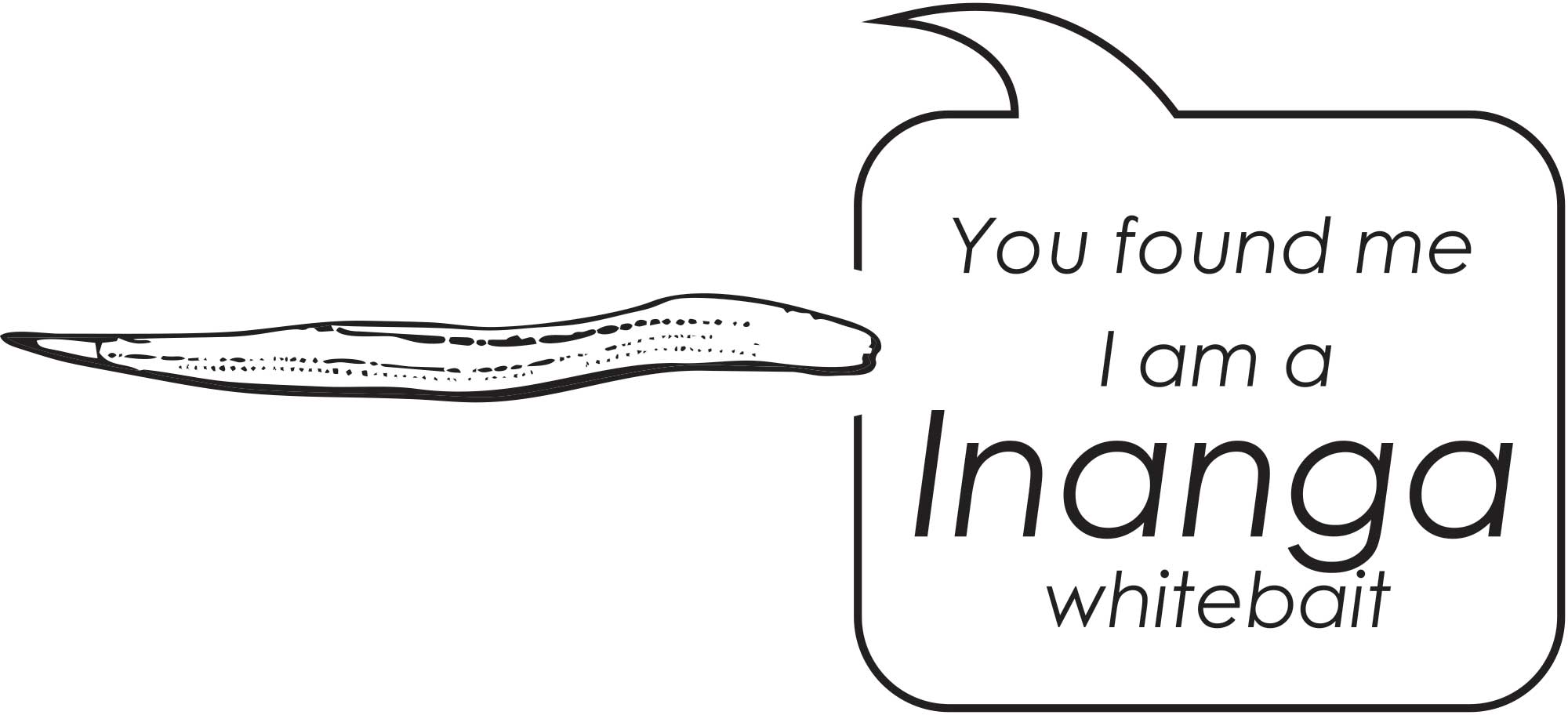
The coastline was abundant in marine life and offered bountiful mahika kai (food resources) for local Māori. There was an abundance of fish and shellfish on the reefs, plenty of sea birds, eggs and seal pups on the coast and tuna (eels), waterfowl and freshwater fish in the estuaries and rivers. Tuna (eel) and inaka (whitebait) patete (fish), and kōareare (the edible rhizome of raupō/bullrushes) were also important staples of the area.


Travel by sea was common and much faster than travelling by land. Many settlements were within sight of each other and only hours away in settled weather by waka (canoe) or the double-hulled waka hunua. Trading of food and resources between villages up and down the coast was an important part of the economy. Pounamu (greenstone) and titi (sooty shearwaters /muttonbirds) were sent north to trade in return for kūmara, taro, stone and carvings.

Rivers were like highways inland. Tākata whenua (local people) foraged inland for weka, ducks, harakeke (flax), aruhe (fern root/bracken) and tī kōuka (cabbage tree) and lowland forests provided a wide range of timber and forest birds.

Southern Māori developed a special vessel to navigate the fast-flowing braided rivers: the mōkihi. Made from bundled raupō (bullrushes) or kōrari (the flower stakes of the harakeke flax bush). They were lightweight, sturdy and could be made on the spot to guide down the river carrying heavy loads. The largest mōkihi could carry up to half a tonne in weight.

It was a long trek from the coast to the inland lakes and mountains, but mōkihi could make the return journey in a single day. Because there was no way to bring them back up-river they were often used just once. If they were to cross a river, there were left in a dry spot for the next party to use.

Local Māori communities have faced massive changes over the past 150 years as a result of European settlement, including loss of traditional food resources especially as the coastline changed and the city expanded.

With the increase in European sea trade came an increase in danger and disaster. The swells threatened ships anchored offshore, and by the time the Harbour Board was formed in 1877 more than 20 had wrecked around the Timaru Coastline.

In 1878 work began on Timaru's new breakwater. It changed the currents and created a sandy beach under the cliffs. Today, when you go along the North-South Promenade, you can find markers for mean tides from over the last 135 years.


WUHOO CPlay KaiHunt CarolineBay 220302 Map


WUHOO CPlay KaiHunt CarolineBay 220302 NoticeChange


In 1929, the 400m long Memorial Wall was built with Bronze plaques feature the battlefield names where kiwis served in international wars. This was also the sea wall at the time.


WUHOO CPlay KaiHunt CarolineBay 220302 NoticeChange2


In 2008 the sandy bay was more than 400 m northeast of the memorial wall and the sand will continue to build out until it finds an equilibrium.

In comparison the coast further north is starved of sediment, where for example Waitarakao Washdyke Lagoon in 1881 was 253 hectares, but now is about 20. This was one of 15 fishing easements set aside in 1868 by the Native Land Court in to allow Ngāi Tahu to continue the practice of mahinga kai. For the longest time it had the perfect mix of saltwater and freshwater, allowing a diverse range of native species to thrive there. Now a combination of the port, industrial area, SH1 and railway prevent the lagoon from expanding, while the sea pushes the gravel barrier ever inland.


WUHOO CPlay KaiHunt CarolineBay 220302 NoticeChange Map


WUHOO CPlay KaiHunt CarolineBay 220302 NoticeChange MapToday 


How do you think the changes to the coastline, have impacted the marine life and Mahika Kai (food gathering) in this area?

How does this change make you feel?


nla.obj 138582273 1


Next time you are at Dashing Rocks compare this painting with the view today.Note the changes to the coastline. This is a section of a watercolour painting by Sir Eliot Whately (1841-1927). Depicts Dashing Rocks bay looking out to Waitarakao Washdyke Lagoon, Timaru in October 1874, commencement of ninety miles beach. Courtesy National Library of Australia nla.gov.au/nla.obj-138582273


CarolineBay Eliot Whately 1874


The view of the Caroline Bay coastline in 1874. This is a section of a watercolour painting by Sir Eliot Whately (1841-1927). Depicts Caroline Bay, Timaru in October 1874. nla.gov.au/nla.obj-138581877

CarolineBay ChangingCoastLine

View from above, the Waimātaitai lagoon has drained and been reclaimed as Ashbury Park with an athletics track. Sand is accumulating in Caroline Bay and tennis courts, grass prominade and caretakers house are established.


CPLAY CarolineBayFromAbove

ABOVE Arial view looking down to Caroline Bay and the Port of Timaru 2019  mapviewer.canterburymaps.govt.nz


CPLAY CarolineBay Map Marker 210317

LEFT The brown lines show the changes to the mean sea level since 1926. Graphic courtesy Roselyn Fauth 2019 with assistance from the South Canterbury Museum. RIGHT One of the mean tide markers along the North to South promenade at Caroline Bay.  Photograph courtesy Roselyn Fauth 2019


WHooTimaru Tuna Eel lifecycle


Tuna is a generic Māori word for freshwater eels. Māori have over 100 names for eels.

I LIVE: lakes and rivers connected to the sea.

I EAT: Small insects larvae, snails, midges and crustaceans. As our mouths get bigger, we can eat kōura (freshwater crayfish), fish, small birds and rats. When scared I bite!


Did you know: I’m the largest fish in Aotearoa freshwaters


There are three tuna species in NZ: The longfin eel, known as tuna, is one of the largest eels in the world.

LONGFIN EEL
(Anguilla dieffenbachii) Max size: 2m, 25kg

SHORTFIN EEL
(Anguilla australis) Max size: 1.1 metre, 3kg

AUSTRALIAN LONGFIN EEL
(Anguilla reinhardtii), Max size: 2 metres, 21kg


Tuna Eel lifecycle


My super power is:
I can swim 1000s km in the sea or fresh water
Near the end of my life, I swim from NZ to the deep trenches near Tonga.
This is where I release eggs/sperm to spawn.
Over 10 months, my tiny larvae follow the ocean currents back to NZ.
They develop into transparent glass eels, and swim to rivers.
They turn greyish-brown and become elvers, to grow into strong adults in fresh water
(rivers, lakes, wetlands). Then the swim back to sea and repeat our life cycle.


I help the eco system as a top predator and food source in the marine food chain and help balance the ocean environment.

I am a Taonga species central to the identity and well being of many Māori and are a significant mahinga kai (food).

WHooTimaru Pipi


Pipi belong to the Mesodesmatidae family (clams) and are about 4–6cm long

Did you know: I’m a little fish that lives inside a shell. To eat I use my strong foot to burrow 10cm deep into the sand. I strain the water to find food particles like phytoplankton. As a filter feeder, I help keep the water clean which is important for the ecosystem.

My super power is: I can create a thread of mucus to make myself float in the water and move to a new location


I help the eco system as a food source in the marine food chain and help clean the ocean by filter feeding.

I am a Taonga species central to the identity and well being of many Māori and are a significant mahinga kai (food).

WHooTimaru Inanga


Whitebait is a term for small 4-5cm long freshwater fish that are tender and edible.

Inanga (Galaxias maculatus) are the most common native fish species caught as whitebait. Other species that make up the whitebait catch are banded kokopu, giant kokopu, kōaro and shortjaw kokopu. These species are all migratory galaxiids.


Did you know:
My life begins as a egg laid in vegetation beside streams in late summer and autumn around the high water mark.
After I am born in freshwater, I am swept out to sea with the tide.
I return after 6 months and migrate upstream as whitebait and grow into adult fish by Autumn.
When I am a mature fish, I will swim back down river to spawn in the estuaries. I usually live for one year.

Most females only have one opportunity to spawn. If she finds good quality spawning habitat then about 80% of those eggs will survive.


My super power is: You can see straight through me


I help the eco system as a food source in the marine food chain and help clean the ocean by filter feeding.

I am a Taonga species central to the identity and well being of many Māori and are a significant mahinga kai (food).

WHooTimaru CabbageTree Kina


I LOOK: Like a rolled up hedgehog and am the largest of our native urchins.
I LIVE: Around coastal reefs - 11 of the 70 sea urchin species in NZ can be found in coastal reefs.
I EAT: Plants and animals, but prefer brown seaweed. My mouth has a five-sided limy structure known as Aristotle's Lantern. My set of jaws and teeth help me grind up food.

Did you know?
We are some of the noisiest species found on NZ reefs.
At dusk, we create an “evening chorus” in the sea.
This is the sound (which humans can hear) of our jaws grinding food.
The sound bounces around and amplifies in our shells.

My super power is:
Using my fearsome spines to protect from predators.
I also I hold bits of weed, shell and gravel on me as camoflauge.
Though I am small (16–17cm) I am no match for rock lobsters, snapper or seven armed starfish.


I help the eco system by controlling and balancing the distribution of kelps and other encrusting species.

I am a Taonga species central to the identity and well being of many Māori.

WHooTimaru CabbageTree TeKouka


Tī kōuka (Cordyline Australis) can grow to be 20m tall with a skinny trunk and sword like leaves.

They are so resilient, that they are often the last indigenous plant to persist within cleared land.


Did you know: We were a significant food source for early Māori and provided a fibre resource prized for its strength. A good stand of our trees is known as a para–kauru, with kauru being the name given to the food processed from the cabbage tree. We are also used for Rongoa (Medicine).

My super power is: My fibre doesn’t shrink in water and is super strong. My fibre is used for making rope, kete baskets, clothing.


I help the eco system by using my strong root system to helps stop soil erosion and tolerate wet soil.

I am a Taonga species central to the identity and well being of many Māori and are a important as food, fibre and medicine.