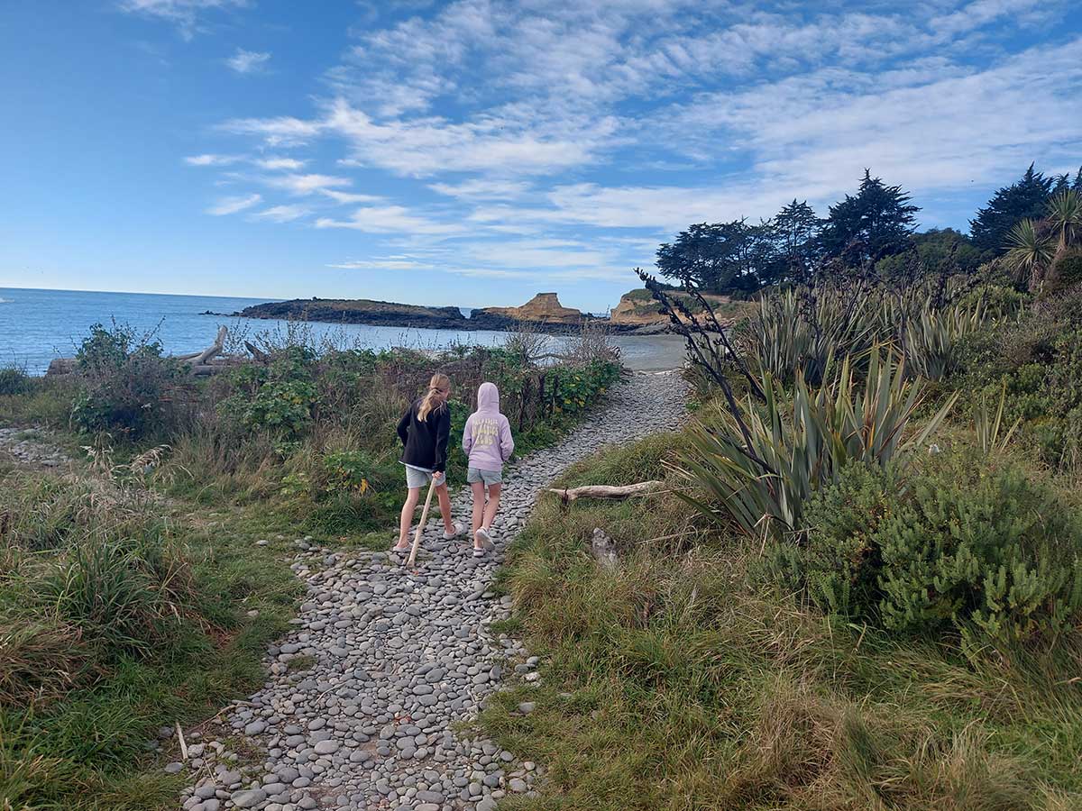
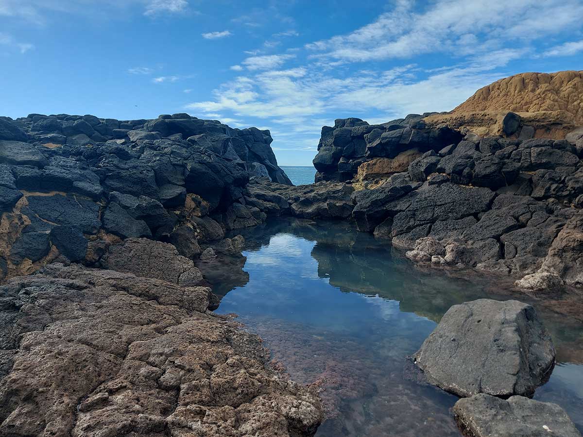
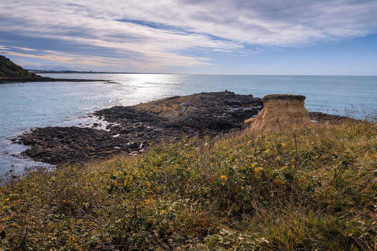
If you have time, this is a great wee walk with views to Caroline Bay along a cliff top to a lava outcrop. It is in between Waitarakao Washdyke Lagoon and Blackett Lighthouse at Benvenue Cliffs. Low tide offers the best access to the lava apron that oozed from Mt Horrible 2 million years ago
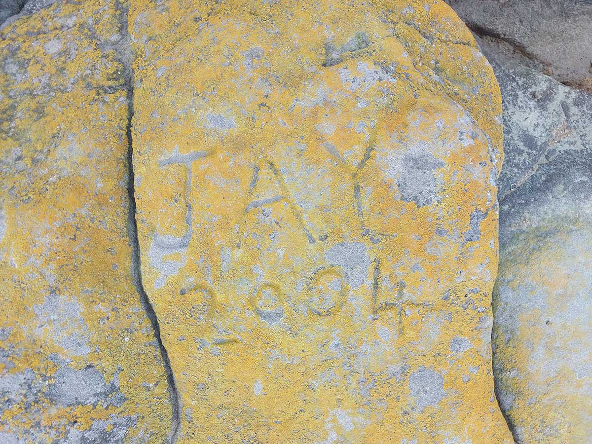
See if you can find peoples names etched in stone, which is the oldest one?
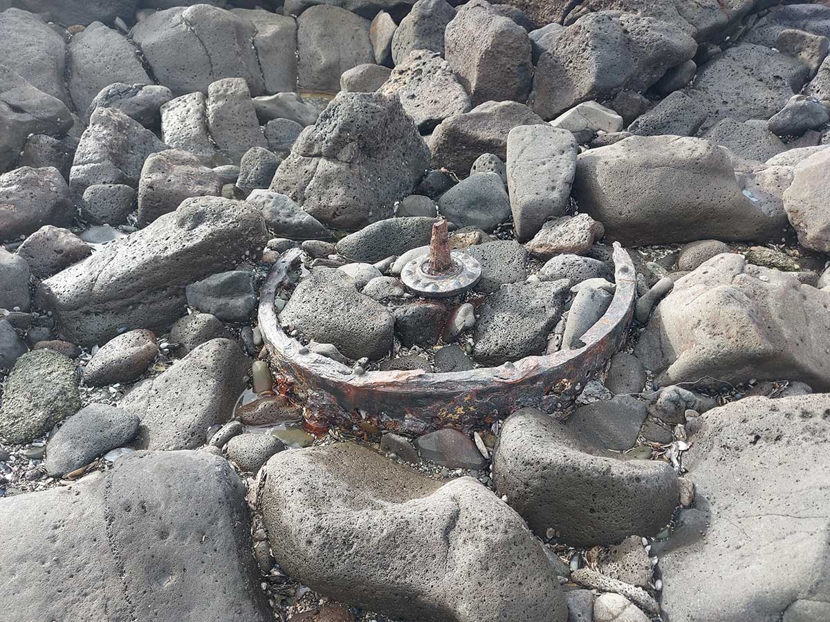
Can see you see a relect from a hydro eletricity generator?
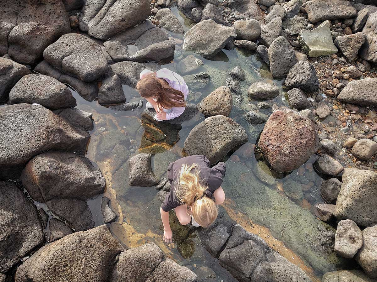
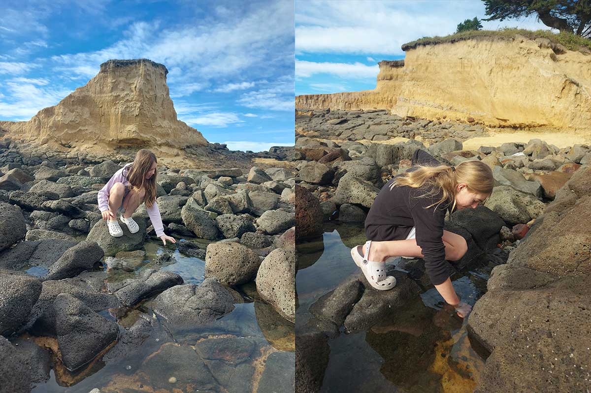
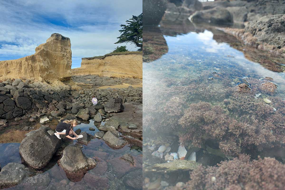
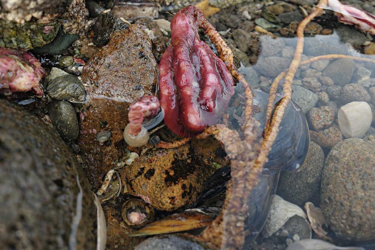
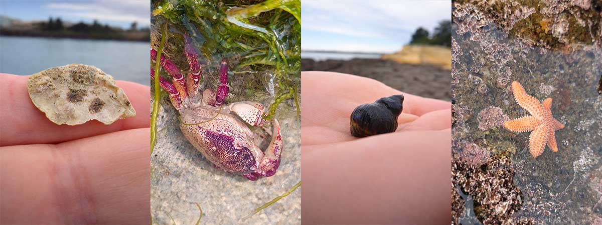
What creatures can you find in the rock pools?
If you have time, this is a great wee walk with views to Caroline Bay along a cliff top to a lava outcrop. It is in between Waitarakao Washdyke Lagoon and Blackett Lighthouse at Benvenue Cliffs. Low tide offers the best access to the lava apron that oozed from Mt Horrible 2 million years ago
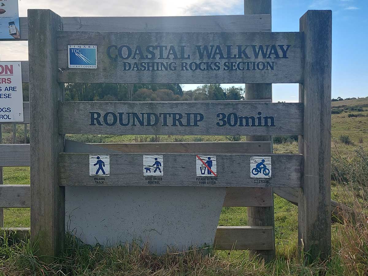
Dashing Rocks can be a short wander or part of a longer coastal adventure. You can start from Caroline Bay, Blackett’s Lighthouse, Moore Street, or the wetland side near the freezing works, depending on how much time you have.
Time: About 30 minutes, or longer if you extend it
Distance: Around 2.2 km for the main loop
Difficulty: Easy, with gradual inclines
Dogs: Permitted on a lead
Type: Walking and cycling trail
Best time: Low tide, especially for seeing lava rock and rock pools
To keep the walk short, enter from the wetland side near the freezing works and follow the public access through the fenced paddock area towards the coast.
For a clifftop view, head up to the road that overlooks Caroline Bay and walk along the cliffs. This gives you wide views across the bay, port and coastline.
To make it longer, start at Blackett’s Lighthouse or Caroline Bay and follow the coastal path towards Dashing Rocks, Benvenue Cliffs and the surrounding streets.
Please stick to marked public access, respect fences and gates, and keep dogs on a lead.
We love Dashing Rocks!
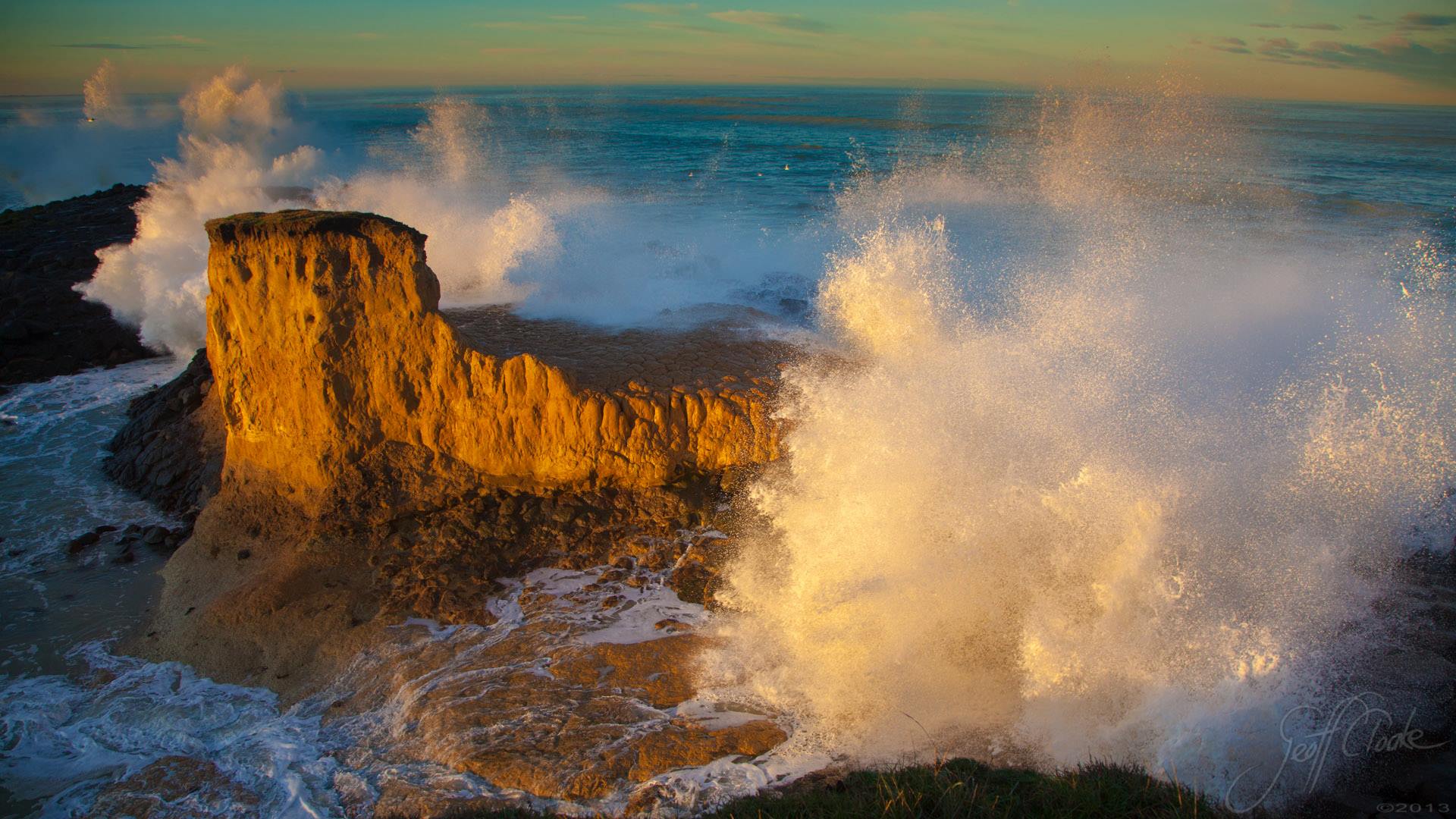
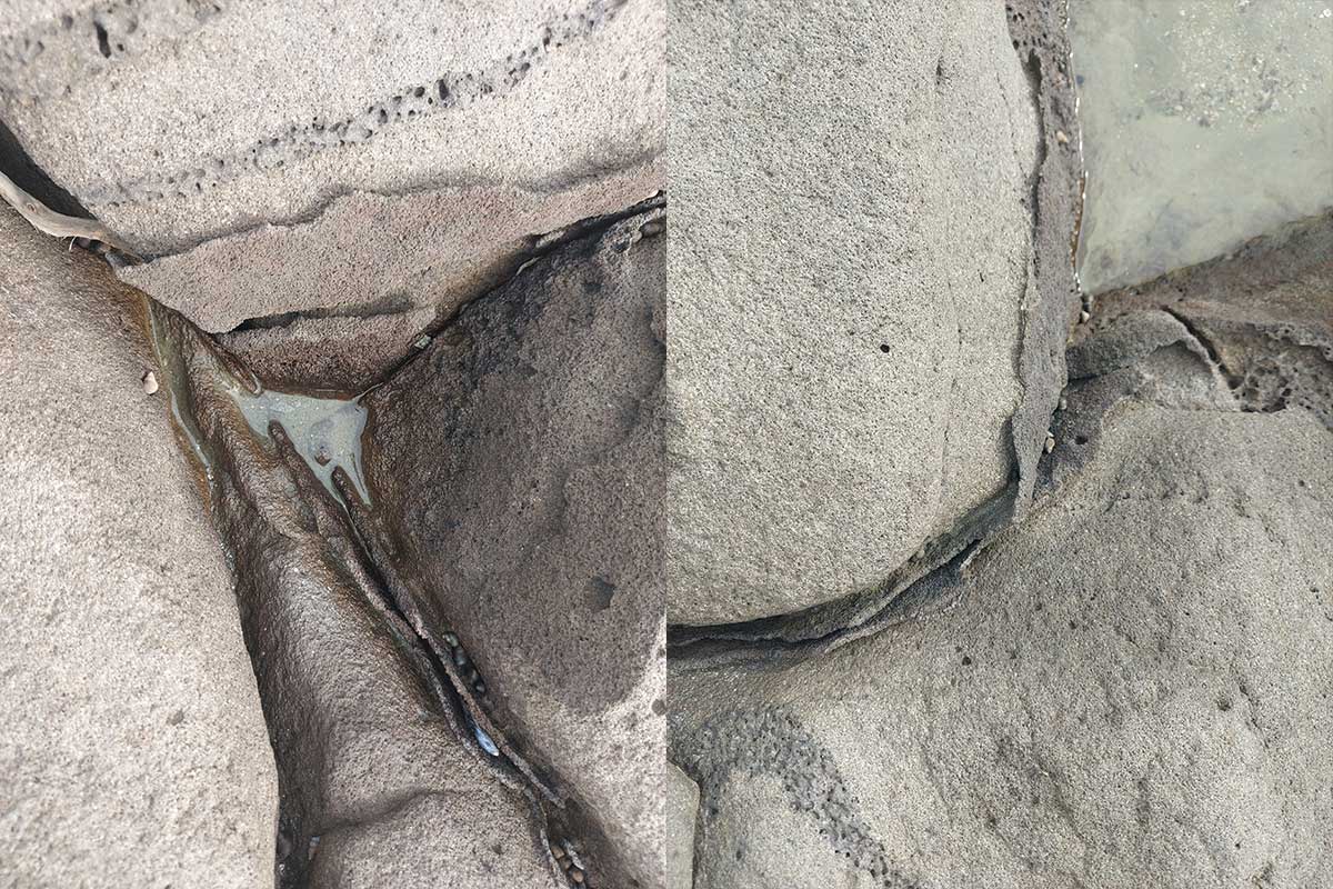
Dashing Rocks is one of Timaru’s best places to see how old the coastline is, and in many ways how young it is. The dark rocks below the cliffs are basalt, formed from ancient lava flows from Mount Horrible around 2 - 2.5 million years ago. when the lava flowed here from near Waipouri/Mt horrible, the coast was not where it is today and this area would have looked very different. When I was a kid there was far more Loess (looks like clay) here, and over the decades the sea has eroded it away.
When the lava flowed here, it cooled, and cracked into patterns and shapes. Slow down and look closely, and you can see the geometric forms in the rock.
Our coast has strong maritime history here connecting to Māori mahika kai, fishing places, coastal watching, whaling history, the lighthouse, the port and Caroline Bay. The cliffs and rocks were dangerous for early shipping, the City of Cashmere shipped nearby here, and further up the shore there was a disastrous day when in 1882 a sailing ship the Benvenue wrecked, the City of Perth also lost its anchor, and drifted into the cliff. A rescue mission to try and save the City of Perth ended in tragedy. At one point there were 40 men in the boiling sea. Nine died within a few days, and another died a few months later from injurites.
There are also inventors who have tinkered around on these rocks, and their efforts to harness the waves energy and convert it to electricity can still be seen in the basalt. There is a history sign that explains this up on the cliff.
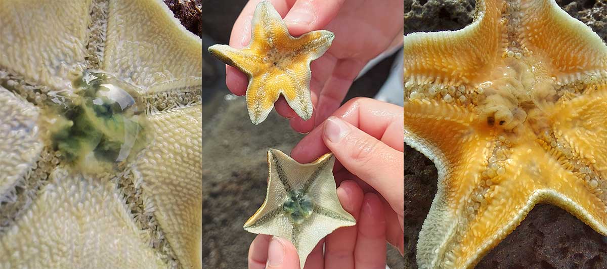
We like to crouch over the rock pools and look for creatures and see what we recognise and what we can name. The starfish are always a popular find in our family.
Find a WuHoo
Can you find the shapes in the basalt rock?
Can you spot old names carved into the stone? Which carved name looks the oldest?
What creatures can you see in the rock pools at low tide?
Can you hear how the waves change when they hit the rocks?
Can you see Blackett’s Lighthouse from different points on the track, is there more than one lighthouse?
How many church towers can you spy?
Can you imagine how this coastline looked before the port and Caroline Bay changed the shoreline?
Dashing Rocks is a small walk with a big story. It connects geology, wildlife, shipping, Māori history, whaling, the lighthouse, the port and Caroline Bay in one short coastal loop. That is the WuHoo idea: finding unexpected things close to home.
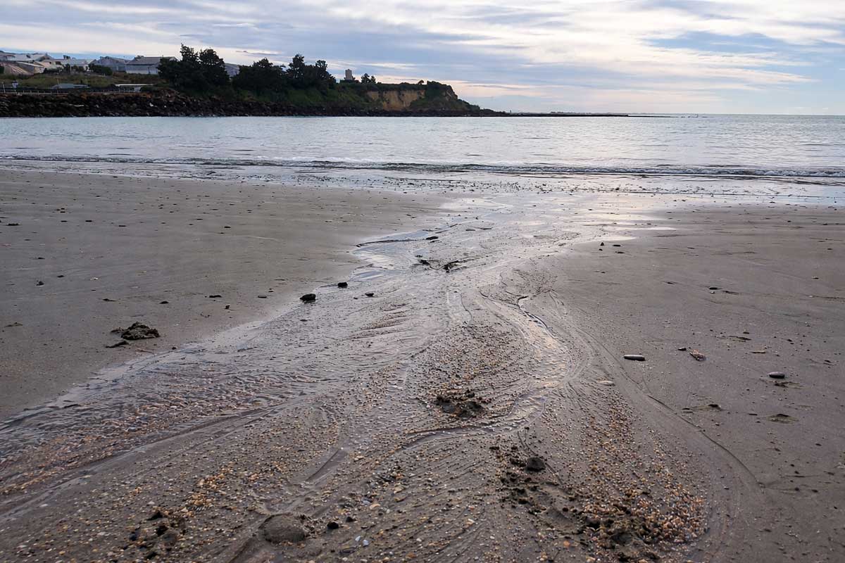
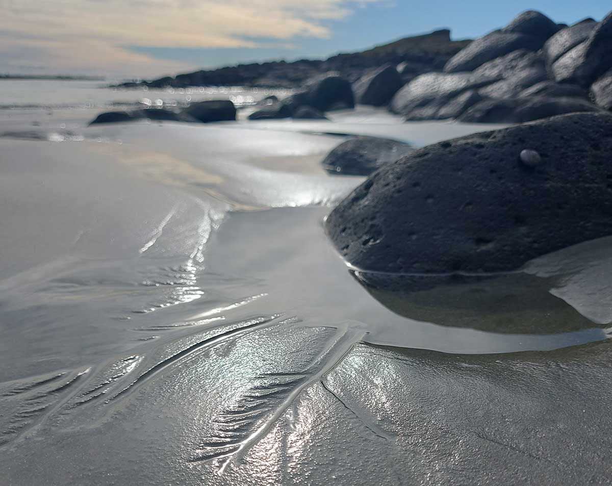
I love to look at the way the water shapes the sand. They look like miniature river systems. This looks a lot like our braided rivers, a pinnate drainage pattern. It is a tiny, temporary drainage network in the wet sand, made as water drains back towards the sea or into a shallow pool after a wave or retreating tide.
Look for a clearer main channel. Lots of small, fine side channels join it at shallow angles. It looks a bit like a feather, which is what “pinnate” means. It also has a little bit of a sub-dendritic look because the branches are natural and irregular, but the feather-like side branches make pinnate the best match from your diagram.
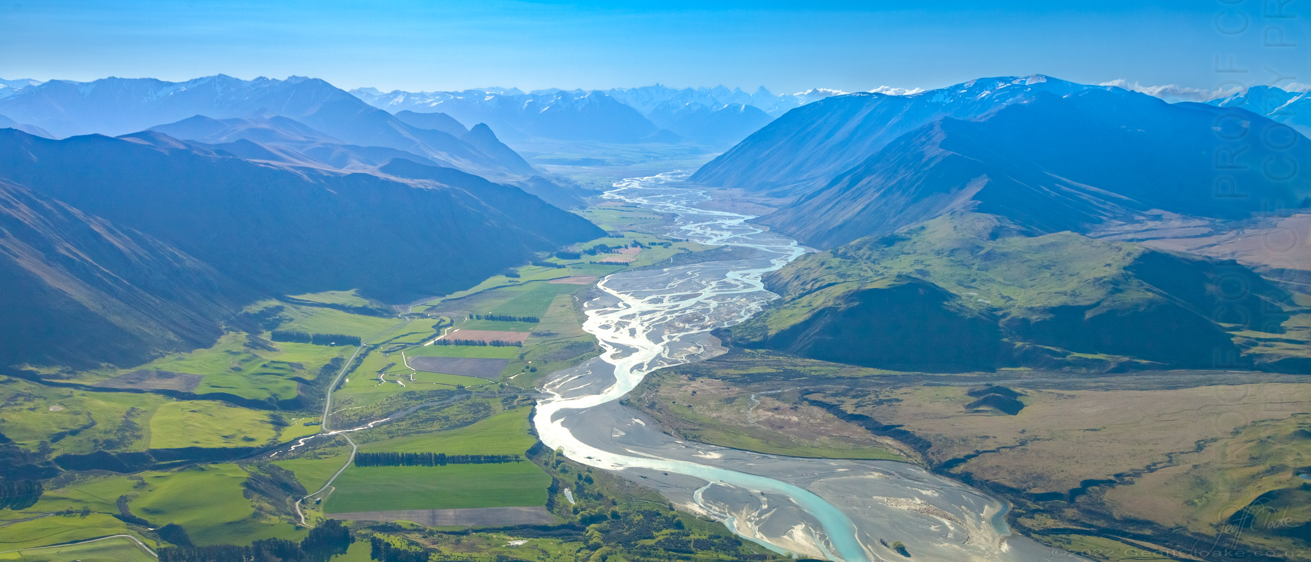
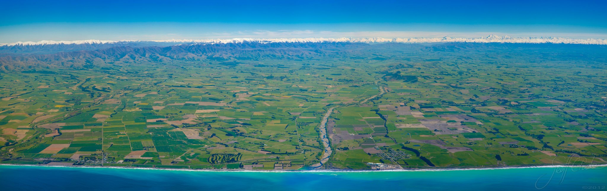
Photos of the Rangitata River
Sometimes it helps to zoom out and see how water drains in context with our big rivers to the tiny drains in the sand on our coast.
In geomorphology, drainage systems, also known as river systems, are the patterns formed by the streams, rivers, and lakes in a particular drainage basin. They are governed by the topography of land, whether a particular region is dominated by hard or soft rocks, and the gradient of the land.
Upper Rangiata looking up the Havelock and Clyde Rivers Erewhon Station to the right Mesopotamia just off to the left - Photography By Geoff Cloake June 2013-copyright
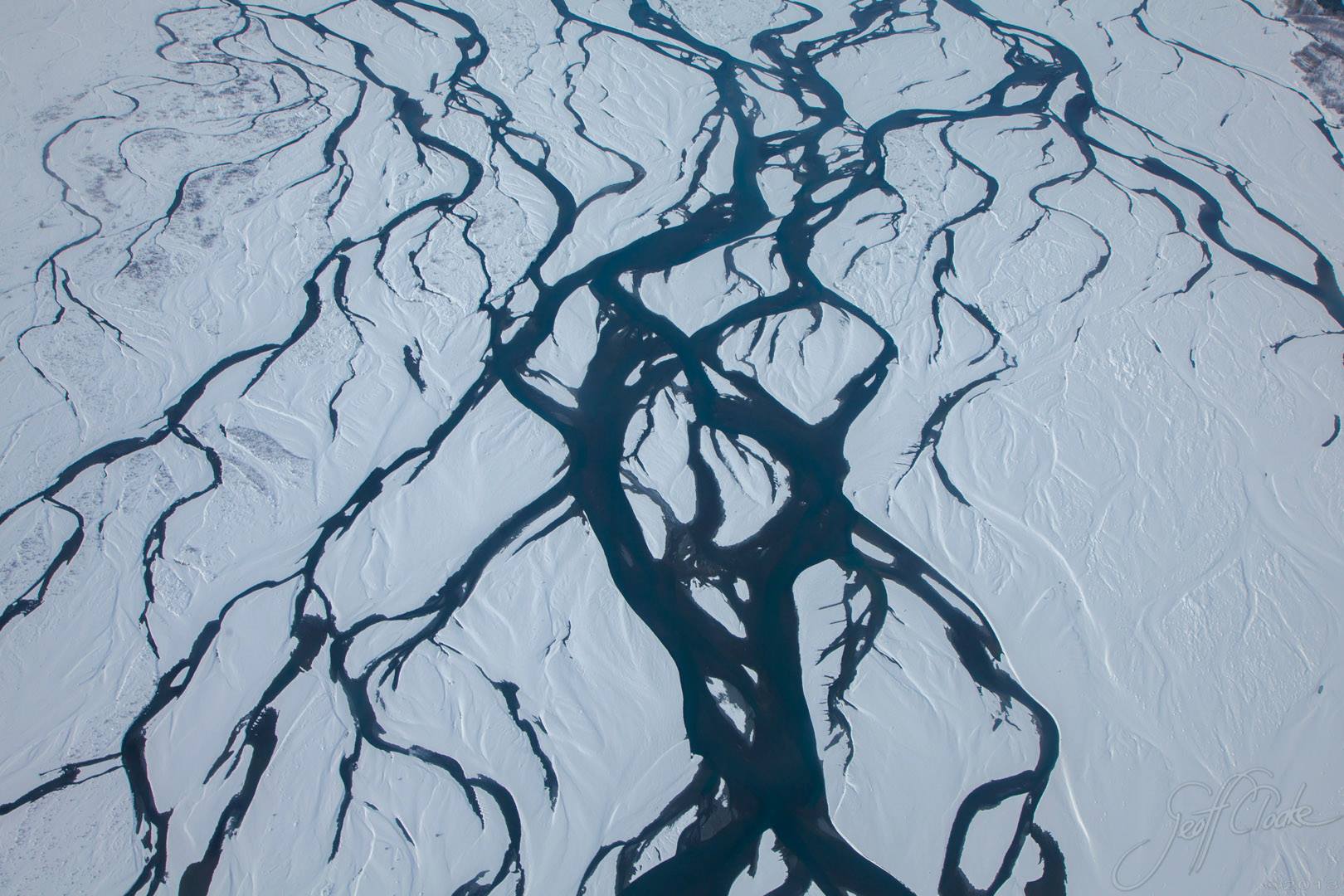
Dendritic drainage systems (from Ancient Greek δενδρίτης (dendrítēs) 'of or like a tree') are not straight and are the most common form of the drainage system. In this, there are many sub-tributaries (analogous to the twigs of a tree), which merge into tributaries of the main river (the branches and the trunk of the tree, respectively). They are seen to feed a river channel that matches and is strongly accordant to the overriding gradient of the land. Truly dendritic systems form in V-shaped valleys; as a result, the rock types must be impervious and non-porous.
A parallel drainage system occurs on elongate landforms like outcropping resistant rock bands, typically following natural faults or erosion (such as prevailing wind scars). The watercourses run swift and straight, with very few tributaries, and all flow in the same direction. This system forms on very long, uniform slopes, for instance, high rivers flowing southeast from the Aberdare Mountains in Kenya and many rivers of Myanmar.
This sometimes indicates a major fault that cuts across an area of steeply folded bedrock.
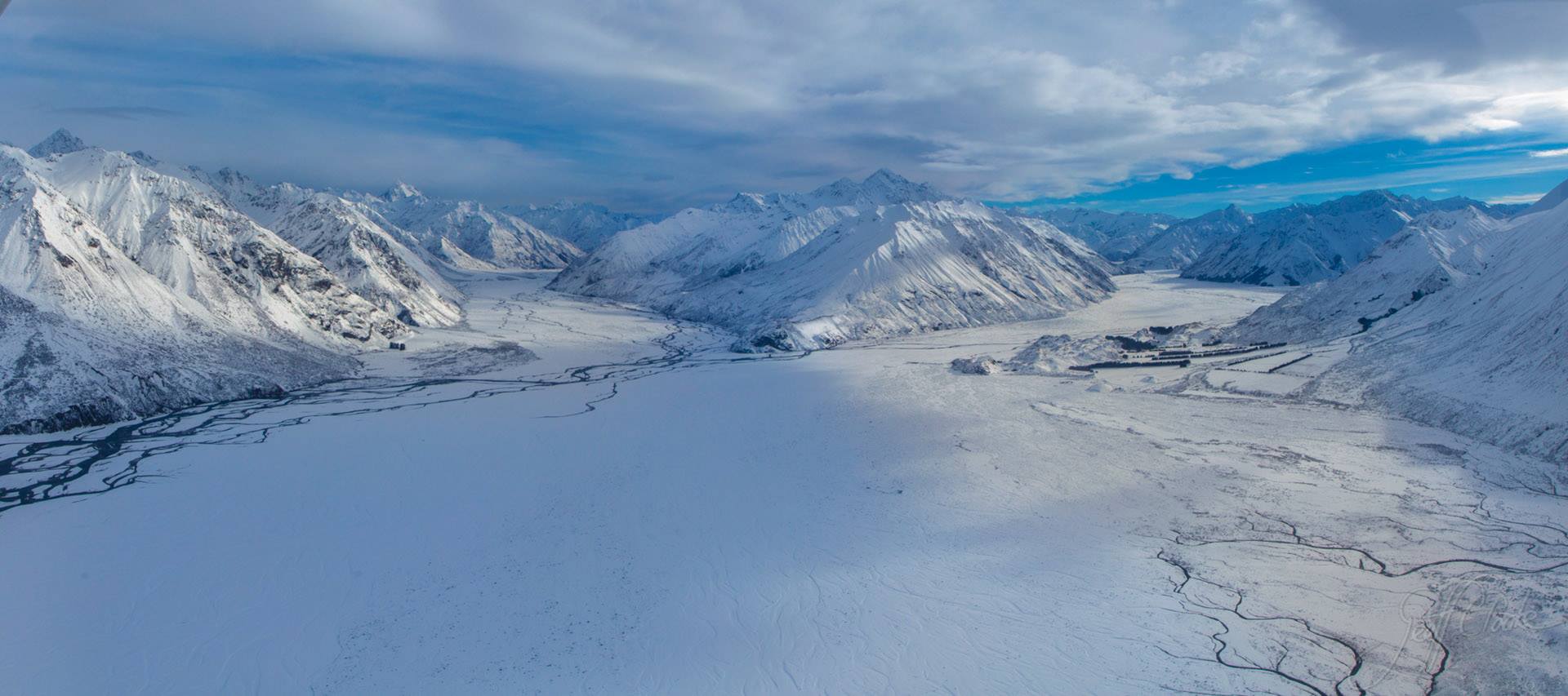
Rangatata River in the Snow - Photography By Geoff Cloake June 2013-copyright
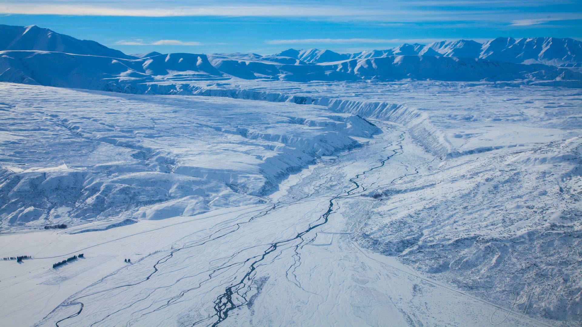
View of the Potts River from above the Rangitata River - Photography By Geoff Cloake June 2013-copyright
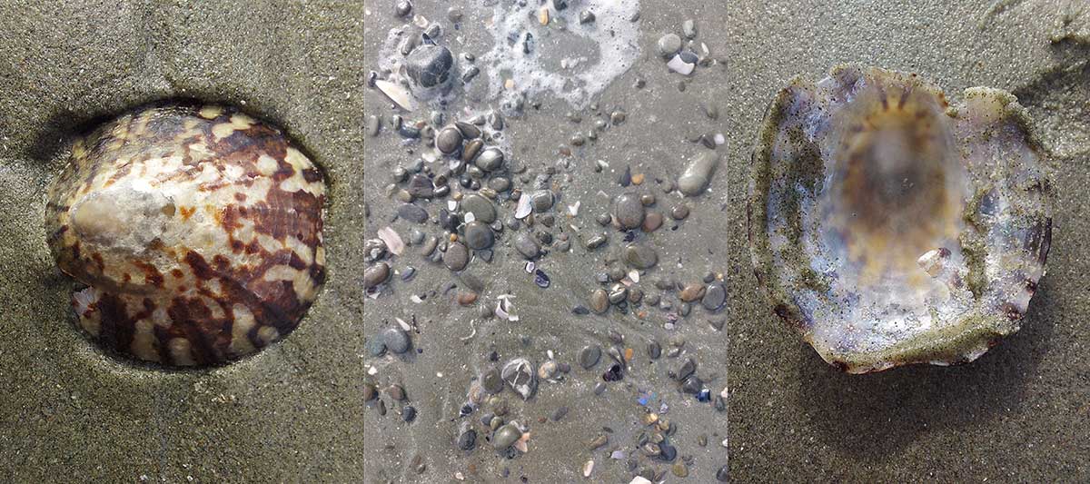
Spy shells in the sand and use INaturalist App to identify what you have found.

Walk out onto the reef at Low Tide. Be very careful because at high tide this can be underwater. In this photo Annabelle has discovered names of people and dates carved into the rock. We had a great time trying to see who could find the oldest date.
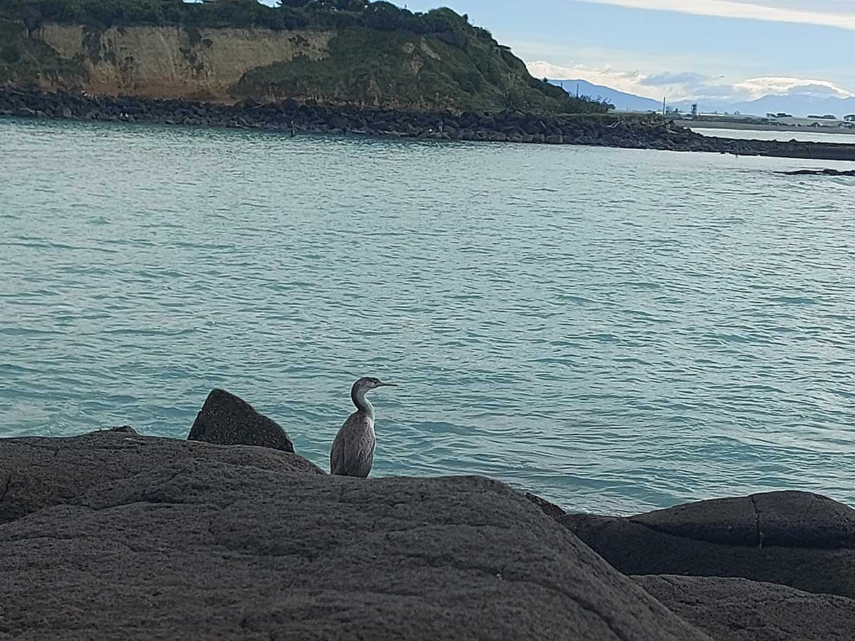
Timaru District Council has installed some new signs about our feathered friends - shags!
New Zealand has an amazing variety of shags and cormorants, and several can be seen around this area, including black shags, little black shags and spotted shags. They are all protected.
The little pied cormorant is the smallest of New Zealand’s shag species and nests only here. The pied cormorant was once rare in Canterbury after being hunted, but it is now making a comeback. Royal spoonbills are easy to spot with their white feathers and wonderful spoon-shaped beaks.
This area is also part of a wider restoration project, helping bring life back to the stream and surrounding habitat. It is a lovely little reminder to slow down on the walk, look a bit closer, and notice the wildlife sharing this special coastal place.
Fun facts we learned from reading the councils information sign
- Te Ahi Tārakihi is a local waterfowl hotspot and an important nesting colony for pied cormorants, little pied cormorants and royal spoonbills.
- Nests can be seen from the viewing point in the poplars and willows north across the stream.
- New Zealand has 12 of the world’s 36 cormorant and shag species.
- Other local species include the large freshwater black shag, little black shag and spotted shag.
- All shag and cormorant species are protected.
- The word “shag” comes from Old English and refers to the bird’s tuft-like crest.
- Foot colour helps identify different shag and cormorant groups. Their feet may be black, yellow or pink. Little pied cormorants and pied cormorants both have black feet.
- True shags are marine birds that usually nest on cliffs, while cormorants are mostly freshwater or estuarine birds that nest in trees.
- Male pied cormorants bring nesting material to the female, and in spring they may be seen flying overhead carrying it.
- The little pied cormorant, or kōauauka, is New Zealand’s smallest shag species. It is endemic, meaning it occurs only in New Zealand, and its conservation status is At Risk, Relict.
- The pied cormorant, or kōau, was once hunted until it became rare in Canterbury. It is now making a strong comeback.
- Te Ahi Tārakihi is one of only four pied shag nesting sites in South Canterbury.
- The pied cormorant subspecies found here is endemic to New Zealand and ranked At Risk, Recovering.
- The royal spoonbill, or kōtuku ngutupapa, is recognised by its white plumage and large spoon-shaped beak.
- Royal spoonbills self-introduced to New Zealand and were first recorded here in 1861.
- Their population was only 52 birds in 1977, but is now around 3,000.
- Although royal spoonbills are widespread, they are still ranked At Risk, Naturally Uncommon.
- The sign was produced by Timaru District Council, with photo credits to Andrew Crossland.


