By Roselyn Fauth
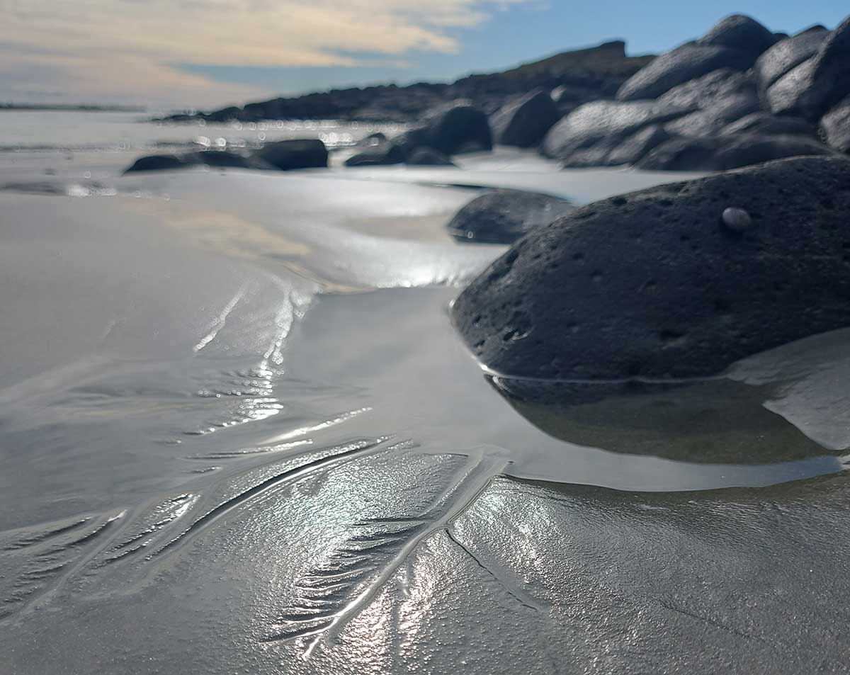
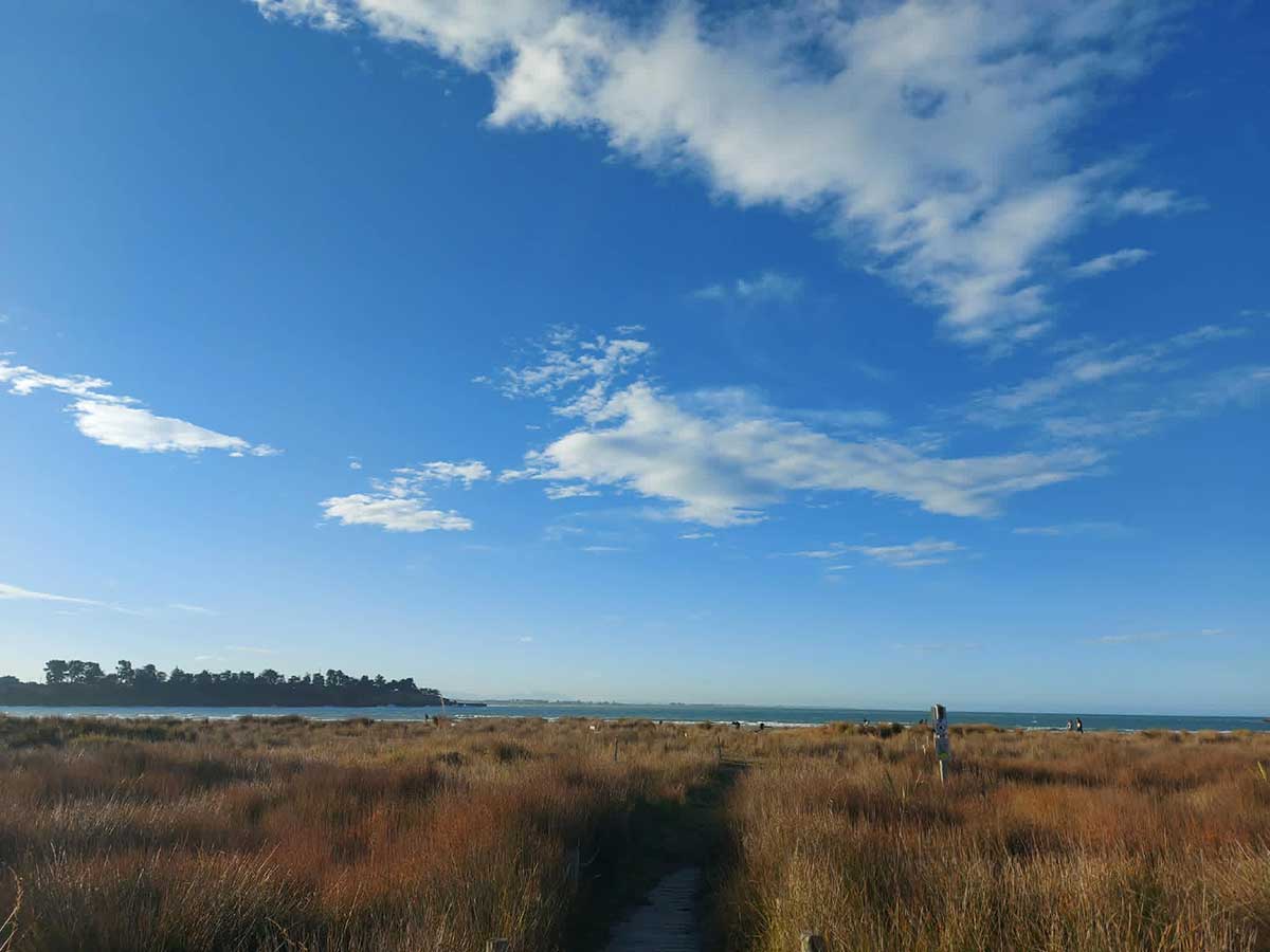
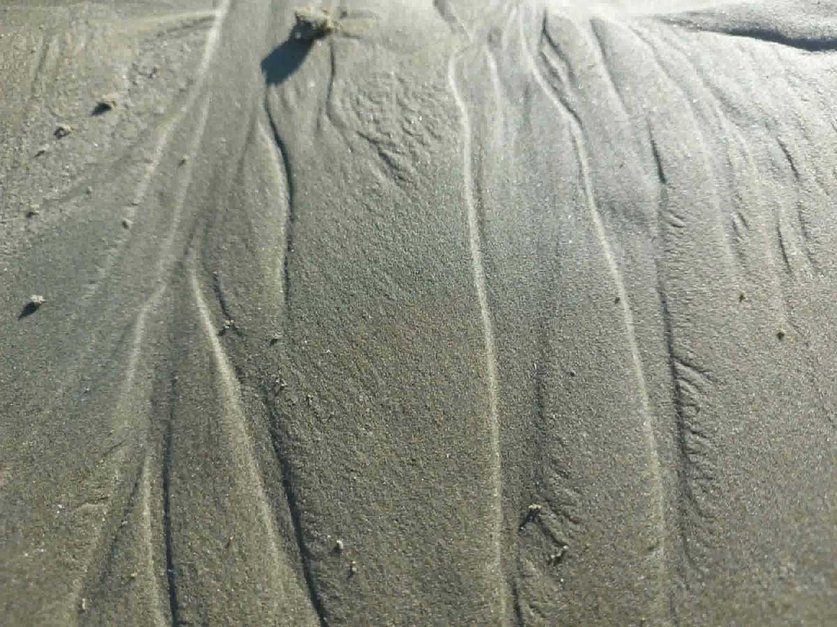
A mini drainage systems in the sand at Shark Bay, Dashing Rocks, Timaru at low tide. - Photo Roselyn Fauth 2026. South Canterbury is not a fixed landscape. It is still being shaped, grain by grain, by mountains, ice, rivers, wind, waves, and time.
Have you ever notices the patterns in the sand of tiny water ways finding their way to the ocean? These mini river systems in the sand are not random, and if you look closely then compare what you see by your foot from what you could see if you were in a plane, it tells us a little bit more about the way water moves from mountains, across plains and into the Pacific Ocean.
Taking notice of how water shapes the sand, can help us think about the larger shapes of the rivers in South Canterbury. A catchment is the area of land where rainwater, stormwater, streams and groundwater drain towards a shared waterway, river, estuary, coast or groundwater system. One catchment or water zone can include urban streets, parks, drains, streams, industrial areas, farms, hillsides, wetlands, estuaries and coastline. Water does not stop at suburb boundaries. What happens in one part of of Canterbury, such as sediment, rubbish, pollution, planting, development or stormwater runoff, can affect waterways further downstream.
For us in Timaru and the wider Canterbury area, we care for more braided rivers than any other region in New Zealand, covering about 164,000 hectares. Seven alpine braided rivers provide about 88%of Canterbury’s river flow. DOC states that Canterbury contains about 60% of New Zealand’s braided river habitat. We live in a very complex and diverse area. Water is managed as a connected system. For example, the Ōrāri Temuka Ōpihi Pareora water zone, which includes Timaru’s wider water context, has hill-fed braided rivers, coastal areas, and strong, complex links between groundwater and surface water.
Understanding the geomorphology of the area helps us appreciate how water connects places. This knoledge then supports plans, processes and projects for flood protection, emergency management, biosecurity, environmental and regulation. I started this blog as a lesson I learned with the sand, and as I delved into this deeper I realised how it is also a story about local knowledge, long-term relationships and integrated planning across land, water, and communities... wouldn't be a WuHoo Blog with out a side quest hey?!
Explore our shore at low tide and see what WuHoo's you can find...
Have you looked down to the sand below your feet and noticed this too?
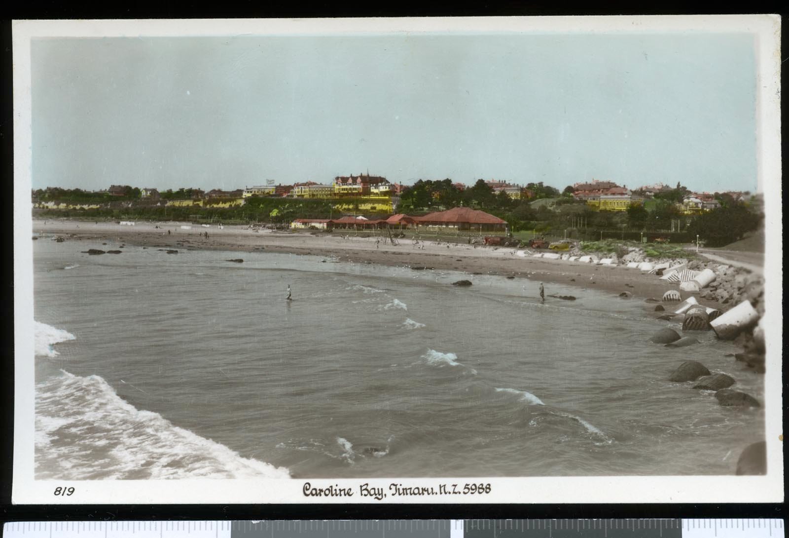
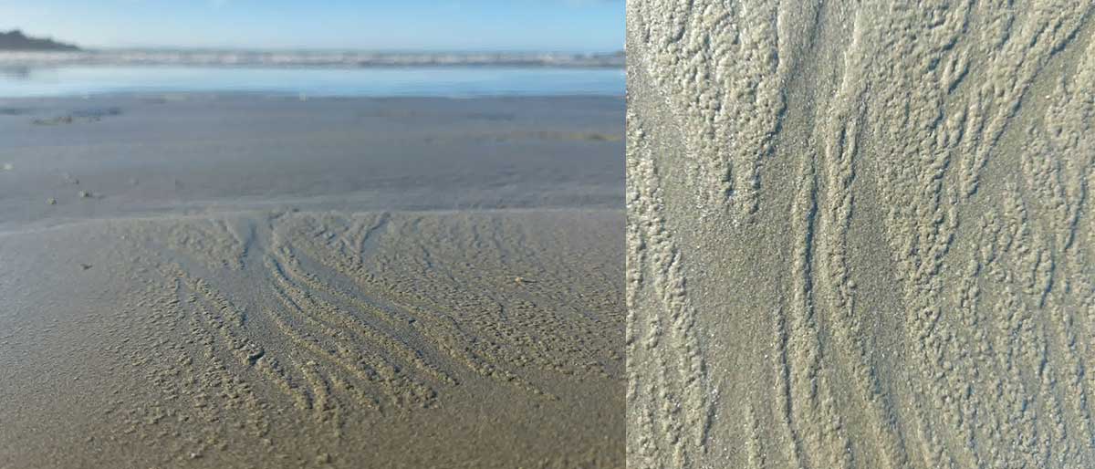
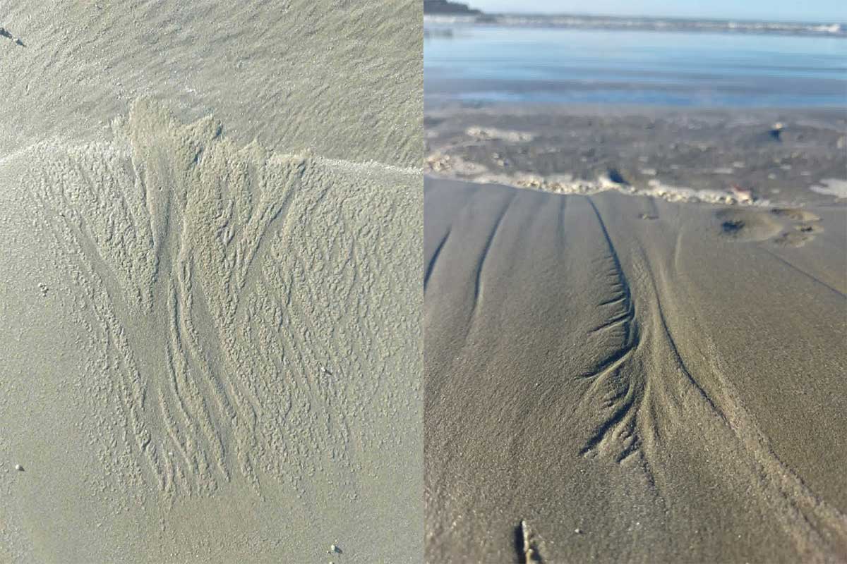
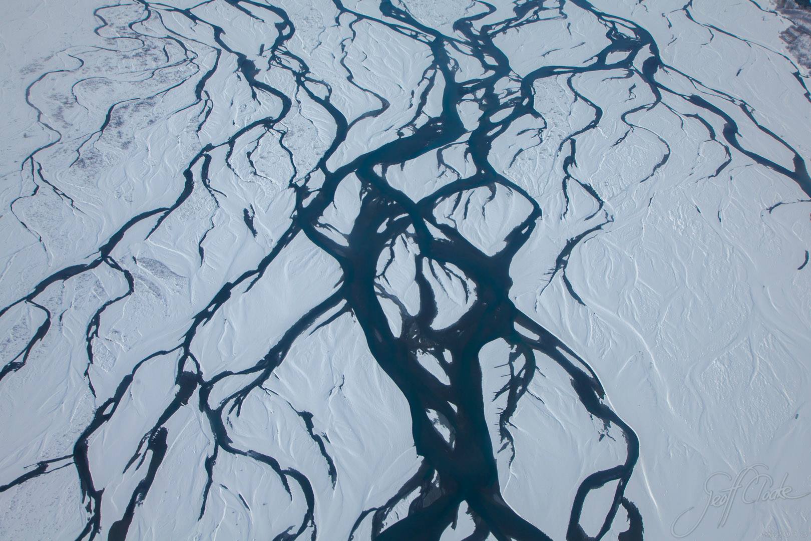
At Caroline Bay or Shark Bay at Dashing Rocks, after the tide pulls back, the sand is briefly covered in tiny lines of water. They gather, split, rejoin, hesitate, then find a path. Some are no wider than a thread. Some branch like trees. Some divide and come back together again, like the familiar braided rivers we know so well in Canterbury.
And then they vanish... The next wave comes in and the whole thing is gone.
I have loved studying these ever since I was kid. A little channel caught the light. Not just a trickle in the sand, but a tiny version of the Rangitata from one of my dad Geoff’s aerial photos. Only this one was small enough to step over, or scape away with a finger...
I probably get that from my parents. My dad has always loved geography. All my life he has been learning about our place and sharing what he sees with my siblings and me. He has been invited to fly over the land and photograph it from above, to help explain how our geography works: how water moves, erodes, carries, deposits and replenishes the land. Those aerial views helped me understand the patterns of rivers, coastlines and catchments in a way maps alone never quite could.
And then, on the beach, there it was in miniature.
Of course, these are not real river systems in the full scientific sense. A geomorphologist would probably call them temporary rill networks or miniature drainage patterns. They form quickly as water drains across wet sand and may last only seconds. But they are not random.
Water is always responding to gravity. In the high country, rain and snowmelt flow down through streams and rivers towards the sea. On the beach, the same basic idea happens on a tiny scale. A wave runs up the sand, then gravity pulls the water back down. As it drains, it shifts grains of sand and carves little paths.
The sea moves in and out because of tides. The Moon’s gravity does most of the pulling, with the Sun playing a part too. As the tide rises, the sea reaches further up the beach. As it falls, wet sand is left behind, and that is when these little patterns appear.
It is all connected: mountain rain, river flow, coastal sand, moon pull, gravity, erosion and renewal.
I love thinking about these big forces, when I study the tiny evidence on our shore.
And you can spy it all just by looking down at your feet. You do not need a ticket, a classroom, a plane ride, or special gear. Just a beach, a low tide and a bit of curiosity. That is what we call a WuHoo, how we find our free fun in Timaru.
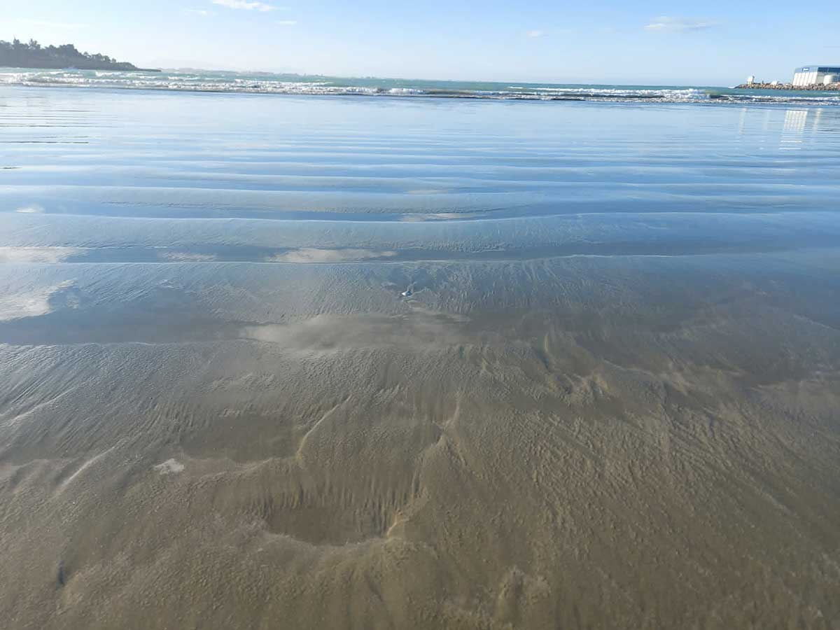
Look for a main channel. Then see if smaller side channels join it. Does it look like a feather? A tree? A fan? A little braided river? Can you see where the water has cut into the sand, and where it has left sand behind?
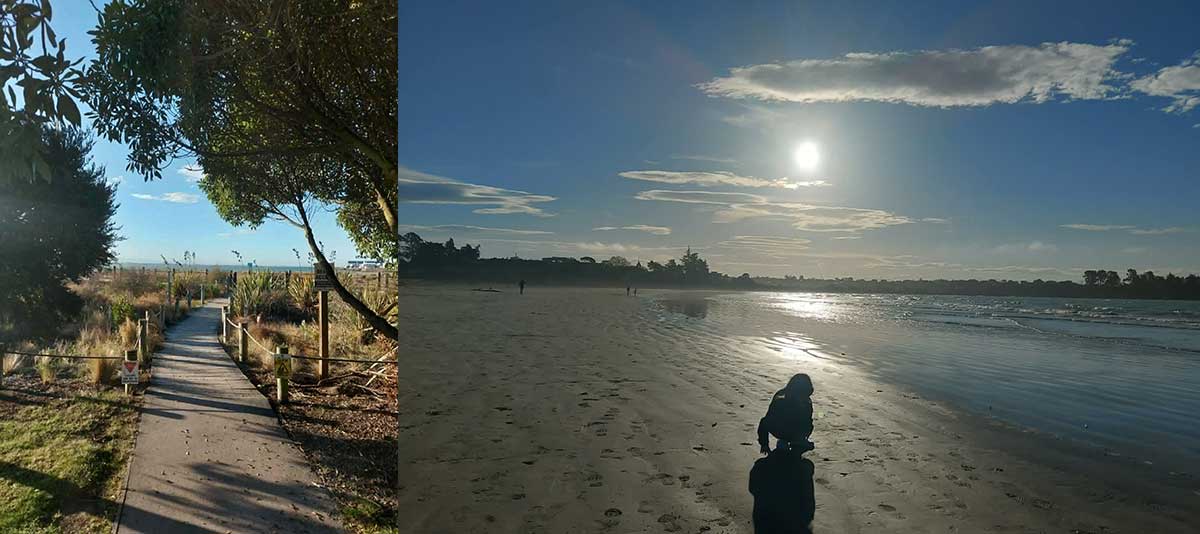
At Caroline Bay, this is easy family fun because the soft sand is right there. At Shark Bay, look near shallow pools and gently sloping wet sand. At Dashing Rocks, low tide gives you even more to explore, with rock pools, carved names in the basalt, and the old lava rock under the cliffs.
That is another thing I love about Dashing Rocks. The dark basalt is millions of years old, formed from ancient lava flows from Mount Horrible. Right beside it, these tiny water patterns may have formed only seconds ago.
While you are there, keep exploring. Look for shells in the sand. Peer into rock pools. See if you can spot starfish or other small creatures. Look up for shags, cormorants and spoonbills. Try to find old names carved into the stone, and see which one looks the oldest.
Just take care please. Visit at low tide, watch the waves, be careful on slippery rocks, stick to public access, respect fences and gates, well back from the cliff edge, and keep dogs on a lead.
This is the kind of free fun I love sharing through WuHoo. It helps us know our place better without making it complicated. You can go for a walk, look down, ask a few questions, and see how the beach is not just sand. It is a tiny landscape, changing every tide.
So next time you are at the beach, look down. You might find a little version of a Canterbury river, right under your feet. The mini “river systems” in the sand are a lovely way into a much bigger story about water, land, coast, sediment, erosion, community action and environmental responsibility.
Some Fun Facts for your free fun hunting
- Canterbury is New Zealand’s braided river heartland. More than 60 percent of Aotearoa New Zealand’s braided rivers are in Canterbury.
- Braided rivers are globally rare. They only form where the right mix of steep mountains, variable flows, loose gravel and open riverbeds allows channels to split and rejoin.
- Canterbury’s braided rivers cover about 164,000 hectares, and the region has more braided rivers than any other region in New Zealand.
- Seven alpine braided rivers provide 88 percent of Canterbury’s river flow. These include the Rangitata and Waitaki, both important to South Canterbury’s wider landscape story.
- The Rangitata / Rakitata River travels about 121 km to the sea and has a catchment of more than 177,000 hectares. DOC describes its braids as criss-crossing a wide gravel bed from the mountains to the coast.
- The Opihi River flows about 75 km through South Canterbury and has a catchment of about 245,000 hectares, with tributaries including the Opuha, Kakahu, Waihi, Tengawai and Temuka.
- Braided rivers are wildlife hotspots. Their shifting gravel beds and channels support native birds, fish, reptiles, invertebrates, plants and lichens.
Understanding where our water flows, what pressures our waterways face, can guide how where our community needs to focus for the health, mauri and biodiversity of the places, wet and dry, around us.
Braided rivers are special because they do not stay in one neat channel. They split, rejoin, shift and rebuild themselves, carrying water and gravel from the mountains towards the sea. In South Canterbury, rivers like the Rangitata, Opihi and Pareora help shape the land, replenish the coast, support wildlife, and remind us that water is always moving through a much bigger system.
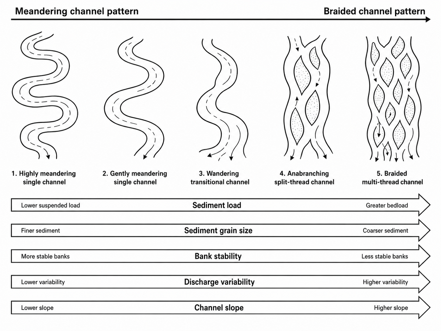
This black-and-white diagram shows how river channel patterns can change along a continuum from a single, highly meandering channel to a multi-thread braided channel. On the left, the river has one winding channel with stable banks, finer sediment, lower slope, and lower discharge variability. Moving towards the right, the channel becomes less stable and begins to split around bars or islands. At the far right, the river forms a braided pattern, with several shallow channels weaving around exposed sediment bars. The arrows beneath the sketches show the main environmental trends associated with this change. From left to right, sediment load increases towards greater bedload, sediment becomes coarser, bank stability decreases, discharge variability increases, and channel slope becomes steeper. The diagram helps explain why some rivers form smooth meanders while others develop braided, shifting channels. - Diagram By Roselyn Fauth based on a number of digarams found on the internet.
We live with a living water system, where rain, stormwater, streams, groundwater and rivers move across the landscape towards a shared outlet. Understanding this bigger area helps us see how actions upstream can affect water quality, flooding, biodiversity and communities downstream.
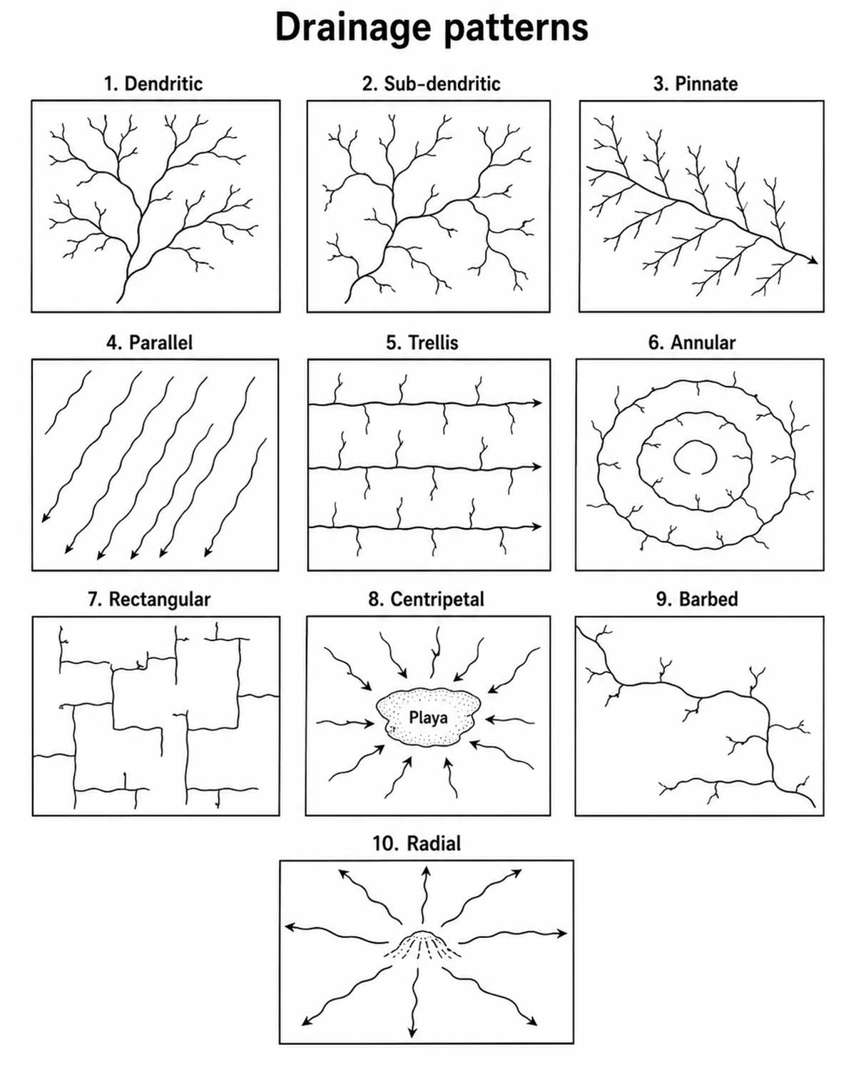
This black-and-white diagram shows ten common drainage patterns, which are the ways streams and rivers arrange themselves across a landscape. Each pattern reflects the shape of the land, the type of rock underneath, slope, erosion, and geological structures such as faults, joints, folds, or basins.
Dendritic drainage has a tree-like form, with many small tributaries joining a larger channel. Sub-dendritic drainage is similar, but less regular. Pinnate drainage looks like a feather, with short tributaries joining a main stream at sharp angles. Parallel drainage forms where streams flow in the same direction down a slope.
Trellis drainage develops where streams follow long valleys and smaller tributaries join at near right angles. Annular drainage forms in ring-like patterns around a dome, basin, or circular geological structure. Rectangular drainage has sharp bends and right-angle turns, often controlled by cracks or faults in the rock.
Centripetal drainage flows inward towards a central low point, such as a playa or basin. Barbed drainage has tributaries that appear to join the main stream from the “wrong” direction, often showing that a river system has changed course. Radial drainage flows outward from a central high point, such as a hill, volcano, or dome.
Miniature drainage patterns in sand
The little tree-like lines you often see in damp sand are usually a dendritic drainage pattern. They form when water trickles across the surface and tiny channels branch and join, a bit like the branches of a tree. On a beach, these miniature patterns can appear as seawater drains back towards the sea, or when rainwater runs over loose sand. This is a small-scale version of how water naturally finds the easiest path downhill. The shape is controlled by the slope of the sand, how wet or compacted it is, and how easily the grains can be moved.
How this links to Canterbury’s braided rivers
Canterbury’s famous rivers, such as the Rangitata, Rakaia and Waimakariri, are more like a braided channel pattern than a dendritic one. Instead of one tree-like network of small streams, a braided river has many shallow channels that split, rejoin and weave around shifting gravel bars. Braided rivers usually form where there is:
- lots of coarse sediment or gravel
- a steep slope from the mountains
- variable river flow, especially after rain or snowmelt
- banks that are easily reworked by the water
So, in sand, the tree-like pattern is usually dendritic. The pattern most like Canterbury’s braided rivers is the multi-thread, braided pattern, where water divides into several channels and flows around bars of sand, gravel or sediment.
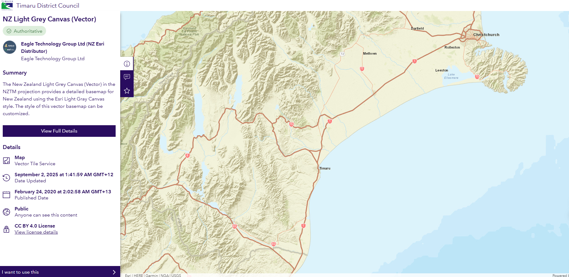
Interactive Basement Layer Map - Timaru District Council https://data-timaru.opendata.arcgis.com/maps/fed71141e42a45c49dabb30a4c2903e1/explore?location=-44.232673%2C171.548035%2C9
Understanding how braided rivers move helps us respect them. They are not just blue lines on a map, but living, changing landscapes. When we notice tiny river-like patterns forming in beach sand, we are seeing a small clue to the same process: water finding its way, cutting channels, leaving sediment behind, and quietly reshaping the world under our feet.
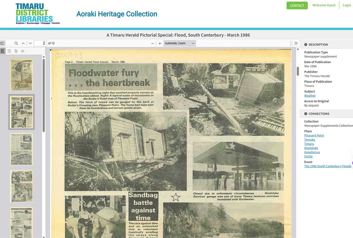
Learn about the devistation a flood can bring by reflecting on the May 1986 Floods: https://digitalnz.org/records/54440047
From miniature rivers to real floods
You can see the same processes in miniature on damp sand. After rain, or as seawater drains back across a beach, tiny channels form like little tree branches. This is geomorphology in action: water finding the easiest path downhill, cutting, carrying, depositing and reshaping the surface as it goes.
On a much larger scale, Canterbury’s braided rivers show the same restless movement. Instead of one fixed channel, rivers can split, rejoin and shift around gravel bars, especially when they carry heavy sediment from the mountains. During extreme rain, that movement can become dangerous very quickly.
The 1986 flood demonstrates how quickly rain falling in one part of a catchment can become a major disaster downstream. Water is connected across the whole landscape, from foothills to rivers, towns, roads, farms and homes. Heavy rain in the foothills sent floodwater rushing through rivers, creeks and low-lying land, overwhelming Pleasant Point, Temuka and surrounding communities. It was a stark reminder that understanding how water moves through a landscape is not just geography. It is essential for planning, preparedness and protecting people.
Facts from the 1986 South Canterbury floods
- On 13 March 1986, more than 100 mm of rain fell in just 12 hours, sending floodwater rapidly down from the foothills into rivers, creeks, roads, farms and towns.
- The flood affected communities across South Canterbury, including Pleasant Point, Temuka, Hakataramea, Cave, Pareora, Seadown and Timaru.
- In Pleasant Point, the Te Ngawai River inundated homes, damaged water and sewerage systems, and forced the evacuation of the town’s 1,200 residents to Timaru.
- In Temuka, sandbags were placed across King Street, showing how quickly flood protection became an emergency response.
- Helicopters made repeated rescue flights, including lifting people from rooftops, while relief centres were set up in Timaru to register evacuees and share updates.
- In Timaru, floodwater transformed familiar streets and roads. Selwyn Street was nicknamed “Selwyn River”, and Hilton Highway became like a lake.
- The flood caused an estimated $50 million in damage, claimed one human life, and killed more than 10,000 farm animals.
- A later scientific report noted that the 1986 weather pattern resembled the major 1945 floods, but the 1986 rainfall was far more intense because it fell over only 12 hours, rather than 36.

Soil erosion caused by flood - South Canterbury Museum 3182
This is a montage showing soil erosion caused by the "great flood" of February 1945 in Levels County.
Fifteen prints mounted on a card backing providing labelled views:
- "Hillside slips. J Agnew. Totara Valley" (two prints);
- "Erosion of clay by running water. Rosewill Valley Road";
- "Hillside slips. W A Hartnett. Levels Valley";
- "Erosion of ploughed land. W J Black. Limestone Valley" (two prints);
- Overflow from the Opuha River - Raincliff. Pleasant Point-Fairlie M.H.";
- "Timaru Airport. Saltwater Creek" (two prints);
- "Opihi River erosion. A P Shaw. Kerrytown" (three prints);
- "Hillside slips. D A Robertson. Rosewill Valley";
- "Hillside slips. E O'Connell. Totora Valley";
- "Erosion of ploughed land. R B Johnson. Rosewill."
The Earth is shaped through ongoing relationships between material, energy, time, and force. A handful of sand can teach us how a whole landscape is made.
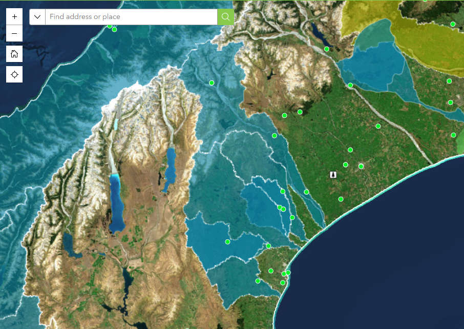
The NZ Landcare Trust Interactive Map has a useful tool for exploring our local catchment and understanding how it connects to the wider environmental picture across Aotearoa New Zealand. The map has been created by NZ Landcare Trust, an independent charitable organisation established in 1996 that works with landowners, catchment groups, Landcare groups, agencies, and communities to support sustainable agriculture and environmental care.
Understanding catchments is important because everything that happens on the land, from farming and planting to stormwater, erosion, pollution, and restoration, can affect the streams, rivers, wetlands, and coastlines that water flows into. By zooming into our area, people can see local catchment and environmental community groups, water quality monitoring sites, marae, Māori land blocks, and iwi areas of interest, helping us understand who is working locally to care for land and waterways, and how our catchment fits within the broader network of community-led environmental action around the country.
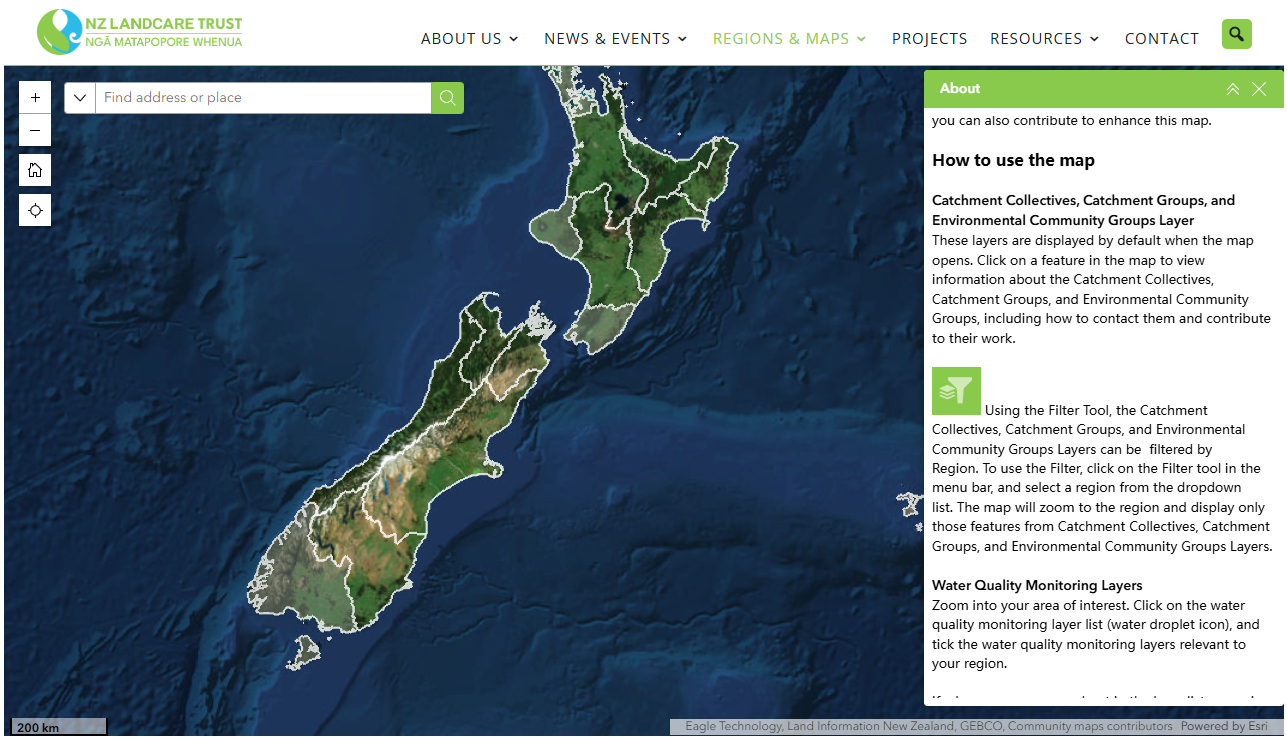
We can use the NZ Landcare Trust Interactive Map to help people understand that Timaru is not just a town beside the sea, but part of a connected network of catchments, waterways, communities, farms, wetlands, coastlines, marae, and environmental restoration work.
The tool lets us zoom into our local area to see nearby catchment groups, environmental community groups, water quality monitoring sites, marae, Māori land blocks, and iwi areas of interest. For Timaru, this helps place us within the wider Ōrāri, Temuka, Ōpihi and Pareora water zone, which stretches from the Pareora catchment in the south to the Rangitata River in the north, and from Burkes Pass to the sea. This area includes hill-fed rivers, spring-fed streams, smaller coastal waterways, and the takiwā of Te Rūnanga o Arowhenua.
In practical terms, the map can help us ask: Where does our water come from? Where does it flow? Who is caring for it? What monitoring is happening? And how do our local streams, rivers and coast connect to the bigger picture across Aotearoa New Zealand? It is a simple way to show that what happens on land, including planting, farming, erosion, stormwater, pollution, and restoration, affects the health of the waterways around us and the places they flow into. It also helps people see that catchment care is community work, involving local groups, landowners, councils, agencies, mana whenua, and volunteers working together. Environment Canterbury describes the local Ōrāri Temuka Ōpihi Pareora water zone committee as a joint committee of Timaru District Council, Mackenzie District Council and Environment Canterbury, working with the community to support the Canterbury Water Management Strategy.
NZ Landcare Trust partners with farmers, stakeholders, agencies; and community catchment and landcare groups to make a tangible difference in the future of New Zealand’s waterways and landscapes.
Local Catchment groups near Timaru:
Pareora Catchment Group
Te Ngawai Catchment Group
Opihi Catchment Group
Orari River Protection Group
Rangitata Landcare Group
NZ Landcare Trust comprise 11 active regions, around 145 catchment groups and over 400 community groups.
Local catchment groups around Timaru have helped build community knowledge, support farmers, monitor stream health, plant native species, restore wetlands and waterways, strengthen relationships with mana whenua, and bring schools, councils, landowners, businesses and volunteers together. Their work can be seen in projects such as Te Ahi Tarakihi Stream, the Ōpihi River restoration work, farm biodiversity planning, eDNA testing, and the Waitarakao Washdyke Lagoon Catchment Strategy.
Team work and legislation shapes how local government is organised with local people to care and improve our place, people and creatures for future generations.
Timaru District Council has an important role in managing local services such as urban stormwater, roads, parks, wastewater and community infrastructure. But as we know water does not stop at the edge of the district. Rain, stormwater, groundwater, rivers, sediment and pollution all move through a wider catchment system, from inland hills and farms to streams, wetlands, lagoons and the coast. That is why Timaru needs to work with its neighbours, mana whenua, landowners, catchment groups and communities. Local councils can manage local infrastructure, but healthy waterways, flood protection, biodiversity and climate resilience work best when planning at the scale of the whole catchment. Just like standing at the sandy beach and noticing the networks of tiny streams following gravity to to the sea.
- Rivers and streams flow across district boundaries.
- Groundwater systems sit beneath more than one council area.
- Floods can begin far inland and affect towns, farms, roads, bridges, wetlands and coastlines downstream.
- Sediment, nutrients, rubbish and pollutants can move from one part of a catchment to another.
- Biodiversity corridors, pest plants, pest animals and fish habitats are not confined to one district.
- Mana whenua relationships, mahinga kai values and cultural landscapes are wider than council boundaries.
- Consistent rules are needed for water takes, discharges, land use impacts, river works and flood protection.
- Big issues such as climate adaptation, river resilience and coastal change need shared planning and shared investment.
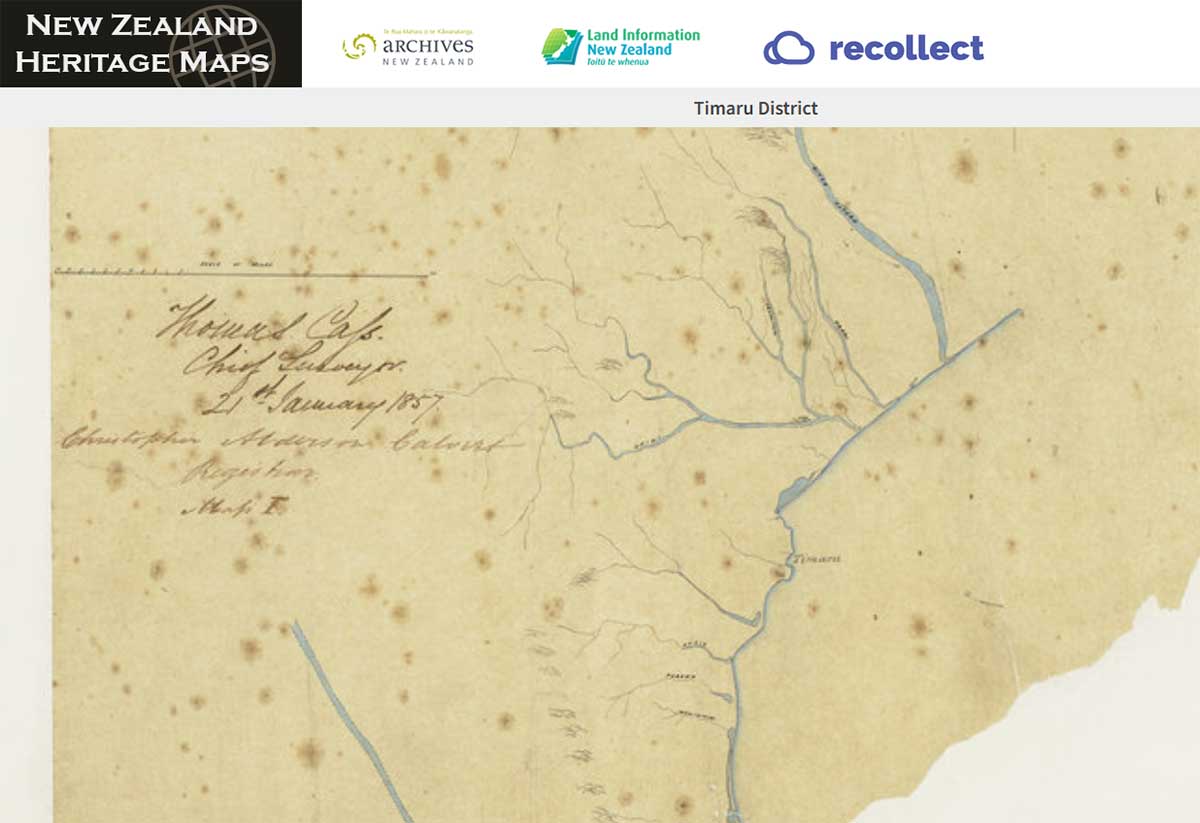
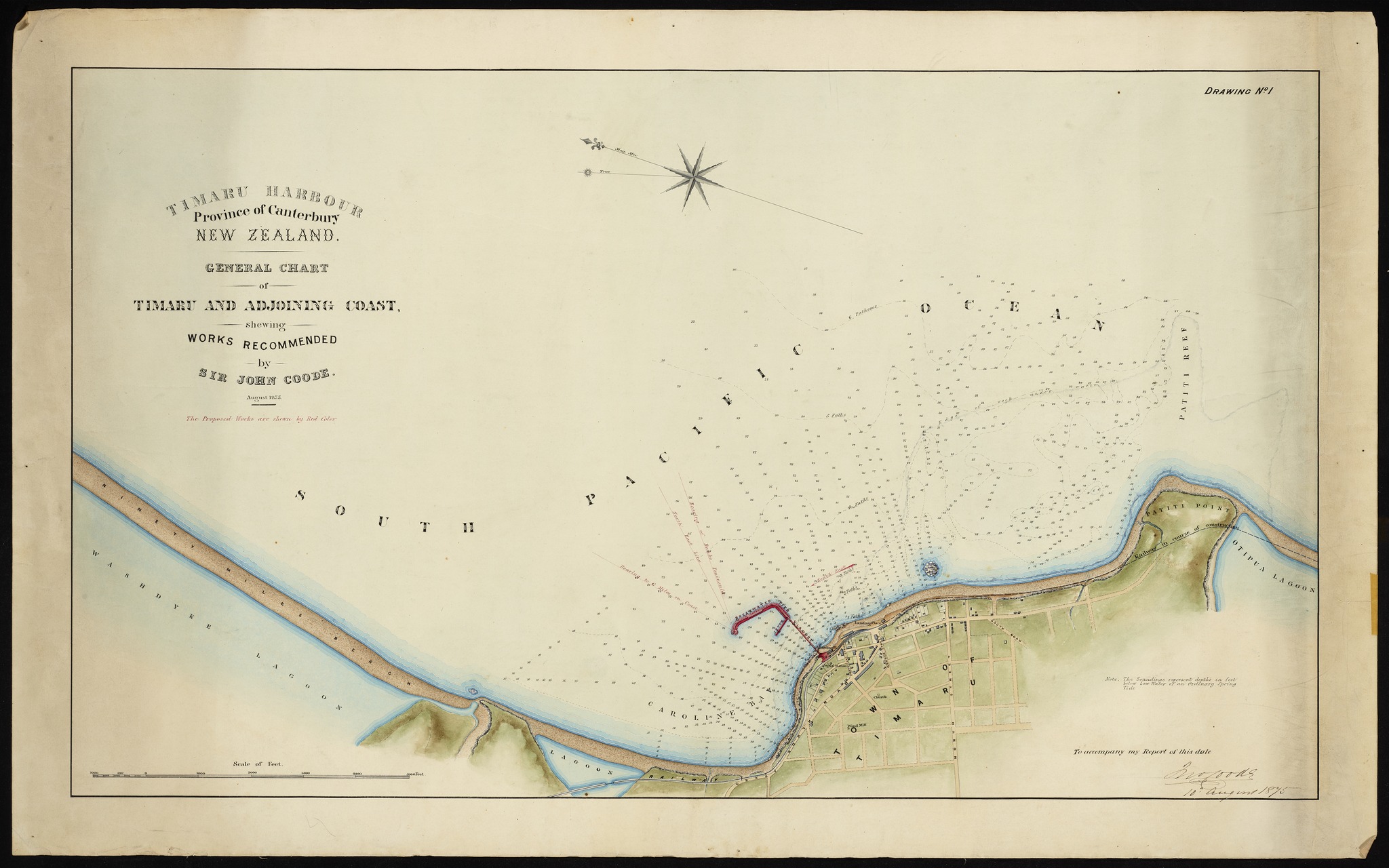
It is interesting to look at old maps and see how the catchment was recorded.
Timaru District (1857). NZ Heritage Maps Platform, accessed 07/05/2026, https://maps.recollect.co.nz/nodes/view/2447
Held by: Archives New Zealand/Te Rua Mahara o te Kāwanatanga, Christchurch Regional Office
The Rosewill Valley Catchment Group, who are based on the rolling downlands inland of Timaru includes Waitarakao (Washdyke Lagoon), one of South Canterbury’s most culturally and ecologically significant sites. Planting along water ways can make a big difference to the water quality, mitigating erosion, and supporting wildlife with corridors of habitat. The bird life in this relatively small patch was a delight.
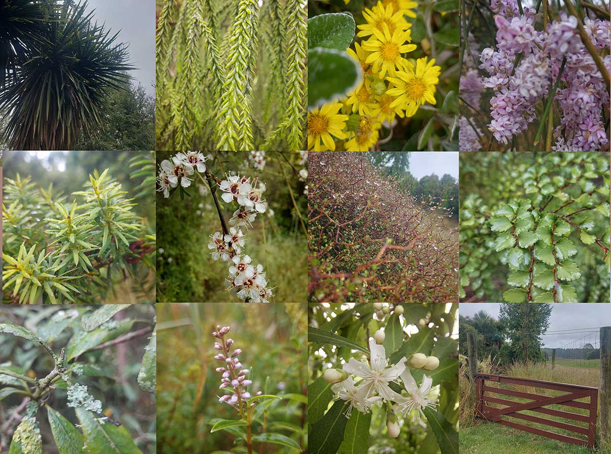
Examples of natives on Bassett Road, Rosewill planted by one man over 10 years to rejuvenate a wee corner by a stream and to bring back the birds. - Photography By Roselyn Fauth 2025
Resources
https://www.geographie.uni-wuerzburg.de/en/geomorphology/current-research-projects/the-geomorphology-sandbox
https://gislab.utk.edu/outreach/ar-sandbox/teaching-with-the-ar-sandbox
https://news.colby.edu/story/geomorphology-teaching-tools
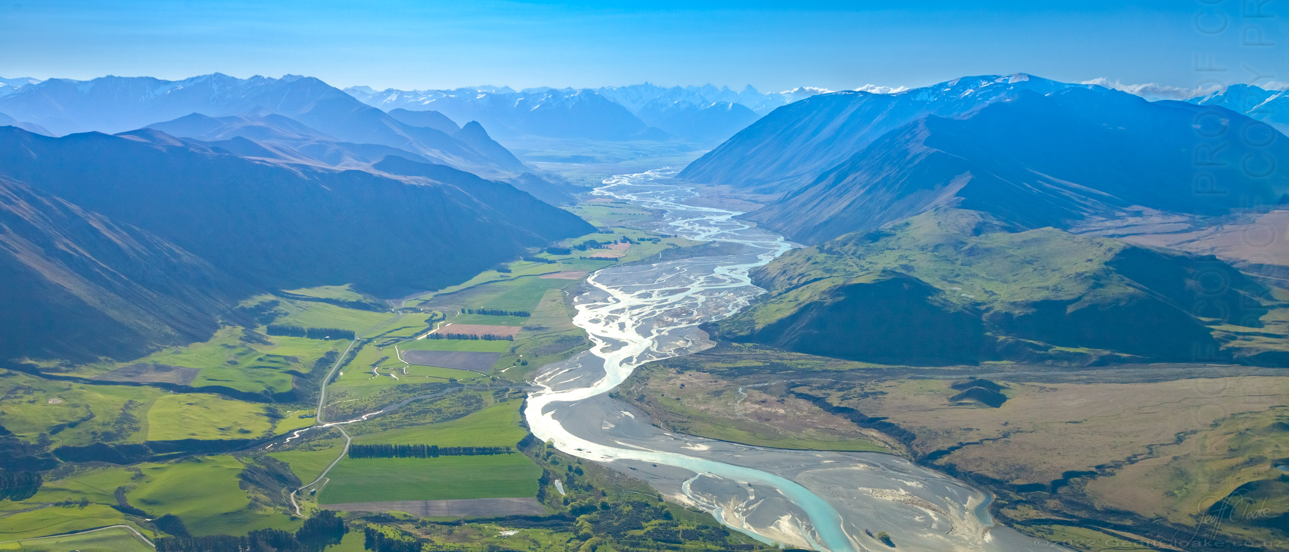
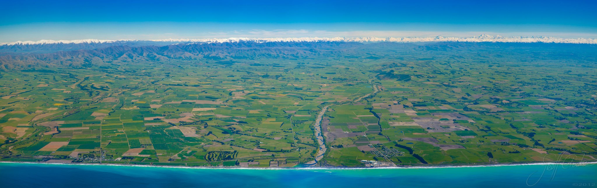
Photos of the Rangitata River By Geoff Cloake - Copyright
The Southern Alps were pushed up by tectonic forces. Ice then carved valleys and ground rock into sediment. Rivers carried that material east, creating braided rivers, fans, and plains. Wind spread fine loess dust across the land, forming fertile soils. At the coast, waves and currents continue to shift sand and gravel, while Timaru’s ancient basalt gives the town its rocky foundation.
While we understandably fear floods and work hard to control and mitigate the devistation of them, the land has also been shaped by them. Over millions of years, floods have carried sediment from the mountains and spread it across the plains, building the varied soils that make South Canterbury so productive. We are lucky here. Our range of soils supports a range of farming, and that diversity helps our region contribute food to New Zealand and the world.
So there is a balance to be found. We need to respect the force of nature, protect people and places from harm, and also understand that water, sediment and flooding are part of the long story of how this land was made. Food security, healthy rivers and respect for Mother Nature are not separate conversations. They are all connected.
Upper Rangiata looking up the Havelock and Clyde Rivers Erewhon Station to the right Mesopotamia just off to the left - Photography By Geoff Cloake June 2013-copyright
Dendritic drainage systems (from Ancient Greek δενδρίτης (dendrítēs) 'of or like a tree') are not straight and are the most common form of the drainage system. In this, there are many sub-tributaries (analogous to the twigs of a tree), which merge into tributaries of the main river (the branches and the trunk of the tree, respectively). They are seen to feed a river channel that matches and is strongly accordant to the overriding gradient of the land. Truly dendritic systems form in V-shaped valleys; as a result, the rock types must be impervious and non-porous.
A parallel drainage system occurs on elongate landforms like outcropping resistant rock bands, typically following natural faults or erosion (such as prevailing wind scars). The watercourses run swift and straight, with very few tributaries, and all flow in the same direction. This system forms on very long, uniform slopes, for instance, high rivers flowing southeast from the Aberdare Mountains in Kenya and many rivers of Myanmar.
This sometimes indicates a major fault that cuts across an area of steeply folded bedrock.
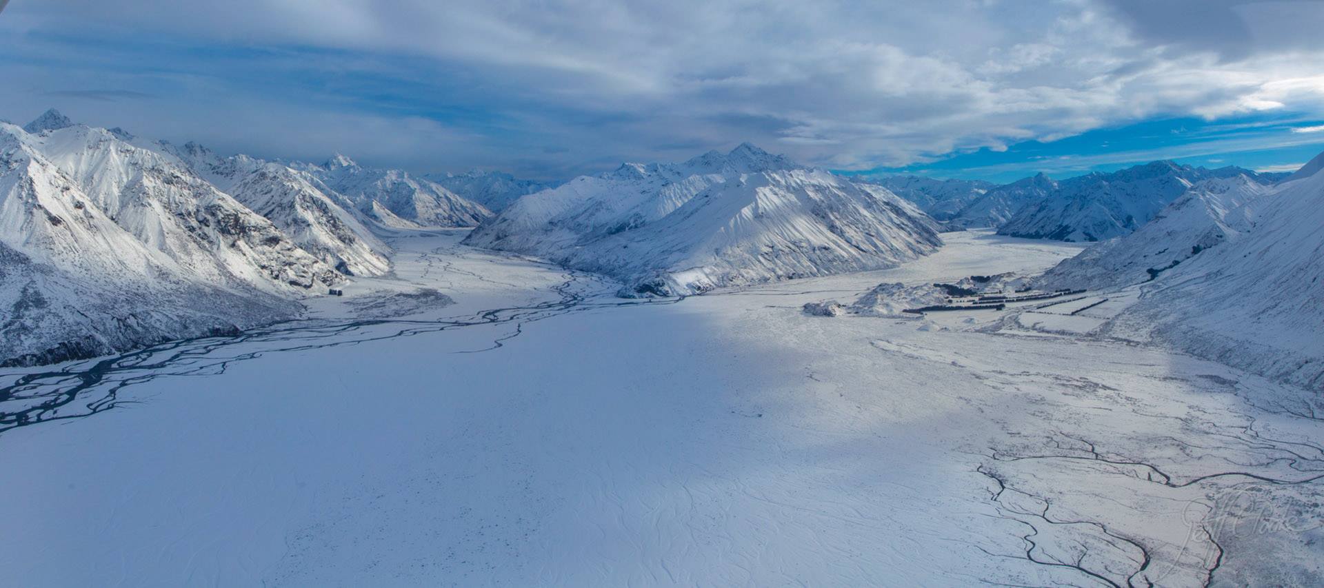
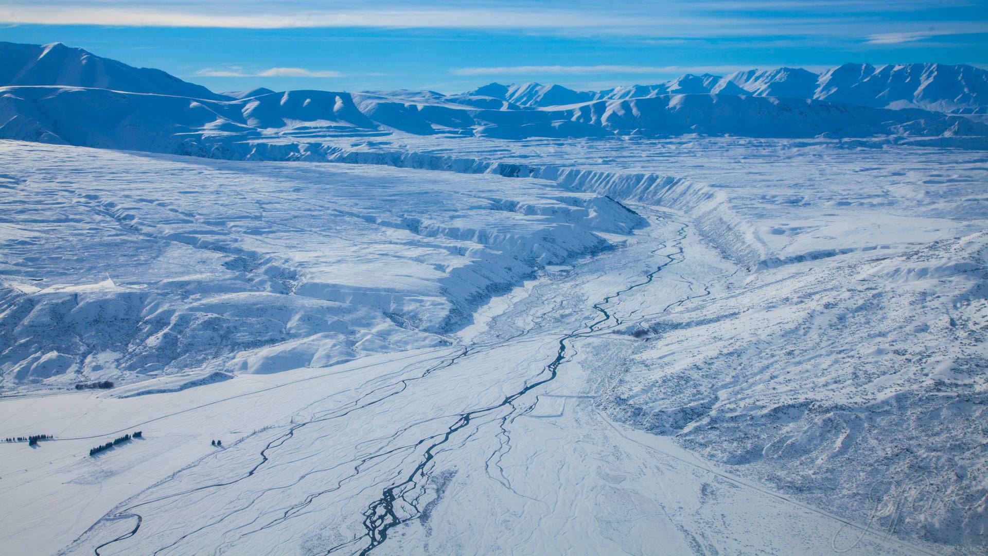
Rangatata River in the Snow - Photography By Geoff Cloake June 2013-copyright
If you have not explored much of the wider country, it is easy to take our braided rivers for granted. In many parts of Aotearoa New Zealand, rivers flow in simpler, narrower channels. Here in South Canterbury, our rivers often spread, divide, rejoin and shift across wide gravel beds. That braided pattern is part of what makes our landscape so distinctive.
It is also part of what has shaped our plains, soils, farms, coast and communities. The more we understand these rivers, the more we can appreciate that they are not just something to cross on a bridge, or to push a farm right up next to. They are moving systems that have helped make this place what it is.
View of the Potts River from above the Rangitata River - Photography By Geoff Cloake June 2013-copyright
South Canterbury’s landscape is a perfect real-world version of what those sand systems are showing you — just stretched out over millions of years. Movement, erosion, deposition, water, gravity, and time.
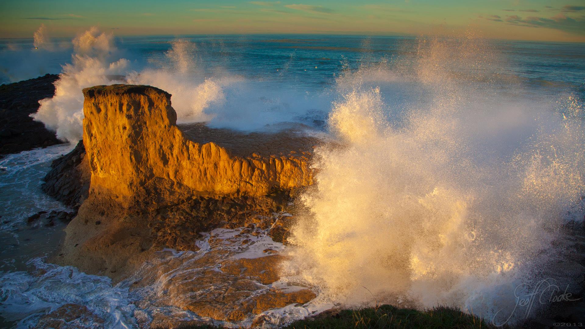
View up the Pareora River from our coastline and the Pacific Ocean. Photography By Geoff Cloake - copyright

Walk out onto the reef at Low Tide. Be very careful because at high tide this can be underwater. It is interesting to see how the rock has been worn by the sea, and the channels where the salty water trys to slip away by the pull of gravity. Photo by Roselyn Fauth
How South Canterbury’s Landscape Was Made: Mountains, Ice, Rivers, Wind and Waves
Uplift: Tectonic forces pushed up the Southern Alps.
Ice: Glaciers carved valleys and ground rock into sediment.
Rivers: Braided rivers carried gravel and sand east.
Deposition: Rivers built fans, plains, and terraces.
Wind: Loess dust settled over the land, creating fertile soils.
Waves: The coast was reshaped by currents, storms, and longshore drift.
Basalt: Timaru’s ancient lava flow formed the town’s rocky base.
Photography By Geoff Cloake of Dashing Rocks in a King tide. You can see these erosion and rivers in what looks like clay (loess).
South Canterbury is not a fixed landscape — it is a system in motion. It is made by mountains rising, ice grinding, rivers carrying, wind spreading, waves reshaping, Over and over again.