By Roselyn Fauth
How Timaru’s bluestone connects geology, built history and civic life
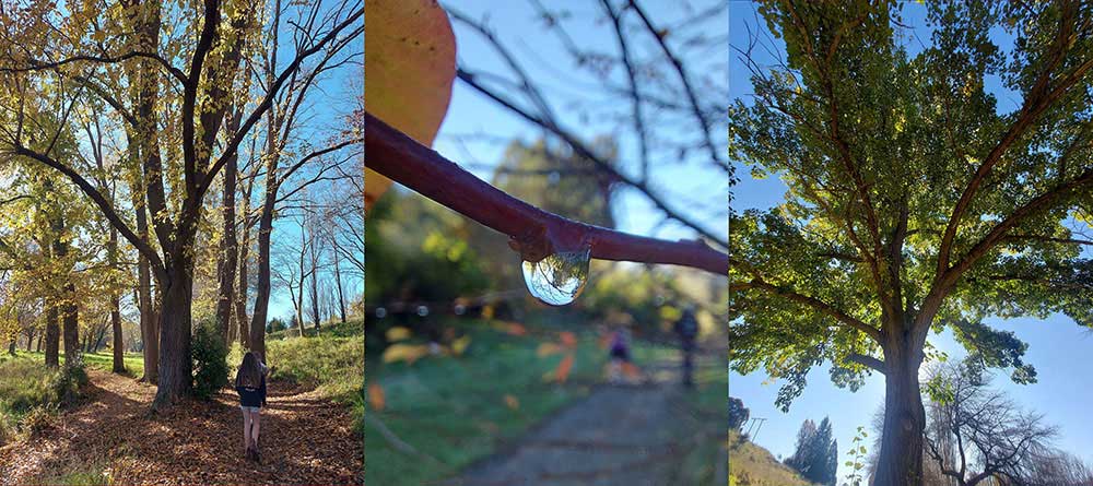
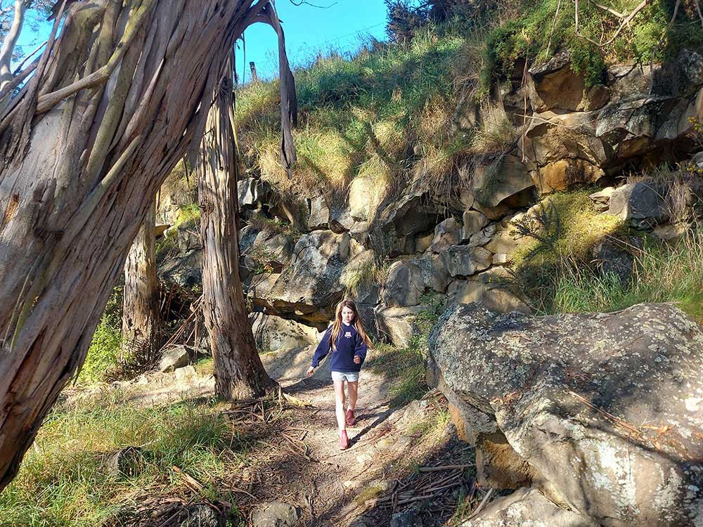
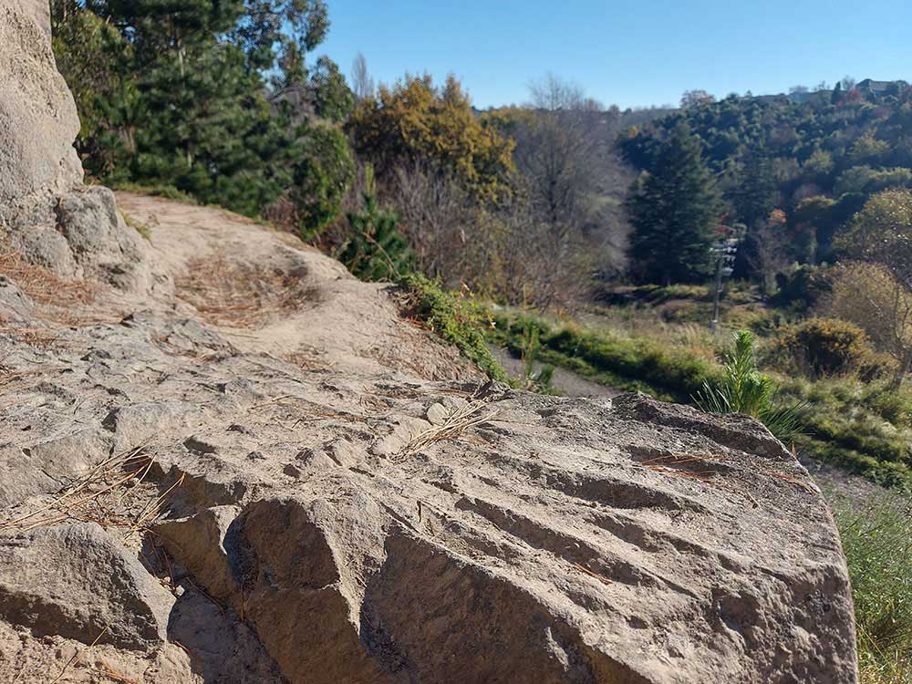
I thought I knew Centennial Park... like many locals, I still think of it as the Scenic. It is the place for walks, dogs, bikes, ducks, children at the lake, school cross-country memories, and that lovely feeling of being out of town without really leaving it. But then I started looking at the land properly. It is a fun place to wander on foot or with wheels. The council and the local volunteers have done a awesome job maintaining the reserve.
Before it was Centennial Park, it was the Scenic Reserve. Before that, many people knew it by a much plainer role: the Quarry.
This was once a working landscape where basalt was blasted from the Otipua Creek valley, loaded by cranes, hauled by tramline and sent across Timaru to the harbour. Stone from this valley helped the town do one of the hardest things in its local history: build a port where the sea, shingle and reefs did not make it easy...
Timaru District Council records that Centennial Park was once the site of several quarries owned by the Timaru Harbour Board and private parties, and that basalt was quarried there for harbour breakwaters for about 75 years.
So next time you walk through the Bowker Gates, try this for fun:
- Do not just look at the trees.
- Look at the land underneath them.
- Because the park is still quietly telling the story of the Quarry.
- The volcano under the walk
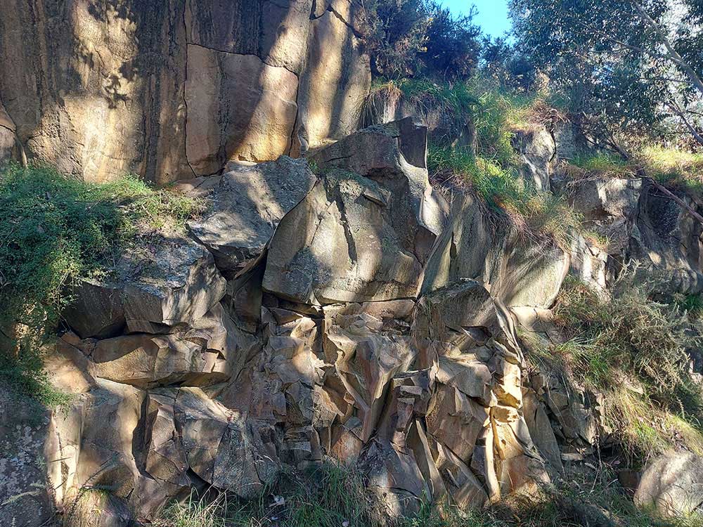
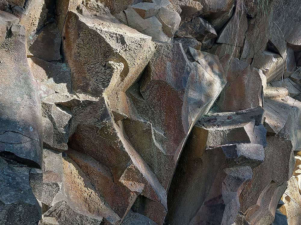
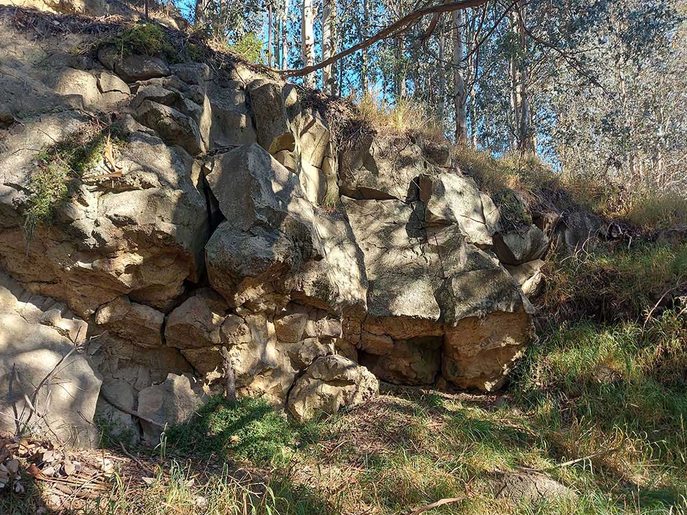
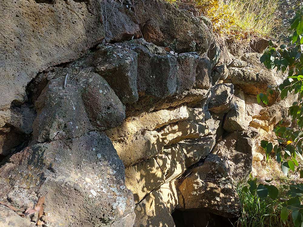
The stone had already had a very long life before anyone in Timaru decided it would be useful because, Timaru bluestone is basalt, a hard volcanic rock formed from lava. The Basalt in Timaru's quarry and the reefs at Dashing Rocks are around 2 - 2.5 million years old, flowing from the Waipouri Mount Horrible area and cooling into the columned rock we can still see today. The University of Otago describes Wapouri / Mount Horrible as the South Island’s youngest volcanic episode producing the Timaru basalt as an extensive lava field.
The story begins with lava.
At Dashing Rocks, the stone still reads as geology. Timaru District Council describes the walk as passing cliffs where waves crash onto two-million-year-old lava from Mount Horrible, and Aoraki Heritage notes that the basalt base at Dashing Rocks is typical of ancient lava flows under Timaru’s coastal cliffs.
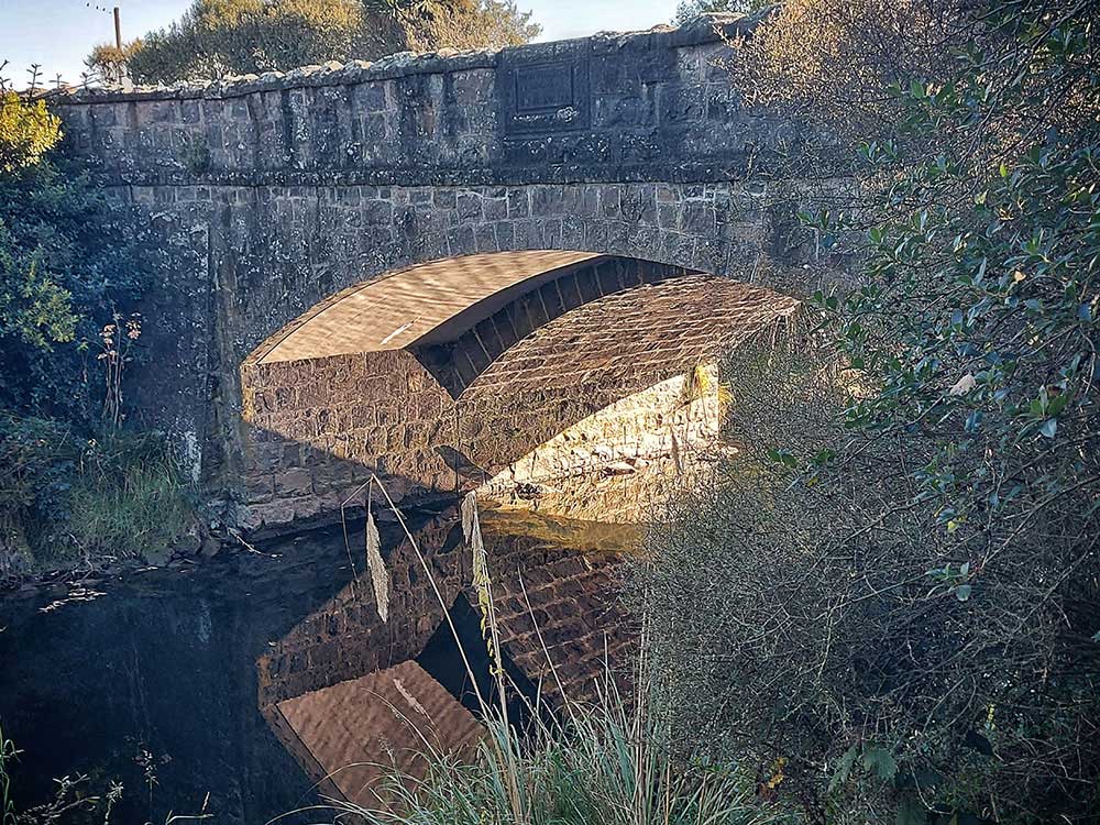
In Centennial Park, the same kind of stone appears in another role. It is not just a landform. It is a resource that has been cut, blasted and moved. That is what makes Timaru bluestone such a good story. It begins as lava, becomes coastline, is opened as quarry stone, then turns up again in harbour walls, bridges, reservoirs, kerbs and buildings.
Why Timaru needed the stone
Timaru’s harbour was not inevitable. In fact it was hard fought for. The town grew beside an open roadstead, with reefs, surf landings, shingle movement and wreck risk all part of the local problem. Te Ara’s historical summary of Timaru notes that port facilities were initially non-existent, ships were moored in the open roadstead, wrecks were frequent, and a Harbour Board was formed in 1877 before a 300-foot breakwater began the following year.
A safe harbour meant a hub for exchange connecting the South Canterbury area with the nation and the world. It meant wool and grain, meat, wool could move. It meant passengers had a better chance of arriving without danger or drama, and South Canterbury could look outward.
But building a harbour here required confidence, engineering and money... it also required rock, Lots of it.
A CPlay Timaru port history records that Eastern Extension work started in 1900 and that by the end of 1906, half a million tons of rock had been used in the 3,000-foot wall.
the valley had the stone we needed
This is where the bluestone story becomes more than geology. Before a wagon of basalt reached the sea, someone had to approve the scheme. Someone had to survey the route. Someone had to cross private land. Someone had to pay. Someone had to work under the quarry face and bring the rock down.
A harbour wall may look solid and silent once it is finished... it was making was anything but.
One of the best clues on how the quarry functioned comes from Te Kura Marumaru South Canterbury Museum. The Museum holds a Timaru Harbour Board plan of quarry lands at Otipua Creek, dated around 1900. The record says the plan covered the length of present-day Centennial Park, from the foot of the zig-zag to Claremont Road. It notes the working face of David Fyfe’s quarry and names landowners including J. C. King, the trustees of J. King, and W. Moody.
There were working faces, tramlines, land boundaries, private properties, Harbour Board operations, later reworkings and names that do not always behave as tidily as I first wanted them to.
- Fyfe’s Quarry.
- Archer’s Quarry.
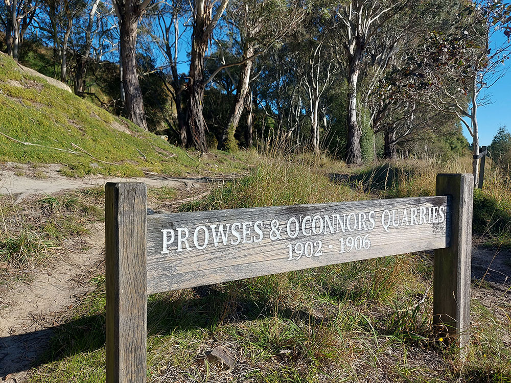
- Prowse Quarry.
- O’Connor’s Quarry.
- King’s Quarry.
- Middle Quarry.
- Upper Quarry.
- New Quarry.
- Bone’s Quarry.
- Miss Fyfe’s Quarry.
Some names seem to come from landowners. Some seem to come from workers or supervisors. Some belong to later phases. Some are strongly documented. Others survive through local interpretation and still need checking against Harbour Board minutes, maps or newspaper reports. That messiness is not a problem. It is part of the history, beacause real places are layered.
Fyfe’s Quarry and the first big stone push
David Fyfe has given me a bit of grief trying to research. I had a good crack, and now his decendants are researching their roots and plan to share their results with me. What I did manage to nut out was that between 1888 and 1890 the Timaru Harbour Board quarried stone from Fyfe’s Quarry, with rock transported by the Wai-iti Road tramway to repair and rebuild the North East breakwater.
The basalt had to be exposed, blasted, lifted and moved. Local research describes steam cranes, flat-topped trucks, a winding engine and a tramway system carrying stone towards the waterfront. The quarry was not a scenic backdrop. It was heavy work, with rock, dust, machinery, risk and repeated journeys from valley to sea.
It is easy to admire old harbour stone once it is settled in place. It is harder to picture the blast, the smoke, the crane, the wagon, the tramline and the men standing near a rock face that could kill them... every load had to be won.
In 1889, local interpretation records one of those strange details that makes a story suddenly open up. Moa bones were found during quarrying connected with harbour stone. Quarrymen cutting into basalt for a modern harbour had uncovered evidence from a much older natural world.
Archer’s Quarry and the problem of getting stone out
Another clue appears in 1899. DigitalNZ, drawing on South Canterbury Museum records, describes a plan showing a proposed tramline through the properties of Rhodes, Clissold and King, beside Otipua Road, leading to Archer’s Quarry. The plan was signed by A. G. Dobson and dated 24 July 1899. That technical detail, tells us a quarry is only useful if you can get the stone out. It took some investment and logistics laying tramlines, gaining land access, surveying. I imagine there were plenty of negotiations, and not doubt a few disagreements.
1901 to 1906, when the valley became a stone machine. Local trail material records that from 1901 the Harbour Board took stone from the Otipua Creek system for the eastward harbour extensions. The route followed Quarry Road, Otipua Road and James Street, passed under the railway at Patiti Street, then continued along the south beach to the mole.
I find that route fascinating because it makes the stone visible again. The stone crossed Timaru along Quarry Road, Otipua Road, James Street, Patiti Street, The south beach, and the mole.
Records that in 1903 one of the 20-ton steam cranes toppled while being moved between quarry sites. These were not small tools neatly stored away at the end of the day, they were dangerous machines being shifted through a working quarry landscape.
By 1905, local research records that the quarry line had nearly reached Claremont Road and J. C. King’s Quarry. By 1906, the eastern extension phase had reached its major completion point. Local summaries differ on the exact amount of stone used, but the safest wording is that hundreds of thousands of tons of rock went into the harbour works.
Hundreds of thousands of tons is a huge amount that I struggle to picture. Especially at a wagon at a time.
Prowse and O’Connor
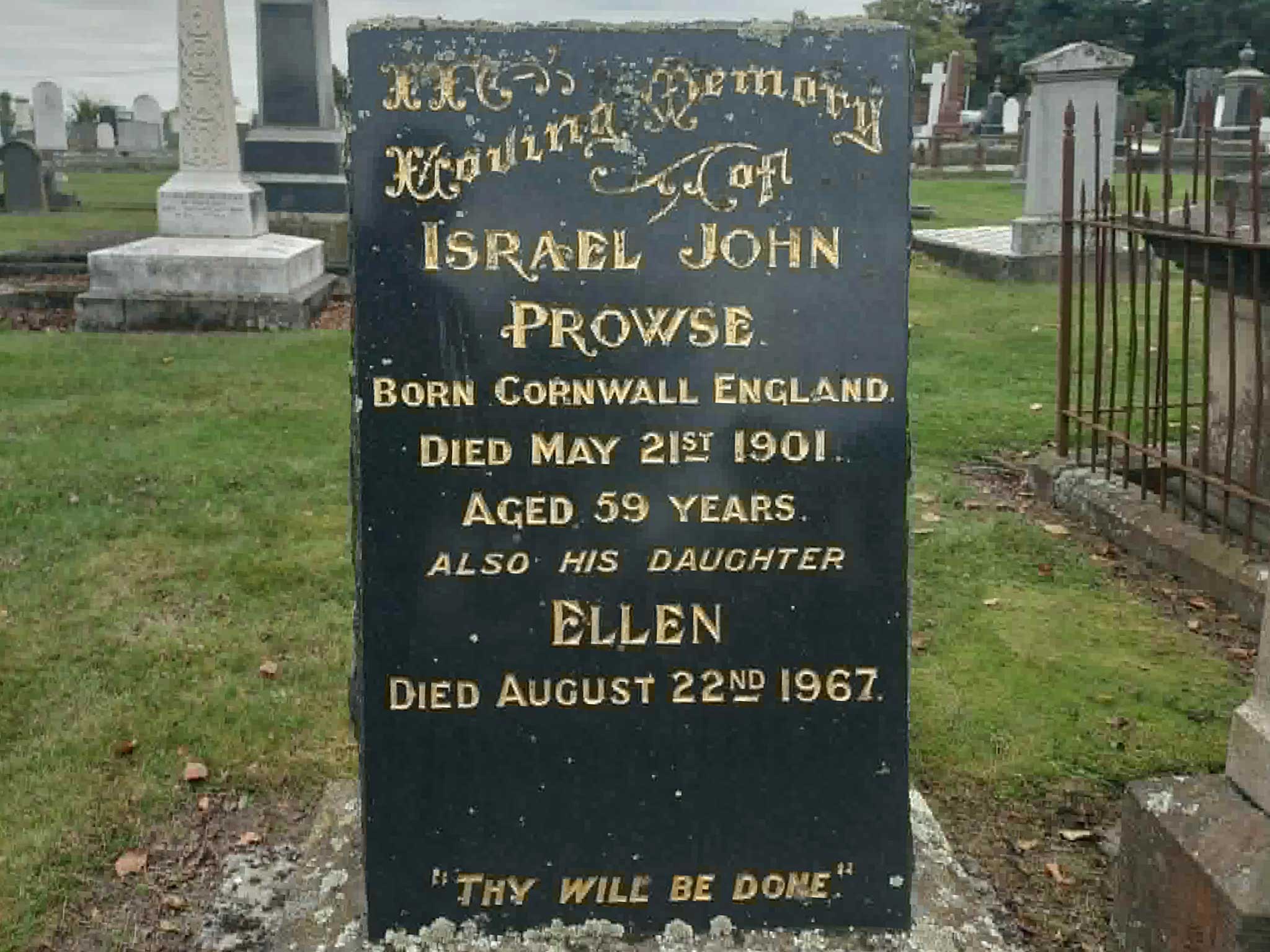
I found out that Prowse and O’Connor’s quarries had workings on the southern side of Otipua Creek, visible from the walkway along the original tramline. Prowse Quarry is (I think) to have been named for Israel Prowse. He was described as a Timaru Harbour Board chief quarryman who died in May 1901. O’Connor’s Quarry is more cautious. It is probably connected with a Mr O’Connor associated with formation work on the quarry line, but that still needs confirmation from Harbour Board minutes, a plan note or a newspaper report.
It is tempting to tidy the past until every name has a full biography and every place has a clean dot on a map. But the records do not always let us. Sometimes we have a name and a likely connection, but not the full life behind it. Sometimes a worker’s name survives on a quarry label while the person himself almost disappears.
Prowse and O’Connor pull the story away from “the Harbour Board did this” and back towards people. Public infrastructure is often remembered through boards, engineers and official openings. Quarry names remind us that it was also built by bodies, risk and labour.
King’s Quarry and the Claremont Road end
King’s Quarry is another part of the story where I had to slow down.
The South Canterbury Museum quarry lands plan from around 1900 identifies J. C. King and the trustees of J. King among the landowners in the Otipua Creek quarry area. Other records suggest King-linked quarrying in more than one part of the present park landscape, so I think it is safest to talk about King’s quarries within the wider Otipua Creek system, rather than pretending there was one perfectly fixed quarry face.
A 1911 South Canterbury Museum photograph shows a locomotive in one of King’s quarries at the north-western end of present Centennial Reserve. The Museum description says the locomotive was used to pull wagons loaded with quarry stone for Timaru Harbour’s Eastern Extension. It also notes that the white post fence in the background bordered Claremont Road.
King’s Quarry was reached by the tramline around 1905. It also records that King’s Quarry was mined several times and was still operating as late as 1963.
The later Fyffe quarry
The Fyfe name also appears in a later phase, with a slightly different spelling.
DigitalNZ, using South Canterbury Museum information, records a 1912 plan of David Fyffe’s Quarry at Otipua Creek. The record places it at the west end of present Centennial Park, north of Otipua Creek, and says it was opened for use in 1914 and worked in short bursts until 1931. This appears to be a later formal quarry phase or reworking connected with the Fyfe or Fyffe name, rather than simply the same as the late 1880s Fyfe quarry story. You can see how I have got a bit confused here, and it will take some futher research out iron this out, if it was a shift in spelling or different people.
Centennial Park gave us our bluestone.
By the 1930s, Timaru began to imagine it differently. Local trail material records that Timaru City Council purchased park land from the Harbour Board in 1934. George Bowker also gifted land that helped form the Otipua Road entrance, later marked by the Bowker Gateway.
That is a major civic shift for our town at the time. They were not only looking for what they could take from the valley, but they were now seeing what the valley could offer if people were invited in for recreation.
I read a bit about the effort it took to grow plants, trees. and over time the paths and trails were developed for recreation and scenery.
While the Quarry became the Scenic Reserve, the memory of the area was not erased.
Timaru District Council records that Centennial Park was officially named in 1939 to commemorate the centennial of the Dominion of New Zealand. Aoraki Heritage also records Centennial Park’s alternative names as Scenic Reserve and the Scenic. Local trail material says the park was dedicated in 1940 to mark the Dominion’s centenary.
NZ History explains that the 1940 celebrations emphasised a century of European effort and progress, while Māori history and the centenary of the signing of the Treaty of Waitangi took a back seat. Te Ara similarly notes that the centenary of Te Tiriti o Waitangi, the Treaty of Waitangi, was marked in 1940, but Māori contributions were often pushed to the periphery.
So with this joint lens, in the 1939 to 1940 national centennial period, marking 100 years since 1840 and the signing of Te Tiriti o Waitangi, the Treaty of Waitangi, the former Scenic Reserve was renamed Centennial Park.
That name change is not just administrative, it was a shift in meaning.
The Quarry was a place of extraction.
The Scenic Reserve was a place of recreation.
Centennial Park became a place linked to national commemoration and local civic identity.
Same valley. Three public identities.
The flat-topped wagons carried rock to the harbour until 1958, when the supply from King’s Quarry ran out. The last quarry railway lines were dismantled in 1959, and that quarrying rights in the park were not officially cancelled until 1975. If you popped out to Pleasant Point railway, a wagon with a load of bluestone sits idle as a artifact and a reminder of those days.
The bluestone story is not only about what happened in the past. It is about how communities make decisions.
Timaru’s harbour did not appear by accident. It required a Harbour Board, public borrowing, engineering advice, land access, contracts, workers, risk and long-term belief in the town’s future. Aoraki Heritage records the Timaru Harbour Board as being founded in 1877 and responsible for building the artificial port that served Timaru and the surrounding South Canterbury area.
The quarry land also changed meaning over time. First it was valued because stone could be taken from it. Later, it was valued because people could enter it, walk through it and enjoy it as public space.
That makes Centennial Park a useful civic studies case study. It shows how public decisions shape places. It asks who benefits from infrastructure, who carries the cost, whose labour is remembered, and how communities decide what to do with land once its first purpose has changed.
The same valley has been understood in three different civic ways:
The Quarry: useful for extraction, labour and harbour-building.
The Scenic Reserve: useful for recreation, access and public wellbeing.
Centennial Park: useful as a commemorative public place and part of Timaru’s shared identity.
That is civics in the landscape.
What the park history hunt taught me
The more I followed the bluestone, the more it seemed to connect everything.
Geology is there in the basalt, lava flows, Dashing Rocks and Mount Horrible.
Built history is there in the harbour, tramlines, cranes, bridges, reservoirs, kerbs and walls.
Civic studies are there in the questions of land, loans, labour, risk, public works and public space.
Who owned the land?
Who approved the works?
Who paid?
Who worked under the quarry face?
Who was remembered?
Who was forgotten?
Who decided the old quarry should become a reserve?
How should we interpret it now?
That is what makes Centennial Park such a powerful local learning site. It is not only a place to visit. It is a place to read.
The next time I go through the Bowker Gates, I will still see the ducks, the trees, the dogs and the tracks. But I will also see the Quarry.
I will see basalt that began as lava.
Stone blasted, cut and hauled away by tramline.
Men working under these quarry faces, refueling their steam engines with water.
Harbour walls built load by load.
A town using what was under its feet to solve the problems in front of it.
And later, a community slowly turning an industrial scar into a public place.
That is the gift of looking closely.
Sources:
Core Centennial Park and quarry sources
Timaru District Council, Centennial Park / Scenic Reserve
https://www.timaru.govt.nz/community/recreation/parks-and-sports-facilities/popular-parks/centennial-park
Aoraki Heritage Collection, Centennial Park
https://aorakiheritage.recollect.co.nz/nodes/view/485
WuHoo Timaru, 5. Centennial Park
https://www.wuhootimaru.co.nz/timaru-scenic-route/330-5-centennial-park
WuHoo Timaru, From Dundee to Sweetwater’s 1860s Fyfe House at Gleniti Timaru
https://wuhootimaru.co.nz/blog/1017-fyfe-house-a-1860-blue-stone-story-in-gleniti-timaru
South Canterbury Museum, Quarry Lands [Otipua Creek, Timaru], Timaru Harbour Board plan
https://timdc.pastperfectonline.com/archive/95444DD5-5267-4898-9347-129494655027
South Canterbury Museum, Locomotive, King’s Quarry, Timaru
https://timdc.pastperfectonline.com/photo/C748FA75-3255-4243-8A03-184058958280
DigitalNZ / South Canterbury Museum, Locomotive, King’s Quarry, Timaru
https://digitalnz.org/records/42281658
DigitalNZ / South Canterbury Museum, David Fyffe’s Quarry, Otipua Creek, Timaru
https://digitalnz.org/records/42251228
DigitalNZ / South Canterbury Museum, Plan showing proposed tramline to Archer’s Quarry
https://digitalnz.org/records/42251154
Geology sources
GeoTrips, Dashing Rocks, Timaru Basalt
https://secure.geotrips.org.nz/trip.html?id=707
Timaru District Council, Dashing Rocks Walk
https://www.timaru.govt.nz/community/recreation/walking-and-cycling/dashing-rocks
Aoraki Heritage Collection, Dashing Rocks
https://aorakiheritage.recollect.co.nz/nodes/view/6768
University of Otago, Wapouri / Mount Horrible, South Island’s youngest volcano
https://www.otago.ac.nz/postgraduate-study/research-opportunities/wapouri-mount-horrible-south-islands-youngest-volcano
CPlay, Ancient Lava Flowed Here Helping to Create Timaru’s Hills and Reefs
https://cplay.co.nz/stories/296-ancient-lava-flowed-here-helping-to-create-timaru-s-hills-and-reefs
Harbour and infrastructure sources
Aoraki Heritage Collection, Timaru Harbour Board
https://aorakiheritage.recollect.co.nz/nodes/view/789
Te Ara, Timaru, 1966 Encyclopaedia entry
https://teara.govt.nz/en/1966/timaru
CPlay, Timaru Port
https://cplay.co.nz/stories/the-story-to-share/28-timaru-port
Heritage New Zealand, Bluestone Reservoir Complex
https://www.heritage.org.nz/list-details/7266/Listing
Timaru District Council, Historic Heritage Assessment, Bluestone and Iron Bridge, Saltwater Creek
https://www.timaru.govt.nz/__data/assets/pdf_file/0004/673897/Historic-Heritage-Assessment-Report-HHI74-Bluestone-and-Iron-Bridge-Category-B-NEW.pdf
Timaru Bluestone Industries, About Us
https://www.timarubluestone.co.nz/about-us/
Timaru Bluestone Industries, Our Stone
https://www.timarubluestone.co.nz/about-us/our-stone/
Centennial and Treaty context sources
NZ History, The New Zealand Centennial, 1940
https://nzhistory.govt.nz/page/new-zealand-centennial-1940
NZ History, The Treaty of Waitangi and the Centennial
https://nzhistory.govt.nz/culture/centennial/the-centennial-and-the-treaty-of-waitangi
Te Ara, Centenary of the Treaty Signing, 1940
https://teara.govt.nz/en/speech/47789/centenary-of-the-treaty-signing-1940
Te Ara, New Zealand’s Centennial, 1940
https://teara.govt.nz/en/anniversaries/page-3
Timeline: Timaru bluestone, the Quarry, the Scenic Reserve and Centennial Park
Date / period Event
c. 2 to 2.5 million years ago Lava from the Mount Horrible / Wapouri volcanic field flows towards the Timaru coast and cools into basalt, later known locally as Timaru bluestone. GeoTrips dates the Timaru Basalt at Dashing Rocks to around 2.5 million years, and the University of Otago describes Wapouri / Mount Horrible as the source of the Timaru basalt.
1852 CPlay’s port history records the first trading vessel visiting Timaru.
1861 Timaru is declared a port of entry because of increasing trade, according to CPlay’s port history.
1864 A landing service is initiated by the Provincial Government, according to Te Ara’s Timaru summary.
1870 The Timaru and Gladstone Board of Works completes a groyne, described by Te Ara as the first step in harbour works.
1877 The Timaru Harbour Board is formed to build the artificial port serving Timaru and South Canterbury.
1878 Construction of a 300-foot breakwater begins.
1880s Bluestone quarrying becomes increasingly important as harbour works require large quantities of durable rock.
1888 to 1890 Local WuHoo Timaru research records stone being quarried from Fyfe’s Quarry and transported by Wai-iti Road tramway to repair and rebuild the North East breakwater.
1889 Local interpretation records moa bones being uncovered during quarrying connected with harbour stone.
1899 A South Canterbury Museum record shows a proposed tramline through Rhodes, Clissold and King properties, beside Otipua Road, leading to Archer’s Quarry.
c. 1900 A Timaru Harbour Board plan of quarry lands at Otipua Creek covers the length of present Centennial Park, from the foot of the zig-zag to Claremont Road, noting David Fyfe’s working face and landowners J. C. King, trustees of J. King, and W. Moody.
1900 Eastern Extension work begins, according to CPlay’s port history.
1901 Local trail material records the Harbour Board taking stone from the Otipua Creek system for eastward harbour extensions, using a route through Quarry Road, Otipua Road, James Street, Patiti Street and the south beach. Israel Prowse dies in May 1901, and Prowse Quarry is understood locally to preserve his name.
Early 1900s Prowse and O’Connor’s quarries appear in local interpretation as workings on the southern side of Otipua Creek. O’Connor’s Quarry is probably connected with a Mr O’Connor associated with line formation, but this still needs stronger primary-source confirmation.
1903 Local research records a 20-ton steam crane toppling while being moved between quarry sites.
1905 Local research records the quarry line as nearly reaching Claremont Road and J. C. King’s Quarry.
1906 The Eastern Extension reaches its major completion point. CPlay records that by the end of 1906, half a million tons of rock had been used in the 3,000-foot wall, so the blog uses the cautious phrase “hundreds of thousands of tons”.
1911 South Canterbury Museum photographs a locomotive in one of King’s quarries at the north-western end of present Centennial Reserve, pulling wagons loaded with stone for Timaru Harbour’s Eastern Extension.
1912 South Canterbury Museum records a plan of David Fyffe’s Quarry at Otipua Creek, with a notation relating to an eight-year period from 27 January 1912.
1914 to 1931 DigitalNZ / South Canterbury Museum records David Fyffe’s Quarry at the west end of present Centennial Park, north of Otipua Creek, as opened for use in 1914 and worked in short bursts until 1931.
1934 Local trail material records Timaru City Council purchasing park land from the Harbour Board. George Bowker’s gift of land helps form the Otipua Road entrance, later marked by the Bowker Gateway.
Late 1930s The former quarry landscape is developed as the Scenic Reserve, shifting public meaning from extraction to recreation.
1939 to 1940 Timaru District Council records Centennial Park as officially named in 1939 to commemorate the Dominion centennial. Local trail material records dedication in 1940 to mark the Dominion’s centenary. The blog frames this as the 1939 to 1940 national centennial period marking 100 years since 1840 and the signing of Te Tiriti o Waitangi / the Treaty of Waitangi.
1958 Local trail material records the supply from King’s Quarry running out after decades of stone transport to the harbour.
1959 The last quarry railway lines are dismantled, according to local trail material.
1963 Local WuHoo Timaru research records King’s Quarry as operating as late as 1963.
1975 Quarrying rights within Centennial Park are finally cancelled, according to local trail material.
Present day Centennial Park remains a public recreation space, but its quarry faces, landforms, old routes and bluestone still reveal its earlier identity as the Quarry and the Scenic Reserve.