By Roselyn Fauth
I love maps! Especially the high resolution ones that you can zoom in and study. And this is my favourite map... a plan of Timaru town in 1875. When I was studying this I noticed some of the sections are very detailed, and on closer inspection I noticed names... who were these people, why did they get more detail on the map? From unravelling their story, what can we learn about our past, to understand where our city grew from... once a sheltered bay for mahika kai, to a dusty bullock wagon trail... to the civil infrastructure we can take for granted today... here is today's blog unravelling the clues....
The people on and behind the 1875 Timaru plan and who is missing and why?
And there were names. Shaw. Sealy Bros. Fussell. Smith. Then the penny dropped... they were surveyors.
This plan of Timaru is now a mystery about the people who measured Timaru, lived in Timaru, worked in Timaru, and helped shape the town we inherited. So who were the men who mapped Timaru who were on the map. (Try saying that fast lol!)
So why were they there? Why did their homes, offices and sections appear with such detail? What were surveyors doing in Timaru in 1875? Were they government officials, private businessmen, engineers, family men, land agents, civic builders, or a bit of all of those things? The answer takes us beneath the printed surface...
Before this 1875 plan, Timaru was already a place of layered use and movement: a sheltered bay and place of mahika kai, a shoreline of landing places, a dusty bullock wagon trail, and then two separate townships that did not quite line up.
First, E. H. Lough and Samuel Hewlings gave Timaru its divided original shape: Rhodes Town to the north and Government Town to the south.
Then Charles Reginald Shaw helped administer and survey the district as it grew.
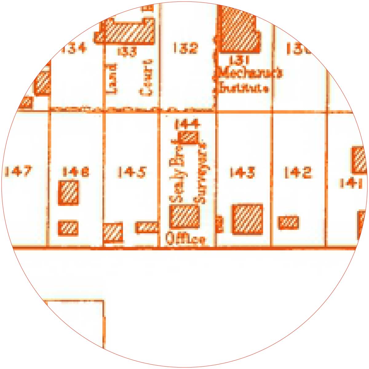
Then the Sealy brothers, John Thompson and Thomas Roberts reveal another layer: private survey work, rural expansion, engineering, architecture and land opportunity.
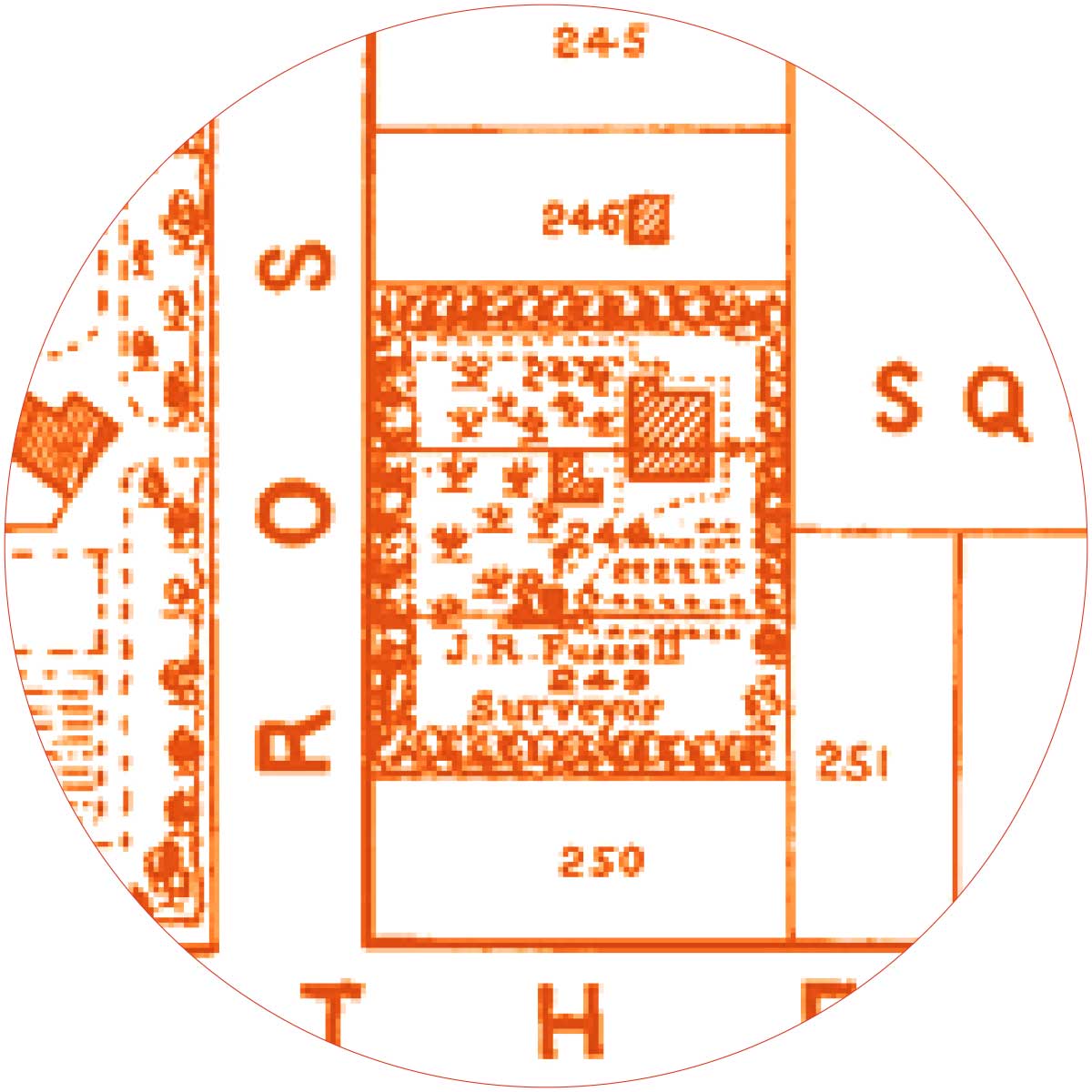
Then Joseph R. Fussell takes us inside the map room, where applications, timings and records could decide who got land.
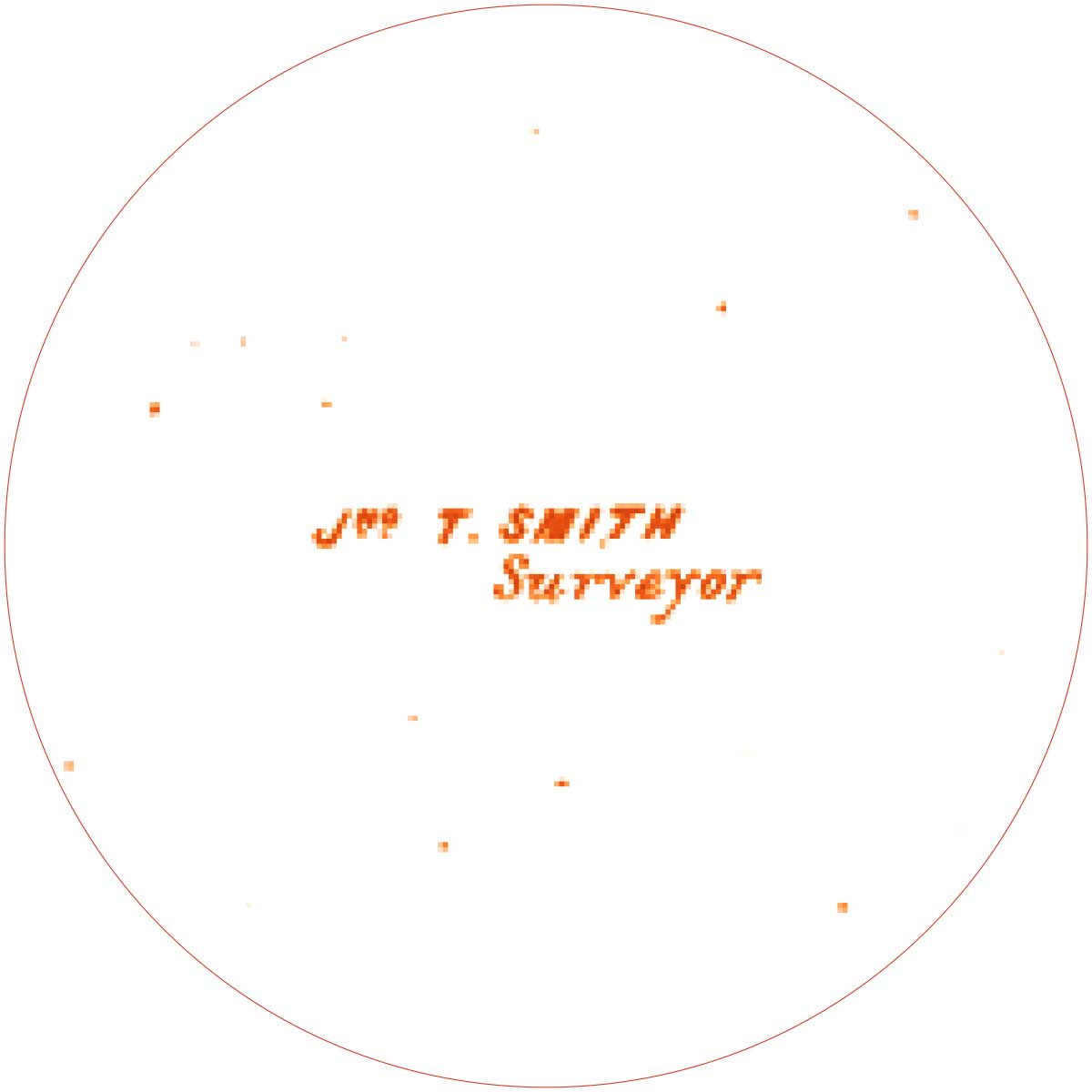
Finally, John T. Smith captured all those layers in the printed 1875 plan.
That is the story arc: Timaru was surveyed, divided, lived in, contested, developed, and finally printed as a map.
And that is why this plan is so facinating... a map is never just a map. It shows what a community chose to measure, who held knowledge, where power sat, and what was considered worth recording. If surveying and mapping helped shape the Timaru we inherited, then the way we plan, protect, record and remember our place today will shape what future generations inherit from us.
Today’s blog is a history hunt through the clues hidden in the 1875 plan of Timaru. Here is a deeper dive in to the surveyors of Timaru...
E. H. Lough
In Timaru: Active in the original layout of Timaru by about 1856. Possibly the same Edwin Henry Lough who later became Timaru Town Clerk, although that identity needs careful confirmation.
Role: Private surveyor of Rhodes Town, the northern township laid out on land owned by the Rhodes brothers.
How he fits the story: Lough belongs at the very beginning of the map mystery. He helped create the northern part of early Timaru, the area that became the commercial centre around Stafford Street, George Street and the beach landings. His survey did not line up neatly with the government town to the south, which is part of why Timaru’s early street pattern has that slightly awkward, fascinating shape. He represents private land, practical beach access, and the Rhodes family’s influence on the town’s beginnings.
Samuel Hewlings
In Timaru: In South Canterbury survey work from the mid 1850s. He laid out southern Timaru in 1856 and later became Timaru’s first mayor from 1868 to 1870.
Role: Government surveyor, South Canterbury triangulation and topographical surveyor, surveyor of the southern Government Town, and later civic leader.
How he fits the story: Hewlings is the other half of the origin story. While Lough surveyed Rhodes Town to the north, Hewlings laid out the government township to the south, between North Street and Patiti Point. The government expected this southern area to become the main centre, but trade and settlement energy gathered instead around Rhodes Town and the beach landings. Hewlings’s work is still part of the skeleton beneath the 1875 plan.
Charles Reginald Shaw
In Timaru: Moved to Timaru in 1861 and served as District Surveyor until 1877.
Role: District Surveyor, Canterbury Provincial Government surveyor, later farmer at Totara Valley.
How he fits the story: Shaw is very likely the “Shaw, Surveyor” labelled on your plan. He was one of the key working surveyors in Timaru at exactly the time the 1875 plan was made. His diary, kept from 1866 to 1872, makes him especially valuable because it records not only survey work, but everyday life, accounts, family matters, social calls and sections surveyed. In the blog, Shaw can be the human face of the official survey world: the man out measuring land, but also living in the town he helped define.
John Thompson
In Timaru: Arrived from Tasmania in 1863 and was soon working as a surveyor in Timaru. Publicly active as “John Thompson, Surveyor, Timaru” in 1875.
Role: Surveyor connected with town and rural land work.
How he fits the story: Thompson should be included if your full plan clearly shows a Thompson label. He helps widen the story beyond the town streets. In 1875 he was connected with the sale of the large Tanganbelanga Estate, showing how surveyors worked across both town and country. He links the neat sections of the Timaru plan to the wider South Canterbury world of estates, roads, railway access, farming and land sales.
Henry John Sealy
In Timaru and South Canterbury: Arrived in New Zealand in 1859. Active in South Canterbury survey work in the 1860s and 1870s. Married Emma Booker Askin in Timaru in 1873 and built his Timaru house about 1875.
Role: Surveyor, farmer, private survey contractor, and one half of Sealy Bros.
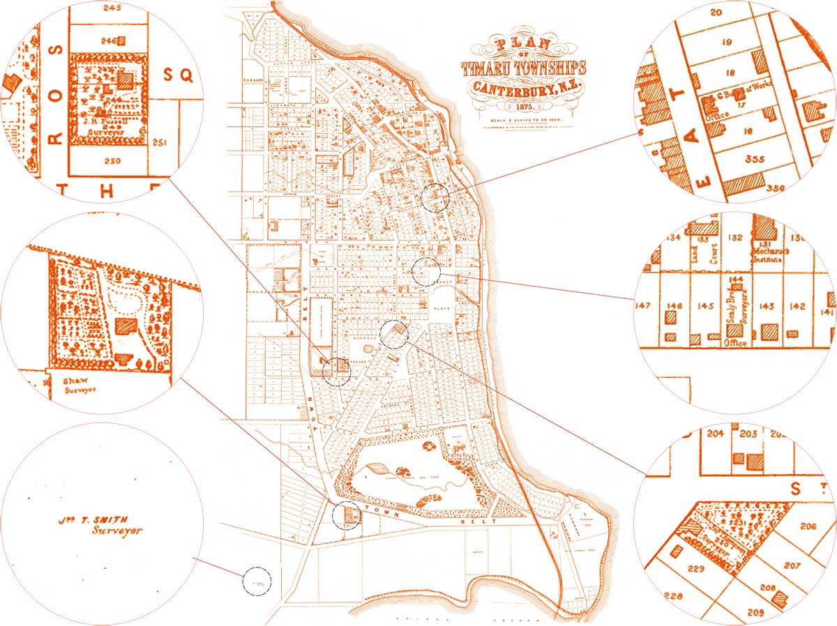
How he fits the story: Henry John Sealy is one of the people behind the label “Sealy Bros Surveyor Office”. He brings in the world of private survey practice, family life, property, ambition and professional networks. His house, later associated with Craighead and Shand House, gives you a strong visual and domestic connection. Henry helps show that these labelled sections were not just workplaces. They were homes, gardens, families and social standing.
Edward Percy Sealy
In Timaru: Settled in Timaru from about 1873. Involved in the Sealy land case in 1876. Died at Southerndown, Timaru, in 1903.
Role: Surveyor, photographer, naturalist, mountaineer, farmer and private survey contractor.
How he fits the story: Edward Percy Sealy is the more colourful half of Sealy Bros. He gives the story a wider horizon because he was not only a surveyor, but also an early photographer of the Southern Alps, a naturalist and a mountaineer. He also brings drama through the 1876 Sealy case, where land knowledge, survey office procedure and private opportunity all collided. In the blog, Edward can carry the theme that surveyors did not just measure land. They saw land, valued land, moved through land, and sometimes used their knowledge of land to their own advantage.
Thomas Roberts
In Timaru: Came to Canterbury in 1870 and was active in Timaru in the early to mid 1870s.
Role: Engineer to the Timaru and Gladstone Board of Works, architect and licensed surveyor.
How he fits the story: Roberts should be included if your full plan clearly shows a Roberts label. He is useful because he shows how fluid professional roles were in early Timaru. A person could be a surveyor, engineer, architect and public works designer. Roberts connects the map to buildings, roads, drainage, bridges, harbour works and civic infrastructure. He helps make the point that surveying was not only about land boundaries. It was part of the making of the built town.
John T. Smith
In Timaru map history: Confirmed on the 1875 plan itself, but his wider biography is not yet securely identified.
Role: Surveyor, draughtsman or compiler credited on the printed plan.
How he fits the story: Smith is the name directly attached to the map: “Jno. T. Smith, Surveyor.” He is probably the person who compiled or prepared the 1875 plan, drawing together earlier surveys, section boundaries, buildings, names and local detail into one printed image. He may not have created Timaru’s original layout, but he captured the town at a remarkable moment. In your blog, he is the doorway into the mystery: the named maker of a map that also contains other surveyors living and working inside it.
Joseph R. Fussell
In Timaru: Confirmed at the Timaru Survey Office in 1876. Likely the J. R. Fussell on your plan if the cropped name has been read correctly.
Role: Draughtsman at the Timaru Survey Office.
How he fits the story: Fussell is the map room figure. He represents the hidden office work behind survey plans: copying, recording, marking applications, handling maps and turning land information into official records. In the 1876 Sealy case, Fussell recorded Edward Percy Sealy’s land application as made at 10 a.m. on 2 February 1876. That tiny administrative detail became important evidence. He is perfect for the blog because he shows that power was not only held by the men in the field. It also sat in the office, beside the clock, the application book and the map drawer.
Who was there at the same time?
By 1875, Timaru’s survey world included Charles Shaw, the Sealy brothers, John Thompson, Thomas Roberts, John T. Smith, and probably E. H. Lough in his civic role if the identification with Edwin Henry Lough is correct. Joseph Fussell is confirmed in the Timaru Survey Office the following year, so he belongs to the same immediate world.
Gladstone Board of Works
Side quest: the surveyor’s house that became Shand House
There is one surveyor-linked place in this story that still gives us something solid to stand in front of.
Henry and Emma Sealy’s former home, later known as Craighead and now Shand House at Craighead Diocesan School, is the strongest surviving physical clue from this 1875 surveyor trail. It takes the story out of the map and into brick, timber, windows, gardens and memory.
The house was built about 1875 for Henry John Sealy, one of the surveyor brothers behind the “Sealy Bros Surveyor Office” label on the plan. Henry had married Emma Booker Askin at St Mary’s Anglican Church in Timaru in 1873, and the house became part of their family life in the town they were helping to measure and define.
This was not a modest cottage. The house stood on a substantial property of about 40 acres. It had the scale and confidence of a family that expected to belong. That matters, because the surveyor labels on the 1875 plan can look very technical, almost anonymous. Shand House reminds us that surveyors were not only men with chains, plans and field books. They were also husbands, fathers, neighbours, landholders and people building futures.
The house also brings Thomas Roberts into the story. Roberts, who moved between engineering, architecture and licensed surveying, is recorded as the architect of the house. That makes Shand House a beautiful convergence point: a surveyor’s home, designed by a man who also worked across surveying, architecture and public works. In one building, we can see how closely land measurement, civic infrastructure and domestic ambition were connected in early Timaru.
Architecturally, Shand House has been described as an Italianate villa, a style popular in the 1870s and 1880s. It is a two-storey, north-facing house with gabled roof forms, bracketed eaves, decorative quoins, bay windows, sash windows and a pedimented main entry. In plain language, it was designed to be noticed. It had presence. It announced status.
The next owner gave it the name that would endure. In January 1881, Henry and Emma Sealy’s residence and land were sold to Henry John Le Cren. Timaru District Council’s heritage record says Le Cren purchased the property and named it Craighead in 1881. A contemporary newspaper notice confirms the January 1881 sale of H. J. Sealy’s residence and 40 acres to H. Le Cren, although the notice itself does not mention the new name.
Le Cren held Craighead until his death in 1895. When the property was offered for sale in 1896, it still stretched across about 40 acres and included a gardener’s lodge. That detail gives a glimpse of the estate world that once existed around the house before later subdivision changed the area.
In 1910, the wider Craighead estate was subdivided. Its old boundaries were gradually translated into the streets and places people know now: Chalmers Street, Craighead Street, Kitchener Square, Wrights Avenue and Sealy Street. That is another reason this house belongs in the surveyor story. The land around it did not stay as one estate. It was measured, divided, named and absorbed into the growing town.
Then came the Shand sisters.
In May 1911, Anna, Eleanor, Fanny and Elizabeth Shand opened Craighead Girls’ School in the old house. They were the daughters of Professor John Shand of Otago University, and their arrival transformed the building again. A private surveyor’s residence became a school. A house built from land ambition became a place of girls’ education.
First this house was Henry and Emma Sealy’s home... then it was Henry Le Cren’s Craighead... then it became the heart of a girls’ school.
In 1926, after the Shand sisters retired, Craighead became an Anglican church school. It later became an integrated state school in 1982. Through all those changes, the old house remained a landmark and memory keeper.
The building has also had its own survival story. Over time it was added to, altered, strengthened and adapted. Additions were made in 1888, later school wings were attached, and in the twenty-first century the building faced earthquake strengthening and redevelopment. Recent work has treated Shand House not just as an old building, but as the emotional heart of Craighead. During redevelopment, old papers and letters were found in walls and under floorboards, as if the house was still quietly giving up pieces of its own archive.
That is why Shand House matters so much in this map mystery... the 1875 plan gives us names. Shand House gives us a survivor.
It lets us trace a line from survey, to settlement, to architecture, to estate, to subdivision, to girls’ education, to heritage. It reminds us that a town is not only made by roads and sections. It is also made by the ways buildings are reused, renamed, loved, repaired and handed on.
And perhaps that is the loveliest part of this side quest. The surveyors helped map Timaru.
But one of their houses helped educate generations of Timaru girls.
Core sources for the 1875 plan and early Timaru layout
Te Ara: “Map of the Timaru townships”
Best for: Rhodes Town, Government Town, E. H. Lough, Samuel Hewlings, and the explanation that the two townships were surveyed separately and did not align neatly.
Full link: https://teara.govt.nz/en/zoomify/10791/map-of-the-timaru-townships
Citation: Te Ara states that the northern township was laid out by private surveyor E. H. Lough, while Samuel Hewlings laid out the government town to the south.
National Library of New Zealand: “Hewlings, Samuel, 1819–1896”
Best for: Hewlings’s career, his 1856 survey of southern Timaru, his work in South Canterbury, Geraldine and Arowhenua / Temuka, and his partnership with Edward Jollie.
Full link: https://natlib.govt.nz/records/22364349
Citation: This record says Hewlings joined Canterbury Provincial Government survey staff in 1854 and laid out southern Timaru in 1856 while E. H. Lough laid out the northern part on Rhodes land.
Timaru District Council: Timaru Central City Historic Character Area report
Best for: Government Town, Rhodes Town, the central city’s development, the 1875 plan as evidence of built development, and local heritage framing.
Full link: https://www.timaru.govt.nz/__data/assets/pdf_file/0004/674032/Historic-Heritage-Historic-Character-Area-Assessment-Report-Timaru-Central-City.pdf
Citation: The report explains that the Canterbury Provincial Government sent a surveyor to Timaru in 1856 and that Hewlings surveyed the government town between North Street and Patiti Point.
Timaru Herald, 14 January 1909: “Timaru. A Double Town.”
Best for: the colourful retrospective explanation of Rhodes Town, Government Town, gullies becoming streets, Lough’s planning of Rhodes Town, Hewlings’s government town, and Fussell’s role in suggesting a recreation reserve.
Full link: https://paperspast.natlib.govt.nz/newspapers/THD19090114.2.45.10
Citation: This article says gullies down to the beach became future streets such as Strathallan and George, says E. H. Lough planned Rhodes Town, and explains that the two townships were planned independently.
Timaru District Council: “Why the stone face?” article
Best for: a public-facing reference to the 1875 Plan of Timaru Townships and its use for interpreting the early 1870s rebuilding of Stafford Street.
Full link: https://www.timaru.govt.nz/news/culture-and-lifestyle/why-the-stone-face
Citation: The council article refers to the 1875 Plan of Timaru Townships and uses it to discuss early 1870s town development.
WuHoo Timaru: “From Lava to Kerb”
Best for: your own existing caption for the map: Plan of Timaru Townships, Canterbury, N.Z., 1875. Scale 3 chains to an inch. Lithographed at the Lyttelton Times Office, Christchurch, N.Z.
Full link: https://wuhootimaru.co.nz/blog/1331-from-lava-to-kerb-what-timaru-s-bluestone-streets-teach-us-about-civic-life
Citation: Search result text confirms the 1875 plan caption and lithography note.
NZ Heritage Maps Platform: “Timaru town”
Best for: finding related official map records and possibly comparing later or earlier Timaru survey plans.
Full link: https://maps.recollect.co.nz/nodes/view/1138
Citation: The record is for “Timaru town” and points to an Archives New Zealand map record.
E. H. Lough and Samuel Hewlings
DigitalNZ: Cyclopedia of New Zealand, Timaru Corporation
Best for: Timaru becoming a borough in 1868, Samuel Hewlings as first mayor, and Edwin Henry Lough as town clerk.
Full link: https://digitalnz.org/records/32130490
Citation: The Cyclopedia entry says Timaru was proclaimed a borough in 1868, Samuel Hewlings was chosen first mayor, and Edwin Henry Lough was appointed town clerk.
Papers Past: Timaru Herald, 15 May 1878
Best for: confirming Edwin Henry Lough as Town Clerk and Collector of Rates for the Borough of Timaru.
Full link: https://paperspast.natlib.govt.nz/newspapers/THD18780515.2.14
Citation: The article names Edwin Henry Lough as Town Clerk and Collector of Rates for the Borough of Timaru.
Aoraki Heritage Collection: Samuel Hewlings
Best for: quick local summary of Hewlings as chief surveyor and first Mayor of Timaru, 1868 to 1870.
Full link: https://aorakiheritage.recollect.co.nz/nodes/view/1420
Citation: Aoraki Heritage describes Hewlings as chief surveyor in South Canterbury and first Mayor of Timaru from 1868 to 1870.
South Canterbury Times, 27 February 1896: Samuel Hewlings obituary / retrospective
Best for: later biographical detail, including his mayoralty and chief surveyor role.
Full link: https://paperspast.natlib.govt.nz/newspapers/SCANT18960227.2.20
Citation: The article says Hewlings was elected Timaru’s first Mayor after borough incorporation and became chief surveyor of the province in 1871.
Charles Reginald Shaw
Christchurch City Libraries: “Charles Reginald Shaw: Diary, December 10th 1866 to August 5th 1872”
Best for: Shaw’s digitised diary, his working and domestic life, diary dates, and sections surveyed.
Full link: https://my.christchurchcitylibraries.com/content/charles-reginald-shaw-diary-december-10th-1866-to-august-5th-1872/
Citation: Christchurch City Libraries describes the diary as that of early surveyor Charles Reginald Shaw in the Timaru district, recording working and domestic details from December 1866 to August 1872.
Christchurch ArchivesSpace: Charles Reginald Shaw papers
Best for: archive-level description of Shaw’s diary, including survey work, accounts, social affairs and family matters.
Full link: https://archives.canterburystories.nz/repositories/3/resources/629
Citation: The archive record says the diary gives daily details of sections surveyed, social affairs and family matters.
Christchurch ArchivesSpace: Shaw, Charles Reginald person record
Best for: linked authority record for Shaw.
Full link: https://archives.canterburystories.nz/agents/people/496
Citation: The authority record connects Shaw with the digitised diary and identifies him as Charles Reginald Shaw, 1829–1906.
Christchurch City Libraries blog: “Charles Reginald Shaw: Father, surveyor, farmer”
Best for: readable biographical summary, family context, and Shaw’s move to Timaru / District Surveyor role.
Full link: https://cclblog.wordpress.com/2015/10/23/charles-reginald-shaw/
Citation: This blog summarises Shaw’s life and his role as a surveyor for the Canterbury Provincial Government.
Timaru District Council: Former Sterndale Homestead, Shaw Dwelling
Best for: surviving Shaw-associated house at Totara Valley, his later farming life, and the caveat that this is a rural survivor rather than the town-map property.
Full link: https://www.timaru.govt.nz/__data/assets/pdf_file/0018/674010/Historic-Heritage-Assessment-Report-HHI189-Former-Sterndale-Homestead-Shaw-Dwelling-Category-B.pdf
Citation: The heritage report identifies the former Sterndale homestead as the Shaw dwelling and records its association with the Shaw family and farming in the area.
Heritage New Zealand: Sterndale Homestead
Best for: heritage listing for Shaw’s Totara Valley property.
Full link: https://www.heritage.org.nz/list-details/1999/1999
Citation: Heritage New Zealand lists Sterndale Homestead at Totara Valley and associates it with C. R. Shaw, surveyor.
DigitalNZ: Sterndale, Totara Valley, South Canterbury
Best for: image lead for Shaw’s property, subject to reuse permissions.
Full link: https://digitalnz.org/records/22886736
Citation: DigitalNZ describes an image of the farmhouse, barns and property of surveyor Charles Reginald Shaw.
Henry John Sealy and Edward Percy Sealy
South Canterbury Museum / Timaru District Council catalogue: “Henry John Sealy and Emma Booker Askin: a family history”
Best for: Henry and Emma Sealy, the Sealy brothers’ immigration, their survey partnership, and Geraldine survey connection.
Full link: https://timdc.pastperfectonline.com/library/6A0DAB42-9173-4FC3-8F73-974546816673
Citation: The catalogue says Edward and Henry were in partnership as surveyors in early South Canterbury and were contracted to survey Geraldine in 1863.
National Library: “Sealy, Edward Percy, 1839–1903”
Best for: Edward Sealy’s official biographical summary: surveyor, naturalist, mountaineer, photographer, arrival on the Clontarf, Hawke’s Bay Survey Department, and Timaru from about 1873.
Full link: https://natlib.govt.nz/records/22392589
Citation: The National Library identifies Edward Percy Sealy as a surveyor, naturalist, mountaineer and photographer who arrived with Henry on the Clontarf in 1859 and entered the Hawke’s Bay Survey Department in 1861.
National Library: portrait of Edwin / Edward Percy Sealy
Best for: possible portrait image lead, with reuse checks.
Full link: https://natlib.govt.nz/records/22861179
Citation: The record describes a portrait inscribed with Edwin Percy Sealy’s dates and notes his survey staff connection.
Christchurch ArchivesSpace: Edward Sealy papers
Best for: photographs and papers, including South Island mountains, high country stations, family and friends.
Full link: https://archives.canterburystories.nz/repositories/4/resources/1282
Citation: The collection contains photographs taken and collected by surveyor and photographer Edward Sealy.
Christchurch Art Gallery Bulletin: He Kāpuka Oneone / A Handful of Soil
Best for: Edward Sealy’s photography and alpine imagery context.
Full link: https://christchurchartgallery.org.nz/bulletin/217/he-kapuka-oneone-a-handful-of-soil
Use note: good for cultural / photographic context, not the core Timaru land evidence.
The Sealy case and Joseph R. Fussell
Papers Past / AJHR 1876: official report on the Sealy case
Best for: Joseph R. Fussell as draughtsman at the Timaru Survey Office, the 10 a.m. application, the Survey Office map room, Henry and Edward Sealy, and land-knowledge controversy.
Full link: https://paperspast.natlib.govt.nz/parliamentary/AJHR1876-I.2.1.4.14
Citation: The AJHR record identifies Joseph R. Fussell as draughtsman at the Timaru Survey Office and records Edward Percy Sealy’s land application as noted at 10 a.m. on 2 February 1876.
Papers Past: general AJHR page for the same 1876 item
Best for: alternate stable access to the parliamentary paper.
Full link: https://paperspast.natlib.govt.nz/parliamentary/appendix-to-the-journals-of-the-house-of-representatives/1876/I/846
Citation: This is another access point for the 1876 AJHR parliamentary paper.
Timaru Herald, 14 January 1909: Russell Square / Fussell reference
Best for: later local memory that Fussell suggested and recommended the unsurveyed space should become a public recreation ground.
Full link: https://paperspast.natlib.govt.nz/newspapers/THD19090114.2.45.10
Citation: The article says Mr Fussell suggested and recommended that the space later associated with public recreation be permanently reserved.
John Thompson
Aoraki Heritage Collection: “John Thompson Surveyor: 20.10.1844 to 11.2.1929”
Best for: Thompson’s dates, arrival from Tasmania in 1863, and employment as a surveyor in Timaru.
Full link: https://aorakiheritage.recollect.co.nz/nodes/view/7709?type=all
Citation: Aoraki Heritage says John Thompson left Tasmania in 1863 for Timaru and was almost immediately employed as a surveyor.
Papers Past: Timaru Herald, 8 February 1875, Tanganbelanga Estate advertisement
Best for: contemporary evidence of “John Thompson, Surveyor” in Timaru in 1875 and his link to rural estate sale activity.
Full link: https://paperspast.natlib.govt.nz/newspapers/THD18750208.2.7.3
Citation: The advertisement says D. and L. Maclean had instructions from John Thompson, Surveyor, to sell the 9,000 acre Tanganbelanga Estate.
Aoraki Heritage / related Elizabeth Jane Whittet record
Best for: family context around John Thompson and Elizabeth Jane Whittet.
Full link: https://aorakiheritage.recollect.co.nz/nodes/view/8115
Use note: useful for family side quest, but I would confirm against BDM and cemetery records before publishing detailed family claims.
Thomas Roberts and civic infrastructure
Timaru District Council: Former Timaru and Gladstone Board of Works Building
Best for: Thomas Roberts as engineer to the Board of Works, architect, licensed surveyor, and designer of the 1874 Board of Works building.
Full link: https://www.timaru.govt.nz/__data/assets/pdf_file/0005/673880/Historic-Heritage-Assessment-Report-HHI57-Former-Timaru-and-Gladstone-Board-of-Works-Building-Category-A.pdf
Citation: The report says Roberts emigrated to Canterbury in 1870, became engineer to the Timaru and Gladstone Board of Works, and later practised as an architect and licensed surveyor.
Heritage New Zealand: Gladstone Board of Works Building, former
Best for: heritage listing for the 1874 Board of Works building.
Full link: https://www.heritage.org.nz/list-details/327/Listing
Citation: Heritage New Zealand lists the former Gladstone Board of Works Building at 95 Stafford Street as a Category 1 historic place.
WuHoo Timaru: Former Timaru and Gladstone Board of Works Building
Best for: accessible local summary, address, date, architect and style.
Full link: https://wuhootimaru.co.nz/cbd-heritage-walk/418-gladstone-board-of-works
Citation: The local heritage walk page gives the building date as 1874, architect Thomas Roberts, and explains the Board of Works’ role in regional public works.
Timaru Civic Trust: “An oldie but still a goody: Timaru’s Gladstone Building”
Best for: readable heritage-column context on the building and Roberts.
Full link: https://www.timarucivictrust.co.nz/blog/an-oldie-but-still-a-goody-timarus-gladstone-building
Citation: The article identifies Thomas Roberts as architect responsible for the Board of Works offices.
Shand House / Heathcliff / Craighead
Timaru District Council: Former H. J. Sealy house / Craighead Lodge / former Le Cren house / Shand House heritage assessment
Best for: the essential Shand House source. Covers Henry Sealy, Emma Askin, Thomas Roberts, 1875 construction, 1888 additions, Henry Le Cren, Craighead, Shand sisters, school use, subdivision, architecture and heritage values.
Full link: https://www.timaru.govt.nz/__data/assets/pdf_file/0006/674025/Historic-Heritage-Assessment-Report-HHI204-Former-HJ-Sealy-house-Craighead-Lodge-%2C-former-Le-Cren-house-Shand-House%2C-Craighead-Diocesan-School-Category-B.pdf
Citation: The report identifies the house as the former H. J. Sealy house, later Craighead / Shand House, names Thomas Roberts, and records the Sealy, Le Cren and Shand school history.
Papers Past: Temuka Leader, 11 January 1881, sale of H. J. Sealy’s residence and land
Best for: contemporary proof of the January 1881 sale to H. Le Cren.
Full link: https://paperspast.natlib.govt.nz/newspapers/TEML18810111.2.4
Use note: the web tool had an internal error opening this specific page, but this is the direct Papers Past URL we identified earlier. I would still use it, checking the page manually before final publication.
Heritage New Zealand: Craighead School House
Best for: Category 2 heritage status, list number 2051, private access note, listing date.
Full link: https://www.heritage.org.nz/list-details/2051/Craighead%20School%20House
Citation: Heritage New Zealand lists Craighead School House as a Category 2 historic place, list number 2051.
Timaru Courier: “Shand House to shine again”
Best for: recent restoration / redevelopment, earthquake closure, school significance, Shand sisters and 1911 opening.
Full link: https://www.timarucourier.co.nz/news/shand-house-to-shine-again/
Citation: The Timaru Courier says Shand House is a Category 2 heritage building and has served as Craighead’s central hub since the school opened in 1911 by the Shand sisters.
Aoraki Heritage Collection: Craighead Diocesan School for Girls
Best for: quick local summary of Craighead as an Anglican girls’ school, established in 1911 by the Shand sisters, with the original house built in 1875.
Full link: https://aorakiheritage.recollect.co.nz/nodes/view/1168
Citation: Aoraki Heritage says Craighead was established in 1911 by the Shand sisters and that the original house was built in 1875.
Te Ara / DNZB: Frederic and Henry John Le Cren
Best for: Henry Le Cren’s broader biography and return to Timaru / Craighead reference.
Full link: https://teara.govt.nz/en/biographies/1l5/le-cren-frederic/print
Citation: The DNZB entry says Henry Le Cren returned to Timaru about 1880 and bought another house that he renamed Craighead.
Craighead School: Shand House Redevelopment tag page
Best for: current school framing around redevelopment and fundraising.
Full link: https://www.craighead.school.nz/tag/shand-house-redevelopment/
Citation: Craighead describes the redevelopment as honouring the school’s past while creating modern facilities for future generations.
Metropol: “Shand House stands again”
Best for: recent media article on the final stages of Shand House restoration.
Full link: https://metropol.co.nz/shand-house-stands-again/
Use note: current / promotional style source, useful for recent images or restoration context, but I would rely on TDC and HNZ for formal heritage facts.
Rushton Architects: Craighead Shand House project
Best for: architectural / redevelopment context.
Full link: https://rushtonarchitects.co.nz/learn-craighead-shand-house/
Use note: useful for modern architectural context, but not a primary historical source.
Images and visual material
Te Papa Collections Online: “Timaru”, Burton Brothers / Alfred Burton, 1875
Best for: atmospheric 1875 Timaru image, with “No Known Copyright Restrictions” noted by Te Papa.
Full link: https://collections.tepapa.govt.nz/object/15863
Citation: Te Papa identifies this as a 1875 Timaru wet collodion glass negative by Burton Brothers / Alfred Burton.
Te Papa Collections Online: another 1875 Timaru view
Best for: additional 1875 image option.
Full link: https://collections.tepapa.govt.nz/object/15911
Citation: Te Papa identifies another 1875 Timaru image by Burton Brothers / Alfred Burton.
DigitalNZ record for Te Papa Timaru image
Best for: reuse-rights summary and DigitalNZ access.
Full link: https://digitalnz.org/records/180079
Citation: DigitalNZ reports Te Papa’s “No Known Copyright Restrictions” rights status for the Timaru image.
National Library: portrait of Edward / Edwin Percy Sealy
Best for: portrait image lead, permissions required.
Full link: https://natlib.govt.nz/records/22861179
Citation: The record describes a black-and-white photographic portrait of Edwin Percy Sealy.
Christchurch City Libraries / Shaw diary pages
Best for: digitised pages of Shaw’s diary.
Full link: https://heritage.christchurchcitylibraries.com/Archives/0698/Pages/Arch698-1-122.asp
Citation: The page is part of the digitised diary of Charles Reginald Shaw, 1866–1872.
Christchurch City Libraries blog: Charles Reginald Shaw
Best for: possible portrait/context image and accessible story.
Full link: https://my.christchurchcitylibraries.com/blogs/post/charles-reginald-shaw/
Citation: Christchurch City Libraries notes the digitised Shaw diary and biographical context.
Christchurch ArchivesSpace: Edward Sealy papers
Best for: photographs taken and collected by Edward Sealy, including mountain and high country views.
Full link: https://archives.canterburystories.nz/repositories/4/resources/1282
Citation: The archive describes Edward Sealy’s papers as including photographs of South Island mountains and high country stations.
Useful general research tools
Papers Past
Best for: newspapers, AJHR, advertisements, court reports, deaths, property sales, civic reports.
Full link: https://paperspast.natlib.govt.nz/
Citation: Papers Past provides digitised newspapers and parliamentary papers from New Zealand and the Pacific.
National Library of New Zealand
Best for: authority records, manuscript records, portraits, maps, photographs.
Full link: https://natlib.govt.nz/
Aoraki Heritage Collection
Best for: Timaru / South Canterbury local history records, biographies, school records and photographs.
Full link: https://aorakiheritage.recollect.co.nz/
South Canterbury Museum research page
Best for: local maps, plans, photographs, archives and research room access.
Full link: https://museum.timaru.govt.nz/research
Citation: The museum describes its holdings as including photographs, newspapers, maps, plans and local history publications.
Births, Deaths and Marriages Historical Records
Best for: confirming family details, marriages, deaths and dates.
Full link: https://www.bdmhistoricalrecords.dia.govt.nz/home/
Citation: This is the New Zealand Government historical BDM search portal.
Wikipedia: Edward Sealy / Henry Le Cren / Craighead Diocesan School
Useful for leads and references, but I would not use these as main citations where a National Library, TDC, Te Ara, Papers Past, HNZ or Aoraki source is available.
Links:
https://en.wikipedia.org/wiki/Edward_Sealy
https://en.wikipedia.org/wiki/Henry_Le_Cren
https://en.wikipedia.org/wiki/Craighead_Diocesan_School